Category:Achriesgill
Jump to navigation
Jump to search
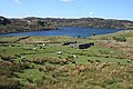
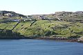
English: Achriesgill is a village that lies at the head of Loch Inchard in Lairg, Sutherland, in the Scottish council area of Highland.
Nederlands: Achriesgill ( Schots-Gaelisch: Achadh Rìdhisgil) is een dorp dat ligt aan Loch Inchard in Sutherland in de Schotse Hooglanden.
human settlement in Highland, Scotland, UK  | |||||
| Upload media | |||||
| Instance of | |||||
|---|---|---|---|---|---|
| Location |
| ||||
 | |||||
Media in category "Achriesgill"
The following 45 files are in this category, out of 45 total.
-
 Achriesgill Bay - geograph.org.uk - 3605985.jpg 640 × 420; 80 KB
-
 Achriesgill Bay - geograph.org.uk - 820951.jpg 640 × 427; 252 KB
-
 Achriesgill East.jpg 492 × 308; 118 KB
-
 Achriesgill from the Rhimichie Road - geograph.org.uk - 819847.jpg 640 × 410; 235 KB
-
 Achriesgill geograph-3485297-by-Ben-Brooksbank.jpg 1,200 × 741; 780 KB
-
 Achriesgill Water - geograph.org.uk - 819836.jpg 640 × 427; 262 KB
-

-
 Boulder by A838 - geograph.org.uk - 712395.jpg 640 × 480; 62 KB
-
 Crofthouse with a view at Achriesgill - geograph.org.uk - 4177629.jpg 1,600 × 1,067; 369 KB
-
 Crofts at Achriesgill West - geograph.org.uk - 3818037.jpg 800 × 533; 78 KB
-
 Foinaven summit at Ganu Mor - geograph.org.uk - 424328.jpg 640 × 480; 169 KB
-
 Foinaven-Ganu Mòr, western cairn - geograph.org.uk - 729064.jpg 640 × 480; 96 KB
-

-
 Ganu Mor, North West ridge - geograph.org.uk - 97889.jpg 640 × 480; 106 KB
-
 Looking down on Achriesgill Bay - geograph.org.uk - 4101366.jpg 1,600 × 1,067; 344 KB
-
 Plaque on roadside well - geograph.org.uk - 237495.jpg 640 × 480; 132 KB
-
 Roadside Well - geograph.org.uk - 237493.jpg 640 × 480; 122 KB
-
 Strath Dionard - geograph.org.uk - 237518.jpg 640 × 480; 57 KB
-
 Strath Dionard - geograph.org.uk - 620734.jpg 640 × 501; 87 KB
-

-

-
 Above Craig na Claise Carnaich - geograph.org.uk - 424320.jpg 640 × 480; 181 KB
-
 Achriesgill - geograph.org.uk - 819832.jpg 640 × 411; 253 KB
-
 Achriesgill and Loch Inchard - geograph.org.uk - 819826.jpg 640 × 321; 172 KB
-
 Achriesgill Bay - geograph.org.uk - 819834.jpg 640 × 427; 252 KB
-
 Achriesgill Water - geograph.org.uk - 819869.jpg 640 × 427; 253 KB
-
 Achriesgill West - geograph.org.uk - 819669.jpg 640 × 398; 218 KB
-
 Achriesgill West - geograph.org.uk - 820950.jpg 640 × 427; 230 KB
-
 Allt an Easain Ghairbh towards A838 - geograph.org.uk - 424292.jpg 640 × 480; 184 KB
-
 Allt na Gualaine - geograph.org.uk - 237505.jpg 640 × 480; 118 KB
-
 Below Ceann Garbh - geograph.org.uk - 424317.jpg 640 × 480; 154 KB
-
 Boulder by the A838 - geograph.org.uk - 237474.jpg 640 × 480; 89 KB
-
 Ceann Garbh summit - geograph.org.uk - 97882.jpg 480 × 640; 80 KB
-
 Coire Duail from Glas-Choire Granda - geograph.org.uk - 424342.jpg 640 × 480; 183 KB
-
 Craig na Claise Carnaich - geograph.org.uk - 424315.jpg 640 × 480; 170 KB
-
 Creag na Claise Carnaich - geograph.org.uk - 97876.jpg 640 × 480; 90 KB
-
 Eas na Glutachan - geograph.org.uk - 237480.jpg 640 × 480; 97 KB
-
 Eas na Glutachan waterfall - geograph.org.uk - 620726.jpg 640 × 505; 72 KB
-
 Entrance to Gualin House - geograph.org.uk - 237498.jpg 640 × 480; 83 KB
-
 From Ceann Garbh on Foinaven - geograph.org.uk - 424333.jpg 640 × 480; 150 KB
-
 Glas-Choire Granda - geograph.org.uk - 424331.jpg 640 × 480; 188 KB
-
 Loch na Claise Carnaich - geograph.org.uk - 424308.jpg 640 × 480; 149 KB
-

-
 Survey Point^ - geograph.org.uk - 237476.jpg 640 × 480; 168 KB
-
 Waterfall on Achriesgill Water - geograph.org.uk - 237468.jpg 640 × 480; 89 KB


_-_geograph.org.uk_-_193374.jpg)


_-_geograph.org.uk_-_1084206.jpg)


