Category:Achentoul
Jump to navigation
Jump to search
human settlement in Highland, Scotland, UK  | |||||
| Upload media | |||||
| Instance of | |||||
|---|---|---|---|---|---|
| Location |
| ||||
 | |||||
English: Achentoul ( Scottish Gaelic: Achadh an t-Sabhail, meaning field of the barn) is a village in the Kinbrace area of Sutherland and is in the Scottish council area of Highland.
Nederlands: Achentoul ( Schots-Gaelisch: Achadh an t-Sabhail) is een dorp in Sutherland in de Schotse Hooglanden.
Media in category "Achentoul"
The following 14 files are in this category, out of 14 total.
-
 Loch an Ruathair - geograph.org.uk - 33137.jpg 640 × 480; 112 KB
-
 Ordnance Survey Sheet NC 83 93 Kinbrace, Published 1965.jpg 11,081 × 5,273; 19.16 MB
-
 Stags below Creag nan Caorach - geograph.org.uk - 505108.jpg 640 × 480; 120 KB
-
 A897 - geograph.org.uk - 162552.jpg 640 × 480; 74 KB
-
 Allt a Bhealach Bhig - geograph.org.uk - 505102.jpg 640 × 480; 71 KB
-
 Blar-mhòr - geograph.org.uk - 162545.jpg 640 × 480; 83 KB
-
 Bog and Bannock Burn - geograph.org.uk - 162548.jpg 640 × 480; 89 KB
-
 Bog land from level crossing - geograph.org.uk - 1441583.jpg 640 × 423; 58 KB
-
 Flood plain - Bannock Burn - geograph.org.uk - 162551.jpg 640 × 480; 85 KB
-
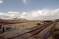
 Inverness to Caithness railway. - geograph.org.uk - 162543.jpg 640 × 480; 96 KB
-
 Loch an Ruathair - geograph.org.uk - 161948.jpg 640 × 480; 87 KB
-
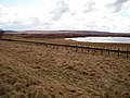 Loch an Ruathair - geograph.org.uk - 162541.jpg 640 × 480; 83 KB
-

-
 Loch Ruathair, seen from the A897 - geograph.org.uk - 577901.jpg 640 × 480; 74 KB


