Category:Achaphubuil
Jump to navigation
Jump to search
human settlement in Highland, Scotland, UK  | |||||
| Upload media | |||||
| Instance of | |||||
|---|---|---|---|---|---|
| Location |
| ||||
 | |||||
English: Achaphubuil ( Scottish Gaelic: Achadh a' Phùbaill) is a small crofting township, on the A86 road, located on the south shore of Loch Eil across from Loch Linnhe from Corpach in Fort William is a location in Highland Region, Scotland.
Nederlands: Achaphubuil ( Schots-Gaelisch: Achadh a' Phùbaill) is een klein dorpje aan de zuidelijke oevers van Loch Eil in de Schotse Hooglanden.
Media in category "Achaphubuil"
The following 19 files are in this category, out of 19 total.
-
 Achaphubil Primary School - geograph.org.uk - 900375.jpg 640 × 480; 84 KB
-
 Achaphubuil School - geograph.org.uk - 1078711.jpg 640 × 427; 70 KB
-
 Cattle, Achnaphubuil - geograph.org.uk - 3366256.jpg 640 × 480; 346 KB
-
 Corpach - geograph.org.uk - 6611954.jpg 5,545 × 3,348; 2.55 MB
-
 Derelict Floating Pier at Corpach - geograph.org.uk - 6099560.jpg 4,032 × 2,268; 6.79 MB
-
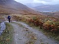 Heading Home - geograph.org.uk - 598845.jpg 640 × 480; 85 KB
-
 Mooring in Loch Linnhe - geograph.org.uk - 3342422.jpg 640 × 480; 274 KB
-
 Screen of trees at paper mill - geograph.org.uk - 4975409.jpg 1,500 × 1,125; 1.27 MB
-
 The shore opposite Corpach - geograph.org.uk - 2941885.jpg 1,600 × 1,200; 843 KB
-
 View down Loch Eil from The Narrows - geograph.org.uk - 1914333.jpg 2,112 × 1,188; 616 KB
-
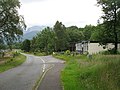
 Entrance to Linnhe Park - geograph.org.uk - 1419160.jpg 640 × 480; 74 KB
-
 Loch Eil - geograph.org.uk - 490844.jpg 640 × 480; 80 KB
-
 Loch Eil from The Narrows - geograph.org.uk - 15576.jpg 640 × 469; 135 KB
-
 Loch Eil meets Loch Linnhe - geograph.org.uk - 656739.jpg 640 × 480; 66 KB
-
 Loch Eil, early morning. - geograph.org.uk - 493364.jpg 640 × 480; 54 KB
-
 On the Shore, Achaphubuil - geograph.org.uk - 52773.jpg 640 × 427; 150 KB
-
 Remains of WWII QF-QL Decoy Site - geograph.org.uk - 15612.jpg 640 × 317; 58 KB
-
 Southern Shore of The Narrows. - geograph.org.uk - 410129.jpg 640 × 480; 105 KB
-
 Trislaig viewed from Fort William - geograph.org.uk - 685637.jpg 640 × 480; 318 KB


