Category:Acaster Malbis
Jump to navigation
Jump to search
village in United Kingdom  | |||||
| Upload media | |||||
| Instance of | |||||
|---|---|---|---|---|---|
| Location | City of York, North Yorkshire, Yorkshire and the Humber, England | ||||
| Population |
| ||||
| Said to be the same as | Acaster Malbis (Wikimedia duplicated page, civil parish) | ||||
| official website | |||||
 | |||||
English: Acaster Malbis is a village and civil parish in the unitary authority of the City of York, England. It is located on the River Ouse, south of York and Bishopthorpe.
Nederlands: Acaster Malbis is een dorp en parish in North Yorkshire in Engeland. Het ligt aan de Ouse, ten zuiden van York.
Subcategories
This category has the following 13 subcategories, out of 13 total.
A
B
C
F
- Fields in Acaster Malbis CP (28 F)
H
- Hauling Lane, Acaster Malbis (3 F)
I
- Intake Lane, Acaster Malbis (5 F)
M
P
R
- RAF Acaster Malbis (11 F)
- River Ouse at Acaster Malbis (36 F)
S
- Stub Wood, Acaster Malbis (8 F)
Media in category "Acaster Malbis"
The following 27 files are in this category, out of 27 total.
-
 Acaster Bridge - geograph.org.uk - 6226052.jpg 5,184 × 3,456; 5.4 MB
-
 Acaster Malbis - geograph.org.uk - 1305511.jpg 640 × 478; 160 KB
-
 Access path to the Trans-pennine Trail - geograph.org.uk - 1819014.jpg 1,600 × 1,067; 744 KB
-
 Brass Monkey Run - geograph.org.uk - 2243417.jpg 640 × 480; 191 KB
-
 Brass Monkey runners 2012 - geograph.org.uk - 2791867.jpg 640 × 480; 89 KB
-
 Brocket Wood - geograph.org.uk - 113981.jpg 640 × 479; 52 KB
-
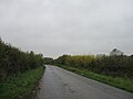 Country road - geograph.org.uk - 4741079.jpg 640 × 480; 38 KB
-
 Cul-de-sac - geograph.org.uk - 4741062.jpg 640 × 480; 72 KB
-
 Drain by Broad Lane - geograph.org.uk - 2776088.jpg 640 × 480; 88 KB
-
 Foss Field Lane - geograph.org.uk - 6226626.jpg 5,184 × 3,456; 5.9 MB
-
 Jam for sale - geograph.org.uk - 5369763.jpg 640 × 427; 83 KB
-
 Lakeside - geograph.org.uk - 5369753.jpg 640 × 427; 45 KB
-
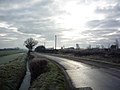
 Minor road towards Acaster Malbis - geograph.org.uk - 2648572.jpg 1,600 × 1,200; 633 KB
-
 Minor road towards Acaster Selby - geograph.org.uk - 2648678.jpg 1,600 × 1,200; 551 KB
-
 Road race - geograph.org.uk - 663789.jpg 640 × 478; 118 KB
-
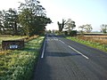
 Road to Acaster Malbis - geograph.org.uk - 2734563.jpg 640 × 480; 71 KB
-
 Sluice Gates at Thomas Dike - geograph.org.uk - 3383593.jpg 4,000 × 3,000; 3.1 MB
-
 Temple Lane heading west - geograph.org.uk - 2648607.jpg 1,600 × 1,200; 307 KB
-
 The boat yard at Nova Scotia - geograph.org.uk - 2811269.jpg 800 × 600; 113 KB
-
-
 The village pinfold - geograph.org.uk - 720593.jpg 640 × 480; 100 KB
-
 Towards Stonebridge Farm - geograph.org.uk - 2776121.jpg 640 × 480; 86 KB
-
 Towards Temple Lane - geograph.org.uk - 6282665.jpg 640 × 412; 75 KB
-
 Track leading towards the Former Acaster Malbis Airfield - geograph.org.uk - 6225410.jpg 5,184 × 3,456; 5.13 MB
-
 Will it ever open - geograph.org.uk - 3383584.jpg 4,000 × 3,000; 4.93 MB
-
 Windmill waterpump near Naburn - geograph.org.uk - 4107110.jpg 1,191 × 1,600; 749 KB
-
 An ornate garden gate - geograph.org.uk - 1512299.jpg 640 × 640; 182 KB


