Category:Abriachan
Jump to navigation
Jump to search
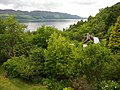
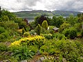
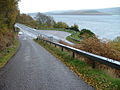
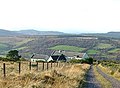
English: Abriachan ( Gaelic: Obar Itheachan) is a village in the Inverness committee area of Highland, Scotland. High above the western shore of Loch Ness, the village has a population of approximately 120. There are many events held in the Abriachan community forest each one proving that fun can be had in the outdoors. The children of Abriachan travel by bus into Inverness or to Dochgarroch for school every day. To really get a taste for Abriachan come to one of their community events like a Ceilidh, the Highland Games or a workday in the forest.
Nederlands: Abriachan is een dorp in het commisiegebied van Inverness in de Schotse Hooglanden en bevindt zich in de hoogtes boven de westelijke oever van Loch Ness. Abriachan telt een bevolking van rond de 120 personen.
human settlement in Highland, Scotland, UK  | |||||
| Upload media | |||||
| Instance of | |||||
|---|---|---|---|---|---|
| Location |
| ||||
 | |||||
Subcategories
This category has the following 3 subcategories, out of 3 total.
Media in category "Abriachan"
The following 70 files are in this category, out of 70 total.
-
 ...and how did THAT get there...^ - geograph.org.uk - 1207000.jpg 640 × 480; 206 KB
-
 A helpful pathside map^ - geograph.org.uk - 1206889.jpg 640 × 480; 251 KB
-
 A82 north of Urquart Bay. - geograph.org.uk - 250768.jpg 640 × 480; 84 KB
-
 A82 south of Inverness near Brachla. - geograph.org.uk - 250765.jpg 640 × 480; 109 KB
-
 Abriachan - geograph.org.uk - 166580.jpg 640 × 480; 73 KB
-
 Abriachan - geograph.org.uk - 4306011.jpg 800 × 600; 364 KB
-
 Abriachan from above Abriachan by Caiplich - geograph.org.uk - 2029107.jpg 2,816 × 2,112; 1.51 MB
-
 Abriachan Gardens - geograph.org.uk - 1337879.jpg 640 × 480; 136 KB
-
 Abriachan Gardens - geograph.org.uk - 2480022.jpg 640 × 480; 174 KB
-
 Abriachan Gardens - geograph.org.uk - 2480027.jpg 640 × 480; 182 KB
-
 Abriachan in winter - geograph.org.uk - 265196.jpg 640 × 480; 62 KB
-
 Abriachan to Foxhole road - geograph.org.uk - 658141.jpg 640 × 426; 66 KB
-
 Abriachan to Foxhole road - geograph.org.uk - 658147.jpg 640 × 426; 90 KB
-
 Abriachan village hall - geograph.org.uk - 166587.jpg 640 × 480; 122 KB
-
 Abriachan village hall - geograph.org.uk - 166594.jpg 640 × 480; 122 KB
-
 Balbeg - geograph.org.uk - 2165722.jpg 2,453 × 1,394; 2.89 MB
-
 Barn with corrugated metal roof near Dallauruach - geograph.org.uk - 2165705.jpg 2,000 × 1,030; 1.99 MB
-
 Café in the woods, Abriachan - geograph.org.uk - 5113771.jpg 1,024 × 678; 295 KB
-
 Cragganvallie Croft - geograph.org.uk - 277339.jpg 640 × 480; 94 KB
-
 Deforestation - geograph.org.uk - 166611.jpg 640 × 480; 116 KB
-
 Fence boundary near Rivoulich - geograph.org.uk - 1773993.jpg 1,000 × 664; 334 KB
-
 Fence in the forest - geograph.org.uk - 1773203.jpg 800 × 531; 240 KB
-
 Great Glen Way, near Abriachan - geograph.org.uk - 3132832.jpg 2,700 × 2,593; 1.64 MB
-
 Loch Laide - geograph.org.uk - 166617.jpg 640 × 480; 81 KB
-
 Minor road near Abriachan - geograph.org.uk - 3889896.jpg 1,600 × 1,200; 477 KB
-
 Recycled Post Box and Old Cooker - geograph.org.uk - 277146.jpg 640 × 480; 136 KB
-
 Road across the moorland near Abriachan - geograph.org.uk - 1740972.jpg 800 × 531; 172 KB
-
 Road across the moorland near Abriachan - geograph.org.uk - 1740979.jpg 800 × 542; 168 KB
-
 Road descending from Abriachan - geograph.org.uk - 4109098.jpg 2,850 × 1,994; 2.14 MB
-
 Road, Abriachan - geograph.org.uk - 4306009.jpg 800 × 600; 425 KB
-
 Small waterfall near Abriachan - geograph.org.uk - 944211.jpg 640 × 425; 153 KB
-
 The Abriachan Road Turning Point - geograph.org.uk - 276882.jpg 640 × 480; 123 KB
-
 The café is open... - geograph.org.uk - 5113763.jpg 1,024 × 678; 314 KB
-
 The path to Carn na Leitire. - geograph.org.uk - 1235251.jpg 640 × 480; 151 KB
-
 Tree and ruin - geograph.org.uk - 3844274.jpg 1,439 × 957; 317 KB
-
 Waterfall at Abriachan - geograph.org.uk - 1777255.jpg 1,224 × 1,632; 875 KB
-

-
 Winter in Abriachan - geograph.org.uk - 265194.jpg 640 × 480; 51 KB
-
 Abriachan Gardens - geograph.org.uk - 1467698.jpg 640 × 480; 117 KB
-
 Allt Lon A Ghiubhais - geograph.org.uk - 658125.jpg 640 × 426; 78 KB
-
 Deforestation - geograph.org.uk - 166614.jpg 640 × 480; 86 KB
-
 Driveway in Abriachan - geograph.org.uk - 276917.jpg 640 × 480; 115 KB
-
-
 Driveway to Moniack Mhor Writing Centre - geograph.org.uk - 277291.jpg 640 × 480; 128 KB
-
 Entrance to Lairgmore Croft. - geograph.org.uk - 250763.jpg 640 × 480; 107 KB
-

-
 Zetor 6245 Tractor - geograph.org.uk - 5103081.jpg 640 × 480; 142 KB
-
 Gated entrance into private forest - geograph.org.uk - 658140.jpg 640 × 426; 97 KB
-
 Gated entrance to private forest - geograph.org.uk - 658132.jpg 640 × 426; 83 KB
-
 Junction - geograph.org.uk - 166603.jpg 640 × 480; 102 KB
-
 Loch Ness - geograph.org.uk - 488972.jpg 640 × 480; 261 KB
-
 Loch Ness - geograph.org.uk - 526622.jpg 640 × 482; 79 KB
-
 Minor road from Abriachan to Foxhole - geograph.org.uk - 658135.jpg 640 × 426; 89 KB
-
 Minor road near Abriachan - geograph.org.uk - 658121.jpg 640 × 426; 67 KB
-
 Minor road near Abriachan - geograph.org.uk - 658122.jpg 640 × 426; 80 KB
-
 Misty day over Loch Ness - geograph.org.uk - 250770.jpg 640 × 480; 87 KB
-

-
 Netted rockface by the A82. - geograph.org.uk - 250767.jpg 640 × 480; 124 KB
-
 New forest , Meall na h-Eilrig. - geograph.org.uk - 36276.jpg 640 × 414; 77 KB
-
 Old Croft near Loch Laide - geograph.org.uk - 277340.jpg 640 × 480; 107 KB
-
 On the slopes of Carn Na Leitire - geograph.org.uk - 40115.jpg 640 × 480; 93 KB
-
 Road Junction - geograph.org.uk - 277284.jpg 640 × 480; 121 KB
-
 Road Through the Trees - geograph.org.uk - 276931.jpg 640 × 480; 113 KB
-
 Road to Tomachoin East - geograph.org.uk - 276935.jpg 640 × 480; 146 KB
-
 Southern slopes of Meall na h-Eilrig. - geograph.org.uk - 36280.jpg 640 × 480; 76 KB
-
 Spot the OS Surface Block^ - geograph.org.uk - 377539.jpg 639 × 479; 101 KB
-
 The road to Inverness - geograph.org.uk - 403291.jpg 640 × 425; 329 KB
-
 Track to Forestry Plantation - geograph.org.uk - 276904.jpg 640 × 480; 106 KB
-
 Track to Woodland - geograph.org.uk - 276922.jpg 640 × 480; 115 KB
-
 Woodland by Loch Ness - geograph.org.uk - 403298.jpg 640 × 425; 419 KB


.jpg)


