Category:Abies concolor range maps
Jump to navigation
Jump to search
Media in category "Abies concolor range maps"
The following 10 files are in this category, out of 10 total.
-
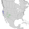
 Abies concolor range map 2.png 3,768 × 3,767; 206 KB
-
 Abies concolor leviala.jpg 1,200 × 910; 125 KB
-
 Abies concolor range map 0.png 9,624 × 12,505; 1.25 MB
-
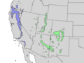
 Abies concolor range map 1.png 7,225 × 7,225; 719 KB
-
 Abies concolor range map 3.png 3,189 × 2,392; 136 KB
-
 Abies concolor range map.svg 1,300 × 1,353; 703 KB
-
 Bulletin of the U.S. Department of Agriculture (1913-1923.) (20498712855).jpg 1,716 × 2,874; 1.16 MB
-
 Grau-Tanne.jpg 1,179 × 883; 315 KB
-
 Lumber recovery from red and white fir in central California (1973) (20574153775).jpg 1,999 × 3,194; 806 KB
-


_(20498712855).jpg)

_(20574153775).jpg)
_Abies_concolor_(20788010890).jpg)