Category:Abergele
Jump to navigation
Jump to search
Cymraeg: Tref a chymuned yng Nghonwy (yn yr hen Sir Ddinbych cyn hynny), ar yr A55 rhwng Bae Colwyn a'r Rhyl, yw Abergele. Saif ar lannau Afon Gele. Mae'n dref farchnad a chanolfan siopa lleol. Mae gorsaf ar Reilffordd Arfordir Gogledd Cymru. I'r dwyrain o'r dref ceir gwlybdir eang Morfa Rhuddlan.
English: Abergele is a community and old Roman trading town, situated on the north coast of Wales between the holiday resorts of Colwyn Bay and Rhyl, in Conwy County Borough. Its northern suburb of Pensarn lies on the Irish Sea coast and is known for its beach, where it is claimed by some that a ghost ship has been sighted. Abergele and Pensarn railway station serves both resorts. Abergele is generally ignored due to the popularity of nearby Rhyl, Prestatyn, Colwyn Bay, Llandudno and Conwy.
Eesti: Abergele on linn Walesis Conwy tervikomavalitsuses. Asub Iiri mere ranniku lähedal Colwyn Bay ja Rhyli kuurortite vahel.
Nederlands: Abergele is een stadje in het noorden van Wales, in het graafschap Conwy. Het stadje heeft ongeveer 18.000 inwoners (het voorstadje Pensarn inbegrepen). Bijna 30% van de bevolking heeft enige kennis van het Welsh.
town and community in Conwy County Borough, Wales, UK | |||||
| Upload media | |||||
| Instance of | |||||
|---|---|---|---|---|---|
| Location | Conwy County Borough, Wales | ||||
| Population |
| ||||
| Area |
| ||||
| official website | |||||
 | |||||
For the district in Ethiopia see Category:Abergele (woreda)
Subcategories
This category has the following 14 subcategories, out of 14 total.
A
- Abergele surrounding area (189 F)
- Afon Gele (4 F)
C
E
- Eglwys Crist, Abergele (6 F)
G
- Golden Lodge, Conwy (1 F)
K
- Kinmel Hall (10 F)
P
S
W
Media in category "Abergele"
The following 200 files are in this category, out of 252 total.
(previous page) (next page)-
18 tonnes vehicle weight limit sign, Pensarn - geograph.org.uk - 6379806.jpg 1,024 × 815; 157 KB
-
A wet day at Traeth Pensarn Beach - geograph.org.uk - 6317826.jpg 800 × 439; 63 KB
-
Abergele - Telephone Call-box outside the Harp Inn - 20221226184913.jpg 3,264 × 4,928; 3.68 MB
-
Abergele Bowling Green - geograph.org.uk - 4445627.jpg 640 × 481; 262 KB
-
Abergele Bowling Green - geograph.org.uk - 6926462.jpg 1,280 × 919; 726 KB
-
Abergele Cemetery - geograph.org.uk - 6926534.jpg 1,280 × 960; 885 KB
-
Abergele Coastal View - geograph.org.uk - 3259838.jpg 2,560 × 1,920; 3.02 MB
-
Abergele Community Centre.jpg 4,672 × 3,504; 6.31 MB
-
Abergele from Tan-y-Gopa.jpg 800 × 600; 127 KB
-
Abergele High Street, looking west - geograph.org.uk - 5636751.jpg 2,592 × 1,944; 1.71 MB
-
Abergele Hospital - geograph.org.uk - 749536.jpg 640 × 392; 47 KB
-
Abergele Library - geograph.org.uk - 1177783.jpg 640 × 407; 40 KB
-
Abergele Town Hall - geograph.org.uk - 4445208.jpg 640 × 481; 365 KB
-
Abergele War Memorial (dedication) - geograph.org.uk - 4445118.jpg 640 × 480; 330 KB
-
Abergele War Memorial - geograph.org.uk - 4445124.jpg 481 × 640; 301 KB
-
Abergele War Memorial - geograph.org.uk - 6943946.jpg 1,280 × 1,106; 933 KB
-
Abergele windmill site - geograph.org.uk - 2305548.jpg 640 × 426; 70 KB
-
Abergele Youth and Community Centre - geograph.org.uk - 3216265.jpg 640 × 480; 57 KB
-
Abergele, Chapel Street - geograph.org.uk - 4444563.jpg 640 × 484; 288 KB
-
Abergele, Dundonald Avenue - geograph.org.uk - 4445619.jpg 640 × 480; 250 KB
-
Abergele, Market Street - geograph.org.uk - 4444561.jpg 640 × 480; 289 KB
-
Abergele, New York Terrace - geograph.org.uk - 4445134.jpg 640 × 480; 239 KB
-
Abergele, Tan-yr-ogo Cave MET DP112695.jpg 3,866 × 2,862; 2.41 MB
-
Abergele.ogg 2.4 s; 38 KB
-
Abergele.wav 3.3 s; 572 KB
-
AbergeleTownCentre.jpg 512 × 384; 39 KB
-
AJ's All-Sorts, Pensarn, Abergele - geograph.org.uk - 4844528.jpg 800 × 691; 134 KB
-
Amusements at Pensarn Pleasure Beach - geograph.org.uk - 5033805.jpg 5,000 × 3,333; 3.65 MB
-
Beach and railway station direction sign, Pensarn - geograph.org.uk - 6379807.jpg 1,600 × 1,241; 344 KB
-
Beach at Abergele - geograph.org.uk - 3469145.jpg 2,560 × 1,920; 1.98 MB
-
Beach at Abergele - geograph.org.uk - 4445439.jpg 640 × 481; 281 KB
-
Beach Café at Pensarn Beach - geograph.org.uk - 4176351.jpg 1,600 × 1,064; 647 KB
-
Bee Hotel - geograph.org.uk - 6945988.jpg 1,280 × 934; 699 KB
-
Bee Market Abergele.jpg 562 × 470; 38 KB
-
Belgrano beach scene - geograph.org.uk - 968307.jpg 640 × 480; 99 KB
-
Bodorin Chapel (Cong), Abergele (1897) NLW3361123.jpg 593 × 445; 46 KB
-
Bodoryn Fawr Farm - geograph.org.uk - 6364165.jpg 4,000 × 3,000; 2.26 MB
-
Bodoryn Independent Chapel, Rhuddlan Road - geograph.org.uk - 6364163.jpg 3,849 × 2,887; 1.63 MB
-
Bowling Green, Abergele - geograph.org.uk - 1177703.jpg 640 × 480; 110 KB
-
Bridge Street, Abergele - geograph.org.uk - 6947090.jpg 1,280 × 837; 777 KB
-
British Red Cross building North Wales Business Park - geograph.org.uk - 2548819.jpg 3,296 × 2,472; 1.92 MB
-
Bryn-gwyn old meeting house, Abergele (1897) NLW3361124.jpg 589 × 447; 59 KB
-
Bryntirion Terrace - geograph.org.uk - 871990.jpg 640 × 480; 87 KB
-
Car Park and Beach at Pensarn - geograph.org.uk - 4630802.jpg 3,184 × 2,123; 1.92 MB
-
Caravan park - geograph.org.uk - 968273.jpg 640 × 480; 77 KB
-
Caravans in Castle Cove Caravan Park - geograph.org.uk - 4319712.jpg 1,224 × 918; 527 KB
-
Cars parked on Pensarn beach - geograph.org.uk - 6379789.jpg 1,600 × 1,201; 493 KB
-
Castell Cawr - geograph.org.uk - 3989630.jpg 3,072 × 2,304; 1.66 MB
-
Castell Cawr - geograph.org.uk - 936860.jpg 640 × 480; 98 KB
-
Castell Cawr.jpg 3,072 × 2,304; 1.58 MB
-
Castle Cove Café ^ Bar - geograph.org.uk - 4176419.jpg 1,600 × 1,044; 427 KB
-
Chapel Street (A458), Abergele - geograph.org.uk - 4444566.jpg 640 × 480; 271 KB
-
Church House, Croeslwyd - geograph.org.uk - 923506.jpg 640 × 480; 94 KB
-
Church on Towyn Road, Pensarn - geograph.org.uk - 3862533.jpg 1,200 × 798; 269 KB
-
Cilfan, Pensarn, Abergele - geograph.org.uk - 4844539.jpg 800 × 741; 101 KB
-
Cm Abergele.jpg 1,200 × 675; 255 KB
-
Coastal Carpets, Pensarn, Abergele - geograph.org.uk - 4847684.jpg 800 × 591; 115 KB
-
Coastal protection wall at Pensarn - geograph.org.uk - 1082910.jpg 640 × 480; 53 KB
-
Concrete Planters, Pensarn - geograph.org.uk - 6903096.jpg 1,024 × 768; 170 KB
-
Conwy County Borough UK electoral wards - Gele ward locator.png 800 × 740; 92 KB
-
Costcutter on Towyn Road, Pensarn - geograph.org.uk - 4176284.jpg 1,600 × 1,064; 658 KB
-
Costcutter, Pensarn, Abergele - geograph.org.uk - 4844534.jpg 800 × 452; 80 KB
-
Cottages at Abergele - geograph.org.uk - 27188.jpg 384 × 288; 19 KB
-
Cottages at Ty'n Llwynog - geograph.org.uk - 6409973.jpg 3,561 × 2,429; 1.83 MB
-
Cottages in Water Street - geograph.org.uk - 920311.jpg 640 × 480; 98 KB
-
CountessDundonald.jpg 1,686 × 3,000; 1,012 KB
-
Cycle route 5 direction sign, Pensarn - geograph.org.uk - 6379302.jpg 1,600 × 1,272; 417 KB
-
Cycle route direction sign in Pensarn 5 miles from Rhyl - geograph.org.uk - 6379314.jpg 1,434 × 1,600; 369 KB
-
Daffodils, Pensarn, Abergele - geograph.org.uk - 4844628.jpg 800 × 791; 218 KB
-
Dechreuad a Chynydd y Methodistiaid Calfinaidd yn Abergele, Pensarn etc.pdf 779 × 1,164, 94 pages; 80.14 MB
-
Distances from Pensarn, Abergele - geograph.org.uk - 4847711.jpg 800 × 595; 158 KB
-
Disused church on Towyn Road, Pensarn - geograph.org.uk - 4176305.jpg 1,600 × 1,064; 519 KB
-
East side of a stone road bridge, Pensarn - geograph.org.uk - 6379799.jpg 1,600 × 972; 379 KB
-
Entrance to Abergele ^ Pensarn railway station - geograph.org.uk - 6379280.jpg 1,600 × 1,200; 343 KB
-
Estate of houses at Hendre Las, Abergele - geograph.org.uk - 6409975.jpg 4,000 × 3,000; 2.43 MB
-
Exercise equipment in Pensarn - geograph.org.uk - 6379368.jpg 1,600 × 1,284; 467 KB
-
Faenol Avenue, Abergele - geograph.org.uk - 871053.jpg 640 × 473; 115 KB
-
Farm and Pet Place - geograph.org.uk - 966878.jpg 640 × 480; 49 KB
-
Farm road to Kinmel Home Farm - geograph.org.uk - 6364168.jpg 4,000 × 3,000; 2.43 MB
-
Former Medical Hall, 51 Market Street, Abergele - geograph.org.uk - 6944069.jpg 1,280 × 960; 935 KB
-
Gainsborough Park, Abergele - geograph.org.uk - 6409985.jpg 4,000 × 3,000; 2.44 MB
-
Gwesty Glyndwr, Pensarn, Abergele - geograph.org.uk - 4847330.jpg 800 × 695; 137 KB
-
Gwrych - near Abergele, Denbighshire.jpeg 952 × 1,375; 855 KB
-
Gwrych castle - geograph.org.uk - 5491089.jpg 1,425 × 1,076; 492 KB
-
Gwrych Castle, Abergele - geograph.org.uk - 5078895.jpg 1,500 × 1,000; 1.12 MB
-
Hanson Aggregates Quarry, near St George - geograph.org.uk - 6410003.jpg 4,000 × 3,000; 2.83 MB
-
Harts Caravan Park, Pensarn, Abergele - geograph.org.uk - 4844543.jpg 800 × 593; 100 KB
-
Holland Drive - geograph.org.uk - 968225.jpg 640 × 480; 88 KB
-
Houses on Towyn Road, Pensarn - geograph.org.uk - 4176279.jpg 1,600 × 1,064; 594 KB
-
I'm a Celebrity build at Gwrych Castle.jpg 4,000 × 3,000; 2.26 MB
-
Image of The Bull Hotel, Abergele, Wales.jpg 3,264 × 2,448; 1.84 MB
-
K^C takeaway, Pensarn, Abergele - geograph.org.uk - 4898659.jpg 750 × 800; 116 KB
-
Landscape gardening - geograph.org.uk - 980918.jpg 640 × 480; 81 KB
-
Lifebelt on Traeth Pensarn Beach - geograph.org.uk - 6317851.jpg 800 × 600; 105 KB
-
Lodge to Kinmel Estate - geograph.org.uk - 6364138.jpg 4,000 × 3,000; 2.9 MB
-
Lois the Crab at Pensarn - geograph.org.uk - 5033815.jpg 5,000 × 3,333; 7.18 MB
-
Marine Road flats, Pensarn,Abergele - geograph.org.uk - 4898312.jpg 800 × 504; 79 KB
-
Marine Road, Pensarn - geograph.org.uk - 5486260.jpg 1,280 × 851; 352 KB
-
Market Street approaching Sea Road - geograph.org.uk - 2344715.jpg 640 × 480; 67 KB
-
Market Street, Abergele - geograph.org.uk - 6607142.jpg 1,600 × 1,200; 414 KB
-
Medical Hall, Ghost sign - geograph.org.uk - 6944076.jpg 1,280 × 1,175; 1.27 MB
-
Meirion, Pensarn, Abergele - geograph.org.uk - 4847709.jpg 800 × 476; 66 KB
-
Memorial plaque - geograph.org.uk - 6364154.jpg 3,909 × 2,933; 2.86 MB
-
Moelfre Calvinsitic Methodist Chapel, Abergele NLW3360972.jpg 581 × 439; 52 KB
-
Mr. Nipper the Abergele crab - geograph.org.uk - 3826240.jpg 2,457 × 1,828; 1.99 MB
-
Mynydd Seion Chapel (CM), Abergele NLW3361144.jpg 582 × 440; 46 KB
-
Nant Ddu Road - geograph.org.uk - 5188032.jpg 640 × 480; 65 KB
-
Nant Ddu Road 2 - geograph.org.uk - 5188037.jpg 640 × 480; 53 KB
-
Nant Ddu Road meets the A55 - geograph.org.uk - 5188041.jpg 640 × 480; 73 KB
-
NatWest Bank Abergele (geograph 3216258).jpg 640 × 480; 65 KB
-
New York Terrace, Abergele - geograph.org.uk - 1177784.jpg 640 × 480; 74 KB
-
North Wales Business Park - geograph.org.uk - 1179563.jpg 640 × 480; 47 KB
-
North Wales Coast Line at Pensarn - geograph.org.uk - 6314993.jpg 800 × 546; 104 KB
-
North Wales Coast Line towards Rhyl - geograph.org.uk - 6314989.jpg 800 × 499; 94 KB
-
North Wales Express Way, looking west - geograph.org.uk - 6364171.jpg 3,847 × 2,885; 1.95 MB
-
Old Kinmae, 1795.jpg 830 × 661; 373 KB
-
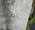
Ordnance Survey Cut Mark - geograph.org.uk - 5009230.jpg 640 × 547; 125 KB
-
Pantri Bach Shop ^ Café, Pensarn - geograph.org.uk - 4176331.jpg 1,600 × 1,082; 617 KB
-
Path to Traeth Pensarn Beach - geograph.org.uk - 6317846.jpg 800 × 528; 84 KB
-
PeBel's Pensarn Promenade Project board - geograph.org.uk - 6379796.jpg 1,600 × 1,200; 423 KB
-
Peel Street - geograph.org.uk - 6920083.jpg 1,280 × 960; 828 KB
-
Pen -y-Bont Inn - geograph.org.uk - 922823.jpg 640 × 480; 98 KB
-
Pensarn beach - geograph.org.uk - 2363866.jpg 640 × 480; 105 KB
-
Pensarn Beach - geograph.org.uk - 4445452.jpg 640 × 481; 298 KB
-
Pensarn Beach - geograph.org.uk - 5031104.jpg 4,184 × 2,789; 2.85 MB
-
Pensarn Beach - geograph.org.uk - 5486269.jpg 1,280 × 851; 300 KB
-
Pensarn Family Church, Abergele - geograph.org.uk - 4898303.jpg 800 × 695; 114 KB
-
Pensarn Post Office, Abergele - geograph.org.uk - 4844109.jpg 800 × 784; 123 KB
-
Pensarnie, Pensarn, Abergele - geograph.org.uk - 4847344.jpg 664 × 800; 115 KB
-
Petplace, Abergele - geograph.org.uk - 5911060.jpg 800 × 600; 78 KB
-
Photo1500405-Colorized.jpg 1,318 × 2,345; 1.44 MB
-
Railings at the edge of the beach, Pensarn - geograph.org.uk - 6379794.jpg 1,600 × 1,200; 325 KB
-
Revd Ellis Thomas Davies, Abergele (1822-95) NLW3364203.jpg 340 × 562; 33 KB
-
Revd Francis Jones, Abergele NLW3363287.jpg 422 × 597; 31 KB
-
Rhos Fawr - geograph.org.uk - 968234.jpg 640 × 480; 80 KB
-
Rhuddlan Road, Abergele - geograph.org.uk - 6607149.jpg 1,600 × 1,200; 388 KB
-
Road to the beach, Pensarn - geograph.org.uk - 6379378.jpg 1,600 × 914; 407 KB
-
Rob's Fish ^ Chip Shop, Pensarn - geograph.org.uk - 3862463.jpg 1,200 × 961; 406 KB
-
Rob's Fish ^ Chip Shop, Pensarn - geograph.org.uk - 3862508.jpg 798 × 1,200; 348 KB
-
Sea wall - geograph.org.uk - 666360.jpg 640 × 480; 56 KB
-
Seat by Llanfair Road, Abergele - geograph.org.uk - 4444544.jpg 640 × 480; 279 KB
-
Shops on Bridge Street - geograph.org.uk - 6947812.jpg 1,280 × 873; 703 KB
-
Shops on Marine Road, Pensarn - geograph.org.uk - 4176308.jpg 1,600 × 1,064; 493 KB
-
Sign of The Bee Hotel - geograph.org.uk - 6945995.jpg 1,280 × 1,540; 1.22 MB
-
Sign of The Harp - geograph.org.uk - 6944957.jpg 1,280 × 1,163; 935 KB
-
Signs and notices on the approach to the beach, Pensarn - geograph.org.uk - 6379797.jpg 1,349 × 1,600; 415 KB
-
Southern House - geograph.org.uk - 920314.jpg 640 × 480; 74 KB
-
St Michael's Church - geograph.org.uk - 6926556.jpg 1,280 × 934; 799 KB
-
St Michael's Church - geograph.org.uk - 6943978.jpg 1,280 × 960; 828 KB
-
St Michael's Clock - geograph.org.uk - 6926650.jpg 1,280 × 991; 1,004 KB
-
St Michael's Lych Gate - geograph.org.uk - 6943981.jpg 1,280 × 960; 776 KB
-
St Michael's, Abergele - geograph.org.uk - 6926945.jpg 1,280 × 960; 845 KB
-
St.Paul's Chapel - geograph.org.uk - 922849.jpg 640 × 480; 115 KB
-
Station Street, Pensarn, Abergele - geograph.org.uk - 4844526.jpg 774 × 800; 112 KB
-
Stop Look Listen - geograph.org.uk - 1177595.jpg 640 × 480; 75 KB
-
Tennis Court Road, Pensarn, Abergele - geograph.org.uk - 4844611.jpg 800 × 742; 123 KB
-
Terfyn Cottages, Bodelwyddan - geograph.org.uk - 6364788.jpg 4,000 × 3,000; 2.24 MB
-
The Bee Hotel (geograph 3216186).jpg 640 × 480; 62 KB
-
The Bee Hotel, Abergele - geograph.org.uk - 4444554.jpg 640 × 480; 254 KB
-
The Bull Hotel, Abergele - geograph.org.uk - 4444572.jpg 589 × 384; 171 KB
-
The Bull Inn, Abergele - geograph.org.uk - 2032576.jpg 640 × 480; 48 KB
-
The Castle (Y Castell), Abergele - geograph.org.uk - 4445601.jpg 640 × 480; 260 KB
-
The cave at Tangrogo - near Abergele, Denbighshire.jpeg 900 × 856; 1.02 MB
-
The centre of Abergele - geograph.org.uk - 6946833.jpg 1,280 × 1,135; 981 KB
-
The Cutting Station, Pensarn, Abergele - geograph.org.uk - 4844531.jpg 800 × 690; 121 KB
-
The George ^ Dragon - geograph.org.uk - 6946851.jpg 1,280 × 1,059; 1.02 MB
-
The grave of William Mark (died 1859), Abergele NLW3362805.jpg 425 × 588; 67 KB
-
The Harp Inn, Market Street, Abergele - geograph.org.uk - 6944956.jpg 1,280 × 1,199; 1 MB
-
The Harp, Market Street Abergele - geograph.org.uk - 4444952.jpg 640 × 481; 268 KB
-
The Kinmel Arms, St George - geograph.org.uk - 6410022.jpg 4,000 × 3,000; 2.72 MB
-
The Lodge in the dip on the Roman Road - geograph.org.uk - 4294774.jpg 1,600 × 1,022; 471 KB


