Category:Abercanaid
Jump to navigation
Jump to search
village in Wales  | |||||
| Upload media | |||||
| Instance of | |||||
|---|---|---|---|---|---|
| Location | Merthyr Tydfil, Wales | ||||
 | |||||

English: Abercanaid is a small village in the Welsh county borough of Merthyr Tydfil, Glamorgan, Wales, United Kingdom. It is situated 2.5 miles south of Merthyr town centre and is west of Pentrebach, across the River Taff and north of Troedyrhiw. The Taff Trail also runs through the village, adjacent to the Glamorganshire Canal, which was an important passage for the transport of iron and coal during the industrial boom in which the Valleys prospered.
Media in category "Abercanaid"
The following 14 files are in this category, out of 14 total.
-
 Abercanaid Post Office - geograph.org.uk - 634054.jpg 640 × 480; 78 KB
-
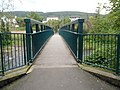
 Abercanaid Taff Trail.jpg 960 × 638; 106 KB
-
 Bikepark Wales (geograph 7037561).jpg 2,048 × 1,536; 1.42 MB
-
 Egg-ended boiler shed, Abercanaid.jpg 1,704 × 1,813; 355 KB
-
-
 Internal layout of the Pit.jpg 960 × 779; 77 KB
-
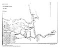
 Map of Abercanaid.jpg 1,000 × 872; 474 KB
-
 Merthyr Tunnel, Merthyr Tydfil - geograph.org.uk - 56859.jpg 640 × 479; 127 KB
-

-
 Revd John Evans, Abercanaid NLW3364299.jpg 426 × 605; 42 KB
-

-
 Sanger Stores Abercanaid (geograph 6073631).jpg 1,024 × 816; 205 KB
-
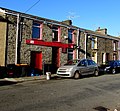
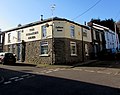 The Colliers Arms, Abercanaid (geograph 6073652).jpg 1,024 × 809; 182 KB
-
 The Richards Arms, Abercanaid (geograph 6073641).jpg 1,024 × 948; 298 KB


.jpg)


.jpg)


.jpg)
.jpg)
.jpg)