Category:Abbotsinch
Jump to navigation
Jump to search
Abbotsinch is a village to the north of Paisley and west of Renfrew, Renfrewshire and is most known as the site of Glasgow International Airport.
Subcategories
This category has only the following subcategory.
S
Media in category "Abbotsinch"
The following 16 files are in this category, out of 16 total.
-
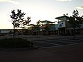 Abbotsinch Retail Park, Paisley - geograph.org.uk - 518837.jpg 640 × 480; 64 KB
-
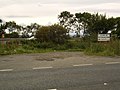
 Abbotsinch Road - geograph.org.uk - 1458682.jpg 640 × 428; 84 KB
-
 Abbotsinch Road - geograph.org.uk - 1524681.jpg 640 × 371; 54 KB
-
 Black Cart Water - geograph.org.uk - 170461.jpg 640 × 480; 79 KB
-
 Burned out building - geograph.org.uk - 1524742.jpg 640 × 480; 79 KB
-
 House by White Cart Water - geograph.org.uk - 860192.jpg 640 × 480; 103 KB
-
 Ploughed Field - geograph.org.uk - 1701623.jpg 3,381 × 2,284; 2.45 MB
-
 Ploughed Field, Netherton Farm - geograph.org.uk - 1701629.jpg 3,648 × 2,073; 3.41 MB
-
 Road at Glasgow Airport - geograph.org.uk - 482739.jpg 640 × 480; 77 KB
-
 Road to West Walkinshaw Farm - geograph.org.uk - 501487.jpg 640 × 480; 89 KB
-
 Roundabout on Abbotsinch Road - geograph.org.uk - 1524735.jpg 640 × 431; 52 KB
-
 Sign for Paisley - geograph.org.uk - 482192.jpg 640 × 480; 63 KB
-

-

-

-
 Walkinshaw Road - geograph.org.uk - 501463.jpg 640 × 480; 80 KB


.jpg)
.jpg)
.jpg)
