Category:Abbeystead
Jump to navigation
Jump to search
English: Abbeystead is a small, picturesque village located in the Forest of Bowland Area of Outstanding Natural Beauty, in Lancashire, England. Abbeystead lies close to the Trough of Bowland but even in medieval times, was considered part of Wyresdale rather than within the domain of that powerful local magnate, the Lord of Bowland, so-called Lord of the Fells. (→Abbeystead)
Polski: Abbeystead – wieś w Anglii, w hrabstwie Lancashire, w dystrykcie Lancaster. Leży 65 km na północny zachód od miasta Manchester i 324 km na północny zachód od Londynu. (→Abbeystead)

village in Lancashire, England, UK  | |||||
| Upload media | |||||
| Instance of | |||||
|---|---|---|---|---|---|
| Location | Over Wyresdale, Lancaster, Lancashire, North West England, England | ||||
 | |||||
Media in category "Abbeystead"
The following 49 files are in this category, out of 49 total.
-
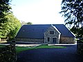 Abbeystead Village Hall.jpg 640 × 480; 204 KB
-
 Above the Wyre - geograph.org.uk - 1192918.jpg 640 × 480; 49 KB
-
 Barn and Woodpile near Abbeystead - geograph.org.uk - 1039418.jpg 640 × 480; 53 KB
-
 Cairn, Hawthornthwaite fell - geograph.org.uk - 928543.jpg 640 × 480; 85 KB
-
 Cawthorne Endowed School, Abbeystead.jpg 2,560 × 1,920; 2.97 MB
-
 Cottage Abbeystead - geograph.org.uk - 1409426.jpg 640 × 426; 301 KB
-
 Entering 'The Forest of Bowland ' - geograph.org.uk - 98058.jpg 640 × 480; 86 KB
-
 Foot Bridges over Cam Brook - geograph.org.uk - 1219402.jpg 640 × 480; 76 KB
-
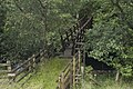
 Footbridge over River Wyre - geograph.org.uk - 514370.jpg 426 × 640; 395 KB
-
 Grizedale Intake, Grizedale Brook - geograph.org.uk - 739858.jpg 640 × 427; 78 KB
-
 Hairpin bend - geograph.org.uk - 951581.jpg 638 × 437; 190 KB
-
 Lancaster Lodge - geograph.org.uk - 580556.jpg 640 × 480; 156 KB
-
 Peat Haggs ,Catshaw Fell - geograph.org.uk - 699076.jpg 640 × 427; 69 KB
-

-
 Road to Catshaw Hall - geograph.org.uk - 739200.jpg 640 × 427; 56 KB
-
 Roadworks - geograph.org.uk - 951580.jpg 640 × 480; 206 KB
-
 Stoops Bridge - geograph.org.uk - 514386.jpg 640 × 426; 467 KB
-
 Stoops Bridge - geograph.org.uk - 580554.jpg 640 × 480; 131 KB
-
 The Shooting Box, near Abbeystead - geograph.org.uk - 14402.jpg 640 × 480; 70 KB
-
 Weir at Abbeystead - geograph.org.uk - 121526.jpg 640 × 480; 179 KB
-
 Weir at Abbeystead - geograph.org.uk - 121529.jpg 640 × 480; 100 KB
-
 Aqueduct, High Cross Moor - geograph.org.uk - 739809.jpg 640 × 427; 75 KB
-
 Aqueduct, Higher Within Syke - geograph.org.uk - 811639.jpg 640 × 427; 63 KB
-
 Beech hedge on Abbeystead Lane - geograph.org.uk - 585803.jpg 640 × 352; 381 KB
-
 Cam Brook - geograph.org.uk - 471760.jpg 640 × 426; 318 KB
-
 Cam Brook - geograph.org.uk - 471772.jpg 640 × 426; 356 KB
-
 Cam Brook, Catshaw Greave - geograph.org.uk - 691309.jpg 640 × 427; 69 KB
-
 Cam Brook, Catshaw Greave - geograph.org.uk - 691317.jpg 427 × 640; 49 KB
-
 Catshaw Cotton Mill , Ruin - geograph.org.uk - 684630.jpg 480 × 640; 124 KB
-
 Catshaw Cotton Mill, Ruin - geograph.org.uk - 684618.jpg 480 × 640; 111 KB
-
 Cattle grid gate - geograph.org.uk - 359546.jpg 640 × 425; 201 KB
-
 Cow crossing Tarnbrook Wyre - geograph.org.uk - 514389.jpg 640 × 438; 424 KB
-
 Disused Millpond - geograph.org.uk - 514372.jpg 640 × 426; 456 KB
-
 Far Greave, Catshaw Fell - geograph.org.uk - 691321.jpg 640 × 427; 75 KB
-
 Farm buildings on the Marl House road - geograph.org.uk - 739648.jpg 640 × 427; 70 KB
-
 Fellside Farm - geograph.org.uk - 359533.jpg 640 × 425; 225 KB
-
 Fellside Farm, Hawthornthwaite Greave - geograph.org.uk - 739711.jpg 640 × 427; 69 KB
-
 Field at Abbeystead - geograph.org.uk - 1409421.jpg 640 × 426; 305 KB
-
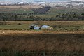
 Field Barn at Abbeystead - geograph.org.uk - 1409428.jpg 640 × 426; 253 KB
-
 Footbridge over the Marshaw Wyre - geograph.org.uk - 1408779.jpg 640 × 426; 364 KB
-
 Grizedale Brook - geograph.org.uk - 699185.jpg 640 × 427; 44 KB
-
 Grizedale Head - geograph.org.uk - 17662.jpg 640 × 480; 75 KB
-
 High House near Bond Clough - geograph.org.uk - 739651.jpg 640 × 427; 70 KB
-
 Isle of Skye Farm near Catshaw Fell - geograph.org.uk - 739192.jpg 640 × 427; 47 KB
-
 Jubilee Tower - geograph.org.uk - 776928.jpg 640 × 480; 67 KB
-
 Plantation Lane, Abbeystead - geograph.org.uk - 580341.jpg 640 × 480; 188 KB
-
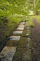 Salmon Ladder - geograph.org.uk - 514384.jpg 426 × 640; 438 KB
-
 Shooters track, Catshaw Greave - geograph.org.uk - 699895.jpg 640 × 427; 57 KB
-
 Tarnbrook Wyre - geograph.org.uk - 580549.jpg 640 × 480; 120 KB


