Category:Abbeyshrule
Jump to navigation
Jump to search
human settlement  | |||||
| Upload media | |||||
| Instance of | |||||
|---|---|---|---|---|---|
| Location | County Longford, Leinster, Ireland | ||||
| Elevation above sea level |
| ||||
| Different from | |||||
 | |||||
Media in category "Abbeyshrule"
The following 22 files are in this category, out of 22 total.
-
 A source of local pride - geograph.org.uk - 5985010.jpg 640 × 480; 345 KB
-
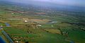 Abbeyshrule Aerodrome (aerial view).jpg 1,624 × 829; 216 KB
-

-
 Abbeyshrule, County Longford - geograph.ie - 1827154.jpg 3,888 × 2,592; 2.76 MB
-

-
 Carrickedmond and Abbeyshrule.svg 4,763 × 3,865; 3.1 MB
-
 Corncrake Meadows housing estate - geograph.org.uk - 5985006.jpg 640 × 480; 228 KB
-
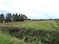 Field alongside the Bog Road - geograph.org.uk - 5985012.jpg 640 × 480; 266 KB
-
 Notice on the Royal Canal Way - geograph.org.uk - 5985024.jpg 640 × 480; 376 KB
-

-
 Picnic spot on the Royal Canal Way - geograph.org.uk - 5985032.jpg 640 × 480; 357 KB
-

-
 Rose bed with information panels - geograph.org.uk - 5984989.jpg 640 × 480; 380 KB
-

-

-

-
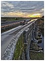
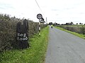 The Bog Road - geograph.org.uk - 5984980.jpg 640 × 480; 235 KB
-
 The Royal Canal Way and Quinn's Bridge. - geograph.org.uk - 5985020.jpg 640 × 480; 315 KB
-
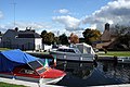
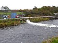 Topping up the canal - geograph.org.uk - 5985045.jpg 640 × 480; 269 KB
-
 Wayside poem - geograph.org.uk - 5985027.jpg 640 × 480; 347 KB
-
 Whitworth Aqueduct - geograph.org.uk - 5985040.jpg 640 × 480; 217 KB
-
 Whitworth Aqueduct Abbeyshrule.jpg 2,699 × 3,598; 2.85 MB

.jpg)


_-_geograph.org.uk_-_5984993.jpg)


