Category:Abbaye de Saint-Sauveur (Meurthe-et-Moselle)
Jump to navigation
Jump to search
| Object location | | View all coordinates using: OpenStreetMap |
|---|
abbey located in Meurthe-et-Moselle, in France  | |||||
| Upload media | |||||
| Instance of | |||||
|---|---|---|---|---|---|
| Location | Saint-Sauveur, canton of Cirey-sur-Vezouze | ||||
 | |||||
Subcategories
This category has only the following subcategory.
Media in category "Abbaye de Saint-Sauveur (Meurthe-et-Moselle)"
The following 3 files are in this category, out of 3 total.
-
 54488 SAINT SAUVEUR 1.jpg 600 × 800; 223 KB
-
 ABBAYE DE SAINT-SAUVEUR.JPG 4,272 × 2,848; 3.67 MB
-
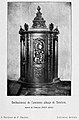 Confessionnal de l'ancienne abbaye de Domévre 755 814.jpg 1,387 × 2,104; 589 KB

