Category:AGS Map Collection
Jump to navigation
Jump to search
The American Geographical Society Library Digital Map Collection, managed by the University of Wisconsin at Milwaukee, contains over 20,000 maps, ranging from early maps of Asia to historical maps of Wisconsin and Milwaukee, and other American cities, states, and national parks.
Website: uwm.edu/lib-collections/agsl-digital-map-collection/
Media in category "AGS Map Collection"
The following 117 files are in this category, out of 117 total.
-
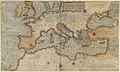 1569 map of the Mediterranean Sea.jpg 9,953 × 5,973; 9.41 MB
-
 1779 - Carte de l' Empire de la Chine avec la Tartarie Chinoise.jpg 7,144 × 5,918; 6.63 MB
-
 1869 Ordnance Survey of the Peninsula of Sinai.jpg 8,429 × 6,117; 5.19 MB
-
 1877 - Stanford’s popular map of the seat of the Russo-Turkish War of 1877–78.jpg 8,534 × 6,016; 10.13 MB
-
 1889 - The Man of Commerce - a map of the United States of America.jpg 12,000 × 7,538; 11.79 MB
-
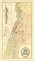 1889 Arabic language map of Syria, Lebanon and Palestine.jpg 7,598 × 13,449; 12.07 MB
-
 1899 detail map of Vienna.jpg 1,443 × 1,540; 520 KB
-
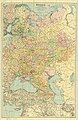
 1899 ethnographic map of Austria-Hungary.jpg 7,712 × 6,417; 9.51 MB
-
 1900 - Romania harta generala.jpg 9,500 × 9,246; 14.71 MB
-
 1918 map of the Caucasus by the British Army.jpg 6,076 × 7,403; 6.44 MB
-
 1921 map of Russia.jpg 7,448 × 11,500; 16.51 MB
-
 1943 map of the Railroads of U.S.S.R.jpg 3,265 × 2,152; 1.02 MB
-
 1946 Kurdistan et groupements Kurdes isolés (detail of Iranian Kurdistan).jpg 2,786 × 4,139; 1.71 MB
-
 1946 Kurdistan et groupements Kurdes isolés (detail of Iraqi Kurdistan).jpg 3,202 × 3,132; 1.45 MB
-
 1946 Kurdistan et groupements Kurdes isolés (detail of Kurdistan).jpg 4,782 × 3,838; 2.71 MB
-
 1946 Kurdistan et groupements Kurdes isolés (detail of Soviet Kurdistan).jpg 3,119 × 2,093; 1.01 MB
-
 1946 Kurdistan et groupements Kurdes isolés (detail of Syrian Kurdistan).jpg 2,693 × 1,803; 753 KB
-

-
 1946 Kurdistan et groupements Kurdes isolés (detail of the Iraq–Iran border).jpg 3,150 × 3,142; 1.49 MB
-
 1946 Kurdistan et groupements Kurdes isolés (detail of the Mediterranean Sea coast).jpg 2,755 × 2,073; 806 KB
-
 1946 Kurdistan et groupements Kurdes isolés (detail of the Persian Gulf coast).jpg 3,732 × 3,049; 1.41 MB
-
 1946 Kurdistan et groupements Kurdes isolés (detail of the Syria–Iraq border).jpg 2,038 × 1,813; 582 KB
-

-
 1946 Kurdistan et groupements Kurdes isolés (detail of the Turkey–Iran border).jpg 1,456 × 1,491; 450 KB
-

-
 1946 Kurdistan et groupements Kurdes isolés (detail of Turkish Kurdistan).jpg 4,106 × 2,602; 1.6 MB
-
 1946 Kurdistan et groupements Kurdes isolés (margins cropped).jpg 10,727 × 5,831; 7.39 MB
-
 1946 Kurdistan et groupements Kurdes isolés.jpg 11,967 × 6,874; 10 MB
-
 1947 Land Hemisphere map.jpg 9,500 × 8,435; 14.79 MB
-
 A land for the Jews, 1944.jpg 1,974 × 1,530; 734 KB
-
 A Map of the Pan American republics.jpg 5,403 × 8,270; 4.29 MB
-
 A new map of India and China from the latest observations, 1721.jpg 7,541 × 6,324; 7.97 MB
-
 Admiralty Chart No 1 Portsmouth to Canary Islands, Published 1914.jpg 8,752 × 15,120; 12.56 MB
-
 Admiralty Chart No 1104 Bay of Biscay, Published 1888.jpg 10,383 × 8,256; 9.45 MB
-
 Admiralty Chart No 12 Norway to Iceland, Published 1915.jpg 18,420 × 8,753; 10.73 MB
-
 Admiralty Chart No 1228 Cape Spartel to Cape Ghir, Published 1897.jpg 8,494 × 12,410; 13.07 MB
-

-
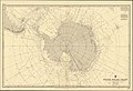 Admiralty Chart No 1240 South Polar Chart, Published 1949.jpg 12,170 × 8,288; 14.44 MB
-
 Admiralty Chart No 144 Gibraltar, Published 1886.jpg 6,040 × 8,182; 5.21 MB
-
 Admiralty Chart No 1479 Norway The Naze (Lindesnes) to the North Cape, Published1891.jpg 8,304 × 11,737; 14.17 MB
-
 Admiralty Chart No 1510 Sandwich Islands (Hawaii), Published 1843.jpg 7,966 × 5,751; 4.14 MB
-
 Admiralty Chart No 1510 Sandwich Islands (Hawaii), Published 1881.jpg 11,775 × 8,050; 9.85 MB
-
 Admiralty Chart No 1800 Malta to Cape Malea, Published 1894.jpg 13,902 × 8,363; 16.83 MB
-
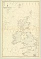
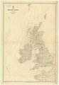 Admiralty Chart No 2 British Islands, Published 1867.jpg 8,411 × 12,129; 11.4 MB
-
 Admiralty Chart No 2 The British Islands, Published 1913 02.jpg 8,616 × 12,553; 10.08 MB
-
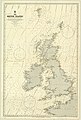 Admiralty Chart No 2 The British Islands, Published 1913.jpg 8,315 × 12,302; 11.98 MB
-

-
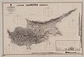 Admiralty Chart No 2074 Cyprus, Published 1892.jpg 12,312 × 8,260; 11.93 MB
-
 Admiralty Chart No 2158a Mediterranean Sea Western Sheet, Published 1883.jpg 12,264 × 8,260; 12.83 MB
-
 Admiralty Chart No 2347 Japan Nipon Kiusiu and Sikok and part of Korea, published 1855.jpg 10,000 × 8,098; 7.85 MB
-
 Admiralty Chart No 2459 North west Pacific Ocean, Published 1877.jpg 10,538 × 8,307; 8.76 MB
-
 Admiralty Chart No 2485 Barbados, Published 1856.jpg 6,140 × 8,058; 4.16 MB
-
 Admiralty Chart No 2516 Gulf of St Lawrence and the River to Quebec, Published 1891.jpg 12,228 × 8,159; 18.92 MB
-
 Admiralty Chart No 260 North Polar Sea, Published 1855.jpg 10,135 × 7,667; 9.63 MB
-
 Admiralty Chart No 274 North Polar Chart, Published 1875.jpg 11,400 × 7,695; 15.27 MB
-
 Admiralty Chart No 278 North Polar Chart, Published 1877.jpg 12,212 × 8,226; 12.15 MB
-
 Admiralty Chart No 554 South America Magellan Strait, Published 1887.jpg 12,300 × 8,141; 16.31 MB
-
 Admiralty Chart No 594 Africa west coast River Gambia to Cape Lopez and Anno Bom, Published 1885.jpg 12,439 × 8,287; 14.14 MB
-

-
 Admiralty Chart No 648 Africa east coast Delagoa Bay to River Zambezi, Published 1886.jpg 8,280 × 14,305; 13.89 MB
-
 Admiralty Chart No 8a Red Sea Sheet 1, Published 1873.jpg 10,054 × 7,987; 12.86 MB
-
 Africa in maps, 1941.jpg 3,383 × 2,095; 2.71 MB
-
 Africa's strides toward freedom, 1960.jpg 1,417 × 2,320; 1.29 MB
-
 AGS World map 1947.jpg 8,839 × 5,566; 4.17 MB
-
 Air age map of the world centered in London, 1945.jpg 8,049 × 8,999; 7.05 MB
-
 Air age octovue map of the world, 1943.jpg 8,624 × 4,985; 4.18 MB
-
 Asia-Pacific, 1932.jpg 1,828 × 2,210; 1.11 MB
-
 Carta Colonia Eritrea 1912.jpg 10,219 × 8,969; 59.89 MB
-
 Cartes de l'Inde pour servir à l'histoire de la rivalité de la France et de l'Angleterre.jpg 5,794 × 3,770; 3.01 MB
-
 Cviic 1913 Ethnic Map.jpg 2,000 × 1,690; 793 KB
-
 Distribution of nationalities in South-Eastern Europe.jpg 3,894 × 3,118; 1.82 MB
-
 European Community, 1983.jpg 5,865 × 4,416; 2.11 MB
-
 Greater Greece Map Detail by John Bartholomew 1920.jpg 2,742 × 2,743; 2.68 MB
-
 Hong Kong and Macau, 1970.jpg 3,213 × 3,637; 1.56 MB
-
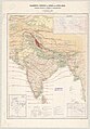
 India, by British Information Services, 1944.jpg 6,118 × 9,000; 7.54 MB
-
 India, with Sikkim and Bhutan, by the CIA, 1973.jpg 8,999 × 6,769; 5.86 MB
-
 It's an interesting World in an interesting Time, 1959.jpg 2,357 × 1,912; 544 KB
-
-
-

-
-

-

-
 Map of Europe, 1959.jpg 2,738 × 1,928; 2.17 MB
-
 Mapa de Colombia, 1951.jpg 2,827 × 3,780; 3.49 MB
-
 Mapa de la República de Colombia, 1952.jpg 6,303 × 8,999; 5.4 MB
-

-
 Mapa histórico de la vida de Simón Bolívar.jpg 2,337 × 5,726; 5.53 MB
-
 Miami, Azimuthal equidistant projection (1945).jpg 8,508 × 9,000; 7.38 MB
-
 Mount Lebanon Mutasarrifate in 1889.jpg 2,292 × 2,549; 1.07 MB
-
 Mutasarrifate of Jerusalem in 1889.jpg 2,795 × 2,854; 1.18 MB
-
 National City guide to the Americas pictorial map.jpg 1,754 × 2,343; 1.08 MB
-
 North Pacific Ocean, 1921.jpg 8,462 × 3,311; 5.64 MB
-
 Planisphère des fuseaux horaires, 1939.jpg 9,000 × 6,434; 5.73 MB
-
 Polar map of the world, 1943.jpg 1,674 × 2,225; 1.09 MB
-
 Political map of Europe, 1931.jpg 6,504 × 8,999; 6.06 MB
-

-
 Rassenkarte von Europa.jpg 970 × 863; 173 KB
-
 Richardreinmap.png 785 × 695; 1.49 MB
-
 Route chart - Chicago, Illinois to Gander, Newfoundland.jpg 4,491 × 2,051; 3.81 MB
-
 Shemya Island, Azimuthal equidistant projection (1945).jpg 8,721 × 9,000; 7.25 MB
-
 The "Time and Tide" Map of the United Nations.jpg 12,000 × 9,286; 16.58 MB
-
 The distribution of forest trees in India, 1893.jpg 8,999 × 7,687; 8.12 MB
-
 The Great Hemisphere Highway, 1941.jpg 3,512 × 2,158; 2.26 MB
-
 The New World and the European colonial system, 1823 and 1931.jpg 2,354 × 2,723; 616 KB
-
 The newly discovered world beneath the waves, 1959.jpg 6,187 × 3,969; 3.1 MB
-

-
 The U.S. commitment, 1952.jpg 4,276 × 3,332; 4.93 MB
-
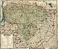 Transport map of Lithuania with distances, 1929.jpg 9,000 × 7,558; 11.03 MB
-
 U.S. Air Force physical-political chart of the world, 1961.jpg 7,448 × 6,243; 6.57 MB
-
 United States, 1959.jpg 9,000 × 5,950; 7.83 MB
-
 Where our tea comes from, 1937.jpg 5,614 × 9,000; 8.71 MB
-
 World affairs map, 1959.jpg 3,066 × 2,249; 2.32 MB
-
 World lake concept - A theoretical division of the seabed, 1977.jpg 3,179 × 2,309; 1.65 MB
-
 World map on Miller cylindrical projection, 1942.jpg 5,709 × 3,047; 6.32 MB
-
 КАВКАЗ~КРЫМ~СССР~1939~USSR~CAUCASUS~CRIMEA~.jpg 4,327 × 2,744; 4.47 MB
-
 경조오부도 (한글).jpg 4,886 × 3,704; 2.38 MB


.jpg)
.jpg)
.jpg)
.jpg)
.jpg)
.jpg)
.jpg)
.jpg)
.jpg)
.jpg)
.jpg)
.jpg)
.jpg)
.jpg)


_to_the_North_Cape,_Published1891.jpg)
,_Published_1843.jpg)
,_Published_1881.jpg)


.jpg)


.jpg)


.jpg)
.jpg)