Category:A850 road (Scotland)
Jump to navigation
Jump to search
road in Scotland  | |||||
| Upload media | |||||
| Instance of | |||||
|---|---|---|---|---|---|
| Location | Highland, Scottish Highlands, Scotland | ||||
| Transport network |
| ||||
 | |||||
Media in category "A850 road (Scotland)"
The following 20 files are in this category, out of 20 total.
-
 A850 - B886 Fairy Bridge junction - geograph.org.uk - 1269020.jpg 640 × 480; 81 KB
-
 A850 - geograph.org.uk - 3702816.jpg 1,024 × 768; 215 KB
-
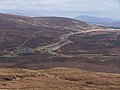
 A850 through Suladale - geograph.org.uk - 1068024.jpg 640 × 480; 82 KB
-
 A850 to Fairy Bridge - geograph.org.uk - 1636831.jpg 640 × 426; 144 KB
-
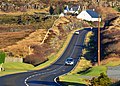
 A850 towards Dunvegan - geograph.org.uk - 1652617.jpg 1,024 × 768; 548 KB
-
 Arnisort Church - geograph.org.uk - 1070884.jpg 640 × 480; 78 KB
-
 Braebost Burn under A850 - geograph.org.uk - 1210461.jpg 600 × 450; 412 KB
-
 Cattle grid on the A850 - geograph.org.uk - 1059955.jpg 640 × 480; 84 KB
-
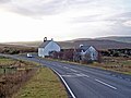
 Entering Edinbane - geograph.org.uk - 1552423.jpg 640 × 480; 71 KB
-
 Former A850 - geograph.org.uk - 1210478.jpg 600 × 450; 445 KB
-
 Former A850 - geograph.org.uk - 1210481.jpg 600 × 450; 309 KB
-
 Gaelic road sign - geograph.org.uk - 1137095.jpg 640 × 480; 104 KB
-
 Junction A850 - B8036 - geograph.org.uk - 1137087.jpg 640 × 480; 92 KB
-
 The A850 approaching Flashader - geograph.org.uk - 3829712.jpg 640 × 457; 140 KB
-
 The A850 at Borve - geograph.org.uk - 948764.jpg 640 × 344; 131 KB
-
 The A850 west of Edinbane, Isle of Skye - geograph.org.uk - 2716051.jpg 800 × 600; 111 KB
-
 UK road A850.PNG 597 × 184; 10 KB
-
 A850 Descending into Edinbane - geograph.org.uk - 1457763.jpg 640 × 427; 92 KB
-
 A850 in Flashader - geograph.org.uk - 1070870.jpg 640 × 480; 58 KB
-
 A850 towards Bernisdale - geograph.org.uk - 1073674.jpg 640 × 480; 70 KB


