Category:A703 road (Scotland)
Jump to navigation
Jump to search
English: The A703 road runs between Peebles in the Scottish Borders and Edinburgh City Bypass-A720 junction 6 at Lothianburn in Midlothian, southeastern Scotland.
road in Scotland | |||||
| Upload media | |||||
| Instance of | |||||
|---|---|---|---|---|---|
| Location | Scotland | ||||
| Transport network |
| ||||
| |||||
Media in category "A703 road (Scotland)"
The following 16 files are in this category, out of 16 total.
-
 UK road A703.PNG 597 × 184; 9 KB
-
 A703 - geograph.org.uk - 158135.jpg 640 × 480; 49 KB
-
 A703 at Peebles town boundary - geograph.org.uk - 3542114.jpg 640 × 481; 61 KB
-
 A703 Edinburgh Road - geograph.org.uk - 3542119.jpg 640 × 480; 64 KB
-
 A703 heading south. - geograph.org.uk - 992622.jpg 640 × 480; 64 KB
-
 A703 south of Redscarhead - geograph.org.uk - 3542111.jpg 640 × 480; 82 KB
-
 A703, leaving Edinburgh - geograph.org.uk - 1300406.jpg 640 × 480; 116 KB
-
 Chapelhill Farm, Peebles - geograph.org.uk - 149964.jpg 640 × 480; 278 KB
-
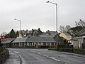 Eddleston Village - the A703 - geograph.org.uk - 1185513.jpg 640 × 480; 54 KB
-
 How many miles to Edinburgh^ - geograph.org.uk - 1185488.jpg 640 × 480; 76 KB
-

-
 The road to Peebles - A703 - geograph.org.uk - 1186014.jpg 640 × 480; 47 KB
-
 The A703 heading north - geograph.org.uk - 1210962.jpg 640 × 480; 41 KB
-

-
 The road to Lyne via the Meldons - geograph.org.uk - 1185518.jpg 640 × 480; 96 KB
-
 Seafield Moor Road at Damhead (A703) - geograph.org.uk - 967794.jpg 640 × 480; 58 KB


_-_geograph.org.uk_-_967794.jpg)