Category:A642 road (England)
Jump to navigation
Jump to search

A-road in West Yorkshire, England which runs from Huddersfield to the A64 near Leeds  | |||||
| Upload media | |||||
| Instance of | |||||
|---|---|---|---|---|---|
| Location | West Yorkshire, Yorkshire and the Humber, England | ||||
| Transport network |
| ||||
 | |||||
Subcategories
This category has the following 18 subcategories, out of 18 total.
A
- Aberford Road, Woodlesford (15 F)
B
H
N
- Northfield Lane, Horbury (9 F)
O
- Oulton Methodist Church (4 F)
R
- Rothwell Interchange (5 F)
S
T
W
- St Faith's Church, Wakefield (3 F)
Media in category "A642 road (England)"
The following 39 files are in this category, out of 39 total.
-
 A walk from Oulton Church ^7 - geograph.org.uk - 2010959.jpg 800 × 600; 306 KB
-
 A walk from Oulton Church ^8 - geograph.org.uk - 2010972.jpg 800 × 600; 279 KB
-
 A642 and A63 Roundabout - geograph.org.uk - 225937.jpg 640 × 424; 31 KB
-
 A642 Roundabout - geograph.org.uk - 238072.jpg 640 × 477; 30 KB
-
 A642 Wakefield Road, Oulton - geograph.org.uk - 1480922.jpg 640 × 480; 72 KB
-
 A642 Wakefield Road, Oulton - geograph.org.uk - 5648796.jpg 1,024 × 683; 257 KB
-
 A642, Swillington Bridge - geograph.org.uk - 5202470.jpg 1,024 × 683; 308 KB
-
 Aberford Road, Oulton - geograph.org.uk - 3857950.jpg 1,200 × 798; 544 KB
-
 After rain - geograph.org.uk - 952081.jpg 640 × 480; 94 KB
-
 Aire and Calder Navigation at Woodlesford - geograph.org.uk - 5653258.jpg 4,608 × 3,456; 3.99 MB
-
 Approaching Royds College - geograph.org.uk - 3362718.jpg 800 × 533; 139 KB
-
 B6135-A642 - geograph.org.uk - 50811.jpg 640 × 476; 76 KB
-
 BP Filling Station - Horbury Road, Lupset - geograph.org.uk - 679317.jpg 640 × 385; 161 KB
-

-
 Bridge Road, Horbury Bridge - geograph.org.uk - 946848.jpg 640 × 480; 81 KB
-
 Bull's Head. - geograph.org.uk - 827845.jpg 640 × 480; 75 KB
-
 Carpet store, Horbury Bridge - geograph.org.uk - 4270165.jpg 640 × 480; 70 KB
-
 Cycle Lane - geograph.org.uk - 270763.jpg 640 × 480; 42 KB
-
 Denby Grange Lane - geograph.org.uk - 105267.jpg 640 × 480; 178 KB
-
 Horbury Bridge - geograph.org.uk - 946852.jpg 640 × 480; 110 KB
-
 Horbury Bridge over the River Calder - geograph.org.uk - 789103.jpg 640 × 480; 139 KB
-
 Lay-by near junction 30 M62 motorway - geograph.org.uk - 1113636.jpg 640 × 393; 34 KB
-
 Milepost, Wakefield Road, Cowmes.jpg 480 × 640; 335 KB
-
 Milepost, Wakefield Road, Garforth.jpg 480 × 640; 104 KB
-
 Milepost, Wakefield Road, Grange Moor.jpg 480 × 640; 269 KB
-
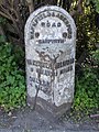
 Milepost, Wakefield Road, Lepton.jpg 480 × 640; 268 KB
-
 Milestone, Aberford Road, Sturton Grange.jpg 604 × 675; 53 KB
-
 Milestone, Aberford Road, Wakefield.jpg 1,200 × 1,600; 400 KB
-
 Milestone, New Road, Middlestown.jpg 500 × 725; 66 KB
-
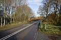
 Northfield Lane (A642) - geograph.org.uk - 4306965.jpg 640 × 480; 70 KB
-

-
 Old Milestone, A642, Wakefield Road, Lepton (geograph 6068797).jpg 718 × 960; 135 KB
-
 Road junction - geograph.org.uk - 1465810.jpg 640 × 480; 64 KB
-
 Service Mains at Swillington Bridge - geograph.org.uk - 706412.jpg 640 × 427; 90 KB
-
 Swillington Bridge - geograph.org.uk - 706377.jpg 640 × 427; 82 KB
-
 The Ship Inn, Horbury Bridge - geograph.org.uk - 4270160.jpg 640 × 480; 65 KB
-

-
 UK road A642.PNG 568 × 184; 8 KB
-
 Wakefield Road A642, Whitley Upper - geograph.org.uk - 903620.jpg 640 × 480; 91 KB


_-_geograph.org.uk_-_4306965.jpg)

.jpg)


