Category:A634 road (England)
Jump to navigation
Jump to search

road in England | |||||
| Upload media | |||||
| Instance of | |||||
|---|---|---|---|---|---|
| Location |
| ||||
| Transport network |
| ||||
| |||||
Media in category "A634 road (England)"
The following 24 files are in this category, out of 24 total.
-
 27 Blyth Road - geograph.org.uk - 1602220.jpg 640 × 480; 80 KB
-
 A634 at Stone - geograph.org.uk - 1242137.jpg 640 × 426; 108 KB
-
 A634 High Street Junction - geograph.org.uk - 1368346.jpg 640 × 480; 67 KB
-
 Abbey Lane junction with A634 - geograph.org.uk - 822889.jpg 640 × 461; 63 KB
-
 Another view of the Stone Wall Stone - geograph.org.uk - 822891.jpg 640 × 513; 104 KB
-
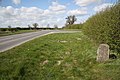
 A634 Milestone - geograph.org.uk - 1242025.jpg 640 × 426; 153 KB
-
 Clouds - geograph.org.uk - 1342655.jpg 640 × 480; 50 KB
-

-

-
 Graves Moor Crossroads - geograph.org.uk - 1242036.jpg 640 × 426; 91 KB
-
 Lodge and Gates to Sandbeck Hall - geograph.org.uk - 208290.jpg 640 × 427; 68 KB
-
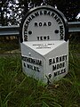
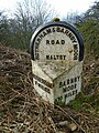
 Maltby Cross - geograph.org.uk - 208282.jpg 640 × 427; 95 KB
-
 Milepost at Stone - geograph.org.uk - 1242124.jpg 640 × 426; 140 KB
-
 Milepost near Gypsy Lane.jpg 1,200 × 1,600; 443 KB
-
 Milepost near Morrell Street.jpg 1,200 × 1,600; 689 KB
-
 Milepost, Stone Green.jpg 1,200 × 1,600; 462 KB
-
 RiverRytonBlythNewBridge.jpg 2,272 × 1,704; 888 KB
-
 Rough pull in on the A634 - geograph.org.uk - 886803.jpg 640 × 377; 53 KB
-
 Stone Wall Stone - geograph.org.uk - 208019.jpg 640 × 480; 105 KB
-
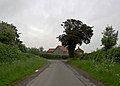
 The A634 near Barnby Moor - geograph.org.uk - 909187.jpg 640 × 405; 62 KB
-

-
 UK road A634.PNG 597 × 184; 9 KB
-
 Unusual Hedge alongside the A634 road - geograph.org.uk - 909150.jpg 640 × 322; 57 KB
-
 St.Mark's mission church, Oldcotes - geograph.org.uk - 78915.jpg 640 × 427; 74 KB


