Category:A6140 road (England)
Jump to navigation
Jump to search

road in Ashton-under-Lyne, Greater Manchester, England | |||||
| Upload media | |||||
| Instance of | |||||
|---|---|---|---|---|---|
| Location | Ashton-under-Lyne, Tameside, Greater Manchester, North West England, England | ||||
| Transport network |
| ||||
| |||||
Media in category "A6140 road (England)"
The following 7 files are in this category, out of 7 total.
-
 A6140 - geograph.org.uk - 5993722.jpg 1,280 × 1,280; 1.17 MB
-
 A6140 and tramway from IKEA building - geograph.org.uk - 3288912.jpg 4,000 × 3,000; 2.64 MB
-
 A6140 junction - geograph.org.uk - 3287465.jpg 3,470 × 2,820; 1.62 MB
-
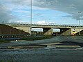 Bridge to nowhere, Thorpe Park - geograph.org.uk - 6292251.jpg 1,024 × 768; 137 KB
-
 Milepost near Gatewood End Farm.jpg 1,200 × 1,600; 619 KB
-
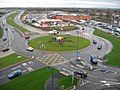 Sainsburys Island Ashton under Lyne - geograph.org.uk - 353656.jpg 640 × 480; 102 KB
-
 UK road A6140.PNG 597 × 184; 9 KB


