Category:A5 road (Great Britain)
Jump to navigation
Jump to search
- (en) A5 road (Great Britain)
- (cy) A5
- (da) A5 (vej)
- (no) A5 (vei)
- (pt) A5 (estrada)

major road in England and Wales    | |||||
| Upload media | |||||
| Instance of | |||||
|---|---|---|---|---|---|
| Location | |||||
| Transport network |
| ||||
| Maintained by |
| ||||
| Has part(s) |
| ||||
| Length |
| ||||
| Different from | |||||
 | |||||
Subcategories
This category has the following 8 subcategories, out of 8 total.
B
L
M
S
- A5 road (Selattyn and Gobowen) (21 F)
- Stretton Aqueduct (13 F)
T
- Tamworth Services (24 F)
W
Media in category "A5 road (Great Britain)"
The following 188 files are in this category, out of 188 total.
-
 A 5 bridge over the River Severn - geograph.org.uk - 727278.jpg 640 × 480; 56 KB
-
 A cut-off section of the A5 - geograph.org.uk - 387484.jpg 640 × 480; 126 KB
-
 A traffic island on the A5 - geograph.org.uk - 832430.jpg 640 × 480; 72 KB
-
 A5 at Pennine Way overbridge - geograph.org.uk - 4877313.jpg 640 × 480; 43 KB
-
 A5 Bridge, Anglesey Branch Canal - geograph.org.uk - 521353.jpg 640 × 480; 112 KB
-
 A5 by-pass - geograph.org.uk - 51546.jpg 640 × 480; 128 KB
-
 A5 Dual Carriageway - geograph.org.uk - 138917.jpg 640 × 480; 41 KB
-
 A5 Dual Carriageway.jpg 563 × 428; 33 KB
-
 A5 Entrance to Europark, near M6 - geograph.org.uk - 1597615.jpg 640 × 480; 75 KB
-
 A5 looking southeast - geograph.org.uk - 367475.jpg 640 × 480; 176 KB
-
 A5 Milestone - geograph.org.uk - 117002.jpg 640 × 480; 150 KB
-
 A5 Milton Keynes.JPG 1,707 × 1,280; 477 KB
-
 A5 near the Brickhills - geograph.org.uk - 367469.jpg 583 × 640; 179 KB
-
 A5 Near Weeford - geograph.org.uk - 982084.jpg 640 × 480; 73 KB
-
 A5 north, the Nesscliffe by-pass - geograph.org.uk - 541176.jpg 640 × 480; 82 KB
-
 A5 Road Bridge over the River Severn - geograph.org.uk - 1753672.jpg 2,816 × 2,112; 2.6 MB
-
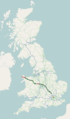 A5 road map.png 250 × 425; 48 KB
-
 A5 Shrewsbury Bypass - geograph.org.uk - 411215.jpg 640 × 480; 89 KB
-
-
 A5 south, the Nesscliffe by-pass - geograph.org.uk - 541155.jpg 640 × 480; 92 KB
-
 A5 Watling Street - geograph.org.uk - 1219405.jpg 640 × 480; 194 KB
-
 A5 Watling Street - geograph.org.uk - 1264314.jpg 640 × 403; 51 KB
-
 A5 Watling Street - geograph.org.uk - 606684.jpg 640 × 458; 58 KB
-
 A5 Watling Street - geograph.org.uk - 670084.jpg 640 × 480; 76 KB
-
 A5 Watling Street and cycleway - geograph.org.uk - 672043.jpg 640 × 477; 82 KB
-
 A5 Watling Street at Hollow Farm - geograph.org.uk - 672008.jpg 640 × 506; 72 KB
-
 A5 Watling Street at Redgate - geograph.org.uk - 672062.jpg 640 × 538; 94 KB
-
 A5 Watling Street near Hinckley - geograph.org.uk - 670103.jpg 640 × 445; 72 KB
-
 A5 Watling Street near Mancetter - geograph.org.uk - 672067.jpg 640 × 452; 77 KB
-
 A5 Watling Street near Nuneaton - geograph.org.uk - 670122.jpg 640 × 466; 72 KB
-
 A5 Watling Street near Nuneaton - geograph.org.uk - 671997.jpg 640 × 493; 78 KB
-
 A5 Watling Street near Nuneaton - geograph.org.uk - 672012.jpg 640 × 437; 73 KB
-
 A5 Watling Street north of Markyate - geograph.org.uk - 657379.jpg 640 × 421; 45 KB
-
 A5 Watling Street towards Atherstone - geograph.org.uk - 672064.jpg 640 × 569; 93 KB
-

-
 A5 Watling Street, Nuneaton - geograph.org.uk - 670119.jpg 640 × 460; 70 KB
-
 A5, Kilburn High Road - geograph.org.uk - 1144435.jpg 640 × 480; 68 KB
-
 A5, Shrewsbury Bypass at Woodcote - geograph.org.uk - 410043.jpg 600 × 600; 96 KB
-
 A5, Watling Street - geograph.org.uk - 1219386.jpg 640 × 480; 214 KB
-
 A5183 High Street South, Dunstable - geograph.org.uk - 5646582.jpg 640 × 428; 96 KB
-
 A5183 London Road, Dunstable - geograph.org.uk - 5646575.jpg 640 × 428; 100 KB
-
 A5183 London Road, Dunstable - geograph.org.uk - 5646577.jpg 640 × 428; 80 KB
-
 A5183-B5120 junction, Dunstable - geograph.org.uk - 5646609.jpg 640 × 428; 109 KB
-
 Beicwyr ailymunwch.jpg 2,232 × 1,641; 1.15 MB
-
 Bittesby, Watling Street, A5 - geograph.org.uk - 1614348.jpg 640 × 480; 49 KB
-
 Brave Old Oak, Towcester - geograph.org.uk - 473882.jpg 640 × 480; 83 KB
-
 Crossing the A5 at 100 ft - geograph.org.uk - 424149.jpg 640 × 449; 58 KB
-
 Damage at The Towers - geograph.org.uk - 1437112.jpg 428 × 640; 205 KB
-
 Foot Bridge Over Traffic - geograph.org.uk - 131820.jpg 640 × 420; 26 KB
-
 Gledrid Roundabout sign.JPG 3,712 × 2,088; 3.08 MB
-
 Heritage Sculpture - geograph.org.uk - 7939.jpg 640 × 373; 96 KB
-
 High Cross, Leicestershire (2) 7.05.jpg 1,600 × 1,200; 331 KB
-
 High Cross, Leicestershire 7.05.jpg 1,600 × 1,200; 407 KB
-
 Houses, A5 Watling Street - geograph.org.uk - 1231572.jpg 640 × 428; 47 KB
-
 Idwal Pass and the Devil's Kitchen - geograph.org.uk - 1266191.jpg 640 × 480; 82 KB
-

-
 Junction of the A4080 with the A5 - geograph.org.uk - 793450.jpg 640 × 480; 52 KB
-
 Junction, on the A5, at Ty'n-y-cefn - geograph.org.uk - 1411037.jpg 640 × 472; 77 KB
-
 Landslide at Ty Nant - geograph.org.uk - 260889.jpg 640 × 480; 88 KB
-

-
 Little wood across the A5 - geograph.org.uk - 325791.jpg 640 × 448; 83 KB
-
 M54Motorway.jpg 541 × 278; 188 KB
-
 Magna Park - geograph.org.uk - 619590.jpg 640 × 344; 52 KB
-
 Milestone near Ensdon House.jpg 768 × 1,024; 321 KB
-
 Milestone near Felton Butler.jpg 768 × 1,024; 343 KB
-
 Milestone, A5 near Hinkley (geograph 6718084).jpg 592 × 786; 808 KB
-
 Milestone, A5, Hinckley (geograph 6718159).jpg 1,024 × 683; 277 KB
-
 Milestone, Betws-y-Coed (Holyhead 45 miles).JPG 3,456 × 5,184; 8.46 MB
-
 Mt. Tryfan, as seen from the A5, in the Ogwen valley.jpg 4,608 × 2,592; 2.74 MB
-
 Northamptonshire.jpg 1,177 × 795; 229 KB
-
 Northwest along the A5 Watling Street - geograph.org.uk - 672055.jpg 640 × 450; 73 KB
-

-

-
 Old Milestone by the A5, Geese Bridge (geograph 6073008).jpg 420 × 560; 98 KB
-
 Old Milestone by the A5, in parish of Newnham (geograph 6050412).jpg 420 × 560; 62 KB
-
 Old Milestone by the A5, Little Brickhill (geograph 5880973).jpg 682 × 1,024; 324 KB
-
 Old Milestone by the A5, south of Little Brickhill (geograph 5622517).jpg 922 × 1,415; 247 KB
-

-

-
 Old Milestone by the A5, west of Little Brickhill (geograph 5622518).jpg 825 × 1,318; 215 KB
-

-
-
 Old Milestone by the former A5 in Denbigh West, Bletchley (geograph 5622520).jpg 879 × 1,350; 187 KB
-
 Old Milestone by the former A5 in Loughton, Milton Keynes (geograph 5622522).jpg 825 × 1,307; 165 KB
-
 Old Milestone by the former A5 in Loughton, Milton Keynes (geograph 5622523).jpg 793 × 1,232; 159 KB
-
 Old Milestone by the former A5 in Milton Keynes (geograph 5622521).jpg 879 × 1,265; 200 KB
-
 Old Milestone by the former A5 in Stony Stratford (geograph 5622526).jpg 793 × 1,318; 162 KB
-

-

-
 Once the A5 (geograph 6387830).jpg 1,024 × 683; 99 KB
-
 Pre Worboys Road sign Belsize Road Kilburn 1.jpg 2,736 × 3,648; 3.51 MB
-
 Pre Worboys Road sign Belsize Road Kilburn 2.jpg 3,648 × 2,736; 3.15 MB
-
 Pre Worboys Road sign Belsize Road Kilburn 4.jpg 2,736 × 3,648; 3.79 MB
-
 Rail and road, Milton Keynes - geograph.org.uk - 1758636.jpg 517 × 640; 202 KB
-
 Railway and road to Shrewsbury - geograph.org.uk - 774231.jpg 640 × 426; 107 KB
-

-

-
 Simpson, Milton Keynes geograph-3862490-by-Ben-Brooksbank.jpg 2,392 × 1,615; 4.17 MB
-
 Smockington Hollow A5-B4114 - geograph.org.uk - 863071.jpg 421 × 640; 51 KB
-
 Smockington Hollow B4114-A5 - geograph.org.uk - 863074.jpg 425 × 640; 60 KB
-
 Southeast along the A5 Watling Street - geograph.org.uk - 620643.jpg 640 × 415; 58 KB
-
 Southeast along the A5 Watling Street - geograph.org.uk - 672004.jpg 640 × 471; 66 KB
-
 Southeast along the A5 Watling Street - geograph.org.uk - 672057.jpg 640 × 426; 64 KB
-
 Stobart L7452 "Abigail Jane" (PN60 YGV) 2010 Scania G400, 26 December 2011.jpg 1,280 × 960; 625 KB
-
 Stretton Bridge over River Penk - geograph.org.uk - 1443937.jpg 640 × 480; 322 KB
-

-
 The A41 meets the A5 - geograph.org.uk - 748010.jpg 640 × 480; 45 KB
-
 The A5 - A422 roundabout at Old Stratford - geograph.org.uk - 256589.jpg 640 × 480; 145 KB
-
 The A5 - geograph.org.uk - 208771.jpg 640 × 480; 124 KB
-

-

-
 The A5 at Hen Valley - geograph.org.uk - 1406346.jpg 640 × 365; 51 KB
-
 The A5 at Plas Offa - geograph.org.uk - 914177.jpg 640 × 480; 82 KB
-

-

-
 The A5 at Valley - geograph.org.uk - 1285134.jpg 640 × 331; 52 KB
-

-

-
 The A5 east of RAF Mona - geograph.org.uk - 779714.jpg 640 × 480; 48 KB
-
 The A5 is perched on quite a steep slope - geograph.org.uk - 1476085.jpg 640 × 426; 117 KB
-
 The A5 looking eastwards from Tai Lon - geograph.org.uk - 998786.jpg 640 × 480; 50 KB
-

-
 The A5 over Pont Pen-y-Benglog - geograph.org.uk - 1039599.jpg 640 × 480; 107 KB
-

-
 The A5 west of the Cefni bridge - geograph.org.uk - 1088273.jpg 640 × 340; 50 KB
-

-
 The Bull Inn, Witherley - geograph.org.uk - 683357.jpg 640 × 394; 57 KB
-

-
 The old A5 (Watling Street) - geograph.org.uk - 373527.jpg 640 × 480; 175 KB
-
 Traffic lights on the A5 at Mona - geograph.org.uk - 779802.jpg 640 × 255; 38 KB
-
 Treban Meurig Farm from the A5 - geograph.org.uk - 998822.jpg 640 × 480; 49 KB
-
 UK road A5.PNG 124 × 84; 896 bytes
-
 UK road A5.svg 286 × 191; 3 KB
-

-
 View towards Witherley Church - geograph.org.uk - 672052.jpg 640 × 499; 77 KB
-
 Watford Gap - geograph.org.uk - 108758.jpg 640 × 480; 126 KB
-
 Watford Gap - geograph.org.uk - 86401.jpg 640 × 480; 63 KB
-
 Watling House in Wibtoft - geograph.org.uk - 619251.jpg 640 × 479; 101 KB
-
 Watling Street - the A5 - geograph.org.uk - 1072908.jpg 640 × 480; 61 KB
-
 Watling Street at Crackleybank - geograph.org.uk - 747963.jpg 640 × 480; 49 KB
-
 Watling Street goes beneath the A5 - geograph.org.uk - 787134.jpg 640 × 426; 55 KB
-
 Watling Street Tree - geograph.org.uk - 367453.jpg 640 × 480; 164 KB
-
 Weeping Cross A5 - geograph.org.uk - 382340.jpg 640 × 480; 63 KB
-
 West along Watling Street - geograph.org.uk - 747973.jpg 640 × 480; 62 KB
-
 Wharf Cottage - geograph.org.uk - 1311780.jpg 640 × 320; 52 KB
-
 White Gate Farm - geograph.org.uk - 622080.jpg 480 × 640; 70 KB
-
 Woodcote Roundabout - geograph.org.uk - 407040.jpg 623 × 468; 97 KB
-

-
 A5 (A483) Oswestry by-pass - geograph.org.uk - 204085.jpg 640 × 480; 106 KB
-
 A5 island - geograph.org.uk - 726793.jpg 640 × 480; 46 KB
-
 A5 junction - geograph.org.uk - 1509463.jpg 640 × 480; 62 KB
-
 A5 near Astcote - geograph.org.uk - 189181.jpg 640 × 480; 86 KB
-
 A5 north of Willey - geograph.org.uk - 619560.jpg 640 × 463; 79 KB
-
 A5 passes over B4473 - geograph.org.uk - 1037672.jpg 640 × 480; 87 KB
-

-
 A5 to Llangollen - geograph.org.uk - 361129.jpg 480 × 640; 137 KB
-
 A5 Towards Gwalchmai - geograph.org.uk - 38866.jpg 640 × 480; 61 KB
-
 A5 towards Three Pots - geograph.org.uk - 657827.jpg 640 × 456; 90 KB
-
 A5 Watling Street - geograph.org.uk - 616894.jpg 640 × 459; 49 KB
-
 A5 Watling Street - geograph.org.uk - 619279.jpg 640 × 433; 79 KB
-
 A5 Watling Street - geograph.org.uk - 619624.jpg 640 × 424; 69 KB
-
 A5 Watling Street - geograph.org.uk - 657813.jpg 640 × 504; 111 KB
-
 A5 Watling Street - geograph.org.uk - 657821.jpg 640 × 431; 94 KB
-
 A5 Watling Street - geograph.org.uk - 659624.jpg 640 × 449; 103 KB
-
 A5 Watling Street - geograph.org.uk - 659625.jpg 640 × 442; 87 KB
-
 A5 Watling Street - geograph.org.uk - 659632.jpg 640 × 552; 92 KB
-

-
 A5 Watling Street towards Wibtoft - geograph.org.uk - 619254.jpg 640 × 482; 93 KB
-
 Derelict buildings - geograph.org.uk - 657805.jpg 640 × 431; 72 KB
-
 Diversion on the A5 - geograph.org.uk - 260907.jpg 640 × 480; 80 KB
-
 Gledrid Truck Stop - geograph.org.uk - 149872.jpg 640 × 424; 74 KB
-
 Layby on the A5 Watling Street - geograph.org.uk - 657778.jpg 640 × 484; 81 KB
-
 Lime Kilns Inn - geograph.org.uk - 659629.jpg 640 × 463; 69 KB
-
 Lime Kilns Inn - geograph.org.uk - 659631.jpg 640 × 492; 75 KB
-
 Magna Park - A5 - geograph.org.uk - 134499.jpg 640 × 480; 49 KB
-
 Northwest along the A5 Watling Street - geograph.org.uk - 619547.jpg 640 × 480; 67 KB
-

-
 Smockington Hollow - geograph.org.uk - 657796.jpg 640 × 431; 64 KB
-
 Smockington Hollow - geograph.org.uk - 657798.jpg 640 × 491; 90 KB
-
 Smockington Hollow - geograph.org.uk - 657801.jpg 640 × 401; 63 KB
-
 Smockington Hollow - geograph.org.uk - 657802.jpg 640 × 480; 91 KB
-
 Smockington Hollow - geograph.org.uk - 657803.jpg 640 × 407; 64 KB
-

-
 The A5 near Montford Bridge - geograph.org.uk - 464587.jpg 640 × 464; 102 KB
-

-
 The Berwyn Arms, Glyndyfrdwy - geograph.org.uk - 478772.jpg 640 × 480; 92 KB
-
 The Longshoot, Nuneaton - geograph.org.uk - 162111.jpg 640 × 480; 109 KB
-
 Three Pots Public House - geograph.org.uk - 657829.jpg 640 × 446; 75 KB


_7.05.jpg)


.jpg)
.jpg)
.JPG)


.jpg)
.jpg)
.jpg)
.jpg)
.jpg)
.jpg)
.jpg)
.jpg)
.jpg)
.jpg)
.jpg)
.jpg)
.jpg)
.jpg)
.jpg)
.jpg)
.jpg)
,_NW2_-_geograph.org.uk_-_2577171.jpg)
.jpg)


.jpg)


_2010_Scania_G400,_26_December_2011.jpg)


_from_the_foot_and_cycle_bridge_-_geograph.org.uk_-_804424.jpg)


_-_geograph.org.uk_-_373527.jpg)


_Oswestry_by-pass_-_geograph.org.uk_-_204085.jpg)


