Category:A53 road (England)
Jump to navigation
Jump to search

primary route in northern England    | |||||
| Upload media | |||||
| Instance of | |||||
|---|---|---|---|---|---|
| Location |
| ||||
| Transport network |
| ||||
| Length |
| ||||
 | |||||
Subcategories
This category has the following 5 subcategories, out of 5 total.
Media in category "A53 road (England)"
The following 130 files are in this category, out of 130 total.
-
 10, Stockwell Street, Leek 01.jpg 3,000 × 4,000; 4.53 MB
-
 16 and 18, Stockwell Street, Leek.jpg 4,103 × 3,138; 2.09 MB
-

-
 A500 approaching the A53 junction - geograph.org.uk - 2343668.jpg 640 × 480; 60 KB
-
 A500 north of the A53 junction - geograph.org.uk - 2343677.jpg 640 × 480; 56 KB
-

-
 A53 above Stanley Moor - geograph.org.uk - 6296734.jpg 1,024 × 769; 103 KB
-

-
 A53 and Trent & Mersey - geograph.org.uk - 3113428.jpg 429 × 640; 81 KB
-
 A53 approaching A529 roundabout - geograph.org.uk - 3532365.jpg 640 × 386; 121 KB
-
 A53 approaching School Lane junction - geograph.org.uk - 3532310.jpg 640 × 423; 54 KB
-
 A53 Approaching Shawbury from Market Drayton - geograph.org.uk - 2769540.jpg 3,824 × 2,868; 3.02 MB
-
 A53 bridge over the M6 - geograph.org.uk - 2647038.jpg 640 × 430; 47 KB
-
 A53 Flyover - geograph.org.uk - 209824.jpg 640 × 480; 36 KB
-

-
 A53 lay-by at Hodnet, Shropshire England.jpg 640 × 426; 302 KB
-
 A53 Leek Road, Burbage - geograph.org.uk - 6296735.jpg 1,024 × 769; 121 KB
-
 A53 near War Hill - geograph.org.uk - 2961459.jpg 1,024 × 768; 349 KB
-
 A53 on Stanley Moor - geograph.org.uk - 5568126.jpg 1,600 × 1,066; 615 KB
-
 A53 past entrance to Shawbury Park. - geograph.org.uk - 655586.jpg 640 × 480; 50 KB
-
 A53 road map.png 250 × 425; 48 KB
-
 Approaching Flash Head on the A53 - geograph.org.uk - 4460479.jpg 4,320 × 3,240; 4.26 MB
-

-
 Autumn colours on the A53 near Leek - geograph.org.uk - 3723613.jpg 1,600 × 1,200; 1.1 MB
-

-
 Benkid77 A53, Buxton 1 080809.JPG 3,648 × 2,736; 3.58 MB
-
 Benkid77 Roundabout, Buxton 2 080809.JPG 3,648 × 2,736; 3.55 MB
-
 Benkid77 Roundabout, Buxton 3 080809.JPG 3,648 × 2,736; 3.52 MB
-
 Benkid77 The Railway, Buxton 080809.JPG 3,648 × 2,736; 3.46 MB
-
 Bings Farm. - geograph.org.uk - 623299.jpg 640 × 480; 104 KB
-
 Blackshaw Moor milepost in its setting - geograph.org.uk - 1598281.jpg 640 × 480; 103 KB
-
 Bridge over the Serpentine Stream - geograph.org.uk - 5830909.jpg 6,032 × 4,014; 7.08 MB
-
 Bridge Pier - geograph.org.uk - 5829966.jpg 3,727 × 5,853; 5.14 MB
-
 Bridge pier - geograph.org.uk - 5829970.jpg 3,752 × 5,886; 5.72 MB
-
 Bus, Buxton 080809.jpg 3,648 × 2,736; 3.61 MB
-
 Claire Austin Plant Centre - geograph.org.uk - 441089.jpg 640 × 480; 94 KB
-
 Cobridge, Church Terrace and the A53 - geograph.org.uk - 5136321.jpg 4,845 × 3,633; 3.15 MB
-
 Cobridge, cycleway off A53 - geograph.org.uk - 5142169.jpg 4,896 × 3,672; 3.96 MB
-
 Cobridge, disused postbox on A53 - geograph.org.uk - 5135065.jpg 3,672 × 4,896; 4.7 MB
-
 Cobridge, former railway bridge beside the A53 - geograph.org.uk - 5141292.jpg 4,896 × 3,672; 4.65 MB
-
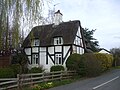 Cottage just off the A53, on the road to Hales - geograph.org.uk - 1804069.jpg 3,296 × 2,472; 1.85 MB
-
 Crossroads - geograph.org.uk - 568481.jpg 640 × 480; 62 KB
-
 Crossroads on the A53, Bloreheath - geograph.org.uk - 1804053.jpg 3,296 × 2,472; 1.91 MB
-
 Dove Head 376618 71ea2781.jpg 3,456 × 2,304; 3.71 MB
-
 Entrance to Blackshaw caravan park from the A53 - geograph.org.uk - 4074929.jpg 1,024 × 768; 173 KB
-
 Entrance to Sneyd Hill Park off the A53 - geograph.org.uk - 5199940.jpg 3,264 × 2,448; 3.32 MB
-
 Essar filling station, Leek Road - geograph.org.uk - 5568117.jpg 1,600 × 1,280; 656 KB
-
 Etruria, Cobridge Road (A53) - geograph.org.uk - 5141275.jpg 4,896 × 3,672; 2.73 MB
-
 Etruria, gas installation on A53 - geograph.org.uk - 5143886.jpg 2,448 × 3,264; 1.94 MB
-
 Field beside the A53 - geograph.org.uk - 535937.jpg 640 × 480; 94 KB
-
 Flash Bar - geograph.org.uk - 1471341.jpg 640 × 480; 35 KB
-

-
 Hanley, store on corner of Century Street and A53 - geograph.org.uk - 5143829.jpg 4,896 × 3,672; 3.29 MB
-
 Hilltop road, the A53 - geograph.org.uk - 2039896.jpg 3,872 × 2,461; 2.89 MB
-
 Hogshaw Lane Viaduct.jpg 4,114 × 2,314; 2.37 MB
-
 Junction of the A5009 with the A53 - geograph.org.uk - 4102116.jpg 1,600 × 1,200; 620 KB
-
 Just some more roadworks - geograph.org.uk - 1800890.jpg 640 × 480; 79 KB
-
 Land alongside the A53 - geograph.org.uk - 4675052.jpg 800 × 451; 182 KB
-
 Lane approaching the A53 - geograph.org.uk - 2961448.jpg 1,024 × 768; 161 KB
-
 Lane at Clod Hall - geograph.org.uk - 535865.jpg 640 × 480; 95 KB
-
-
 Looking toward Buxton - geograph.org.uk - 5830902.jpg 6,032 × 4,014; 5.41 MB
-
 Maer lane crossing A53 - geograph.org.uk - 3532360.jpg 640 × 401; 94 KB
-
 Mile post at NGR SJ 973 551.jpg 3,000 × 4,000; 4.83 MB
-
 Mile post at NGR SJ 973 552.jpg 3,000 × 4,000; 4.66 MB
-
 Milepost 2 miles from Leek.jpg 492 × 701; 70 KB
-
 Milepost 3 miles form Leek.jpg 492 × 701; 72 KB
-
 Milepost at SJ 923 528.jpg 492 × 701; 82 KB
-
 Milepost at SJ 933 541.jpg 492 × 701; 65 KB
-
 Milepost at SJ 973 551.jpg 492 × 701; 65 KB
-
 Milepost at SK 00012 57696.jpg 492 × 701; 70 KB
-
 Milepost on the A53 at the Winking Man - geograph.org.uk - 5084361.jpg 600 × 800; 101 KB
-
 Moorland west of the A53 near Flash - geograph.org.uk - 4074806.jpg 1,024 × 487; 67 KB
-
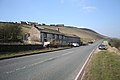
 Morridge Top on the A53 - geograph.org.uk - 4074812.jpg 1,024 × 691; 94 KB
-
 Newcastle-under-Lyme, road junction on King Street (A53) - geograph.org.uk - 5286474.jpg 4,032 × 2,894; 2.7 MB
-

-

-
 Old Milepost by the A53, north of Hopton Methodist Chapel (geograph 6490208).jpg 2,908 × 4,242; 6.13 MB
-
 Old Milepost by the A53, Shawbury Bridge, Shawbury (geograph 6072847).jpg 1,454 × 1,704; 500 KB
-
 Old Milestone by the A53, Ash Almshouses, Broad Street, Leek (geograph 6038633).jpg 1,913 × 1,368; 543 KB
-
 Peak Park boundary stone - geograph.org.uk - 1601649.jpg 640 × 493; 151 KB
-
 Privilege - geograph.org.uk - 121718.jpg 480 × 640; 28 KB
-

-

-
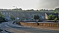
 Railway viaduct and A53 roundabout. Buxton - geograph.org.uk - 6314881.jpg 4,608 × 3,456; 5.18 MB
-
 Ramshaw Rocks from the A53 - geograph.org.uk - 1565546.jpg 640 × 480; 45 KB
-
 River Tern downstream of A53 bridge - geograph.org.uk - 788114.jpg 480 × 640; 398 KB
-
 Road sign on the A53 - geograph.org.uk - 2705818.jpg 640 × 480; 97 KB
-
 Road to Brandside from A53 - geograph.org.uk - 5568172.jpg 1,600 × 800; 458 KB
-

-
 Rural crossroads at The Lymes on the A53 - geograph.org.uk - 5036656.jpg 3,264 × 2,448; 3.56 MB
-
 Serpentine Bridge - geograph.org.uk - 5829963.jpg 6,032 × 4,014; 6.01 MB
-
 Sheet Anchor Baldwins Gate - geograph.org.uk - 433960.jpg 640 × 462; 80 KB
-
 Shepherding on the A53-21st Century style - geograph.org.uk - 1775207.jpg 3,072 × 2,304; 743 KB
-
 Site of a former car-showroom - geograph.org.uk - 1800905.jpg 640 × 480; 56 KB
-

-
 Superb trees - geograph.org.uk - 5830897.jpg 4,014 × 6,032; 4.72 MB
-
 Ternhill Farm - geograph.org.uk - 568477.jpg 640 × 480; 73 KB
-
 The A53 looking West after Baldwins Gate - geograph.org.uk - 511692.jpg 640 × 480; 115 KB
-

-
 The A53 through Endon - geograph.org.uk - 4271540.jpg 1,600 × 1,200; 830 KB
-
 The bridge on St John's road - geograph.org.uk - 5832896.jpg 6,032 × 4,014; 5.8 MB
-
 The Edge End milepost in its setting - geograph.org.uk - 1381395.jpg 640 × 480; 143 KB
-
 The Moss Rose Inn - geograph.org.uk - 123366.jpg 640 × 480; 78 KB
-
 The Moss Rose Inn, Leek - geograph.org.uk - 1471350.jpg 640 × 480; 69 KB
-
 The Pavilion care home - geograph.org.uk - 5830916.jpg 6,032 × 4,014; 5.67 MB
-
 The Rowans on the A53 - geograph.org.uk - 3532335.jpg 640 × 382; 99 KB
-
 The Stake Gutter milepost - geograph.org.uk - 1381405.jpg 480 × 640; 48 KB
-

-
 The Travellers Rest - geograph.org.uk - 762864.jpg 640 × 426; 68 KB
-
 The Village junction with A53 Endon - geograph.org.uk - 4074888.jpg 1,024 × 768; 99 KB
-
 The Winking Man on the A53 - geograph.org.uk - 4908003.jpg 815 × 1,200; 214 KB
-
 Three Horseshoes Inn, Blackshaw Moor - geograph.org.uk - 1757899.jpg 1,024 × 768; 192 KB
-
 Turncliff Common - geograph.org.uk - 5956027.jpg 5,471 × 3,408; 1.77 MB
-
 UK road A53.PNG 568 × 184; 7 KB
-
 UK road A53.svg 387 × 191; 3 KB
-

-
 View from A53 towards Cistern's Clough - geograph.org.uk - 5568167.jpg 1,600 × 1,200; 614 KB
-
 A53 at Ramshaw Rocks - geograph.org.uk - 785753.jpg 640 × 480; 74 KB
-
 A53 Crossing, Stanton Heath - geograph.org.uk - 601572.jpg 640 × 480; 57 KB
-

-
 A53 Ramshaw - geograph.org.uk - 785765.jpg 640 × 480; 59 KB
-
 A53 towards Upper Astley - geograph.org.uk - 655577.jpg 640 × 480; 52 KB
-
 A53 trunk road - geograph.org.uk - 604978.jpg 640 × 480; 80 KB
-
 Brightlee beside the A53 - geograph.org.uk - 655578.jpg 640 × 480; 55 KB
-
 Derelict farmhouse near Flash - geograph.org.uk - 376658.jpg 640 × 426; 72 KB
-
 Loggerheads Crossroads - geograph.org.uk - 1248.jpg 640 × 480; 35 KB
-
 Road junction - geograph.org.uk - 595798.jpg 640 × 480; 154 KB
-
 Roadsign near Shawbury - geograph.org.uk - 655596.jpg 640 × 480; 59 KB
-
 The Lostford turn on the A53 - geograph.org.uk - 568321.jpg 640 × 480; 58 KB


_junction_bridges_-_geograph.org.uk_-_2343673.jpg)


_-_geograph.org.uk_-_5141275.jpg)


_-_geograph.org.uk_-_5286474.jpg)
.jpg)
.jpg)
.jpg)
.jpg)
.jpg)


_alongside_A53_at_Cistern%27s_Clough_-_geograph.org.uk_-_4074939.jpg)


