Category:A533 road (England)
Jump to navigation
Jump to search

road in England | |||||
| Upload media | |||||
| Instance of | |||||
|---|---|---|---|---|---|
| Location | Cheshire, North West England, England | ||||
| Transport network |
| ||||
| Connects with | |||||
| Has part(s) |
| ||||
| Length |
| ||||
| Terminus | |||||
 | |||||
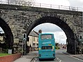
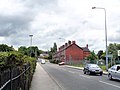
English: The A533 road is a road linking Rode Heath in Cheshire, England with Widnes, also in Cheshire.
Subcategories
This category has the following 7 subcategories, out of 7 total.
K
- Kinderton Arms, Middlewich (7 F)
N
- Northwich Viaduct (21 F)
P
- St Peter's Church, Elworth (4 F)
S
- Silver Jubilee Bridge (125 F)
W
- Winnington Bridge (21 F)
Media in category "A533 road (England)"
The following 15 files are in this category, out of 15 total.
-

-
 Almshouses, Sandbach.jpg 4,000 × 3,000; 1.97 MB
-
 Approaching The Bridge - geograph.org.uk - 1071008.jpg 640 × 330; 63 KB
-
 On top of Preston Brook Tunnel - geograph.org.uk - 89291.jpg 640 × 426; 93 KB
-
 Post box at junction of A533 & Dubthorn Ln near Sandbach - geograph.org.uk - 5626390.jpg 5,184 × 2,920; 6.19 MB
-
 Randle Rode - geograph.org.uk - 92444.jpg 640 × 480; 126 KB
-

-

-
 The A533 looking North © Dr Duncan Pepper.jpg 3,072 × 2,304; 3.01 MB
-
-
 UK road A533.PNG 568 × 184; 7 KB
-
-
 Winnington Lane road bridge - geograph.org.uk - 2532992.jpg 640 × 481; 56 KB
-

-
 Petrol Station at Dones Green - geograph.org.uk - 153077.jpg 640 × 480; 68 KB


_-_geograph.org.uk_-_861202.jpg)

_Dutton_-_geograph.org.uk_-_153096.jpg)
