Category:A4304 road (England)
Jump to navigation
Jump to search

road in England | |||||
| Upload media | |||||
| Instance of | |||||
|---|---|---|---|---|---|
| Location |
| ||||
| Transport network |
| ||||
| |||||
Subcategories
This category has only the following subcategory.
Media in category "A4304 road (England)"
The following 42 files are in this category, out of 42 total.
-
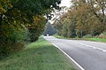 A4304 Theddingworth Road - geograph.org.uk - 580467.jpg 640 × 424; 116 KB
-
 Approaching Theddingworth - geograph.org.uk - 547332.jpg 640 × 432; 115 KB
-
 Husbands Bosworth 1.jpg 640 × 587; 104 KB
-
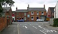
 Husbands Bosworth High Street - geograph.org.uk - 1428451.jpg 640 × 480; 76 KB
-
 Husbands Bosworth High Street - geograph.org.uk - 1428467.jpg 640 × 480; 69 KB
-
 Husbands Bosworth High Street - geograph.org.uk - 1439445.jpg 640 × 480; 56 KB
-
 Husbands Bosworth The Bell Inn - geograph.org.uk - 1433132.jpg 640 × 532; 64 KB
-
 Lubenham geograph-3764155-by-Ben-Brooksbank.jpg 2,391 × 1,446; 2.86 MB
-
 Lubenham-The Green (geograph 2133491).jpg 640 × 425; 57 KB
-
 Lutterworth Road at Walcote - geograph.org.uk - 867801.jpg 640 × 473; 116 KB
-
 Lutterworth Road towards North Kilworth - geograph.org.uk - 865488.jpg 640 × 537; 108 KB
-
 Lutterworth Road towards North Kilworth - geograph.org.uk - 865529.jpg 640 × 509; 119 KB
-
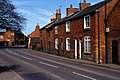
 Main Street, Husbands Bosworth. - geograph.org.uk - 400404.jpg 640 × 480; 111 KB
-

-
 The High Street, Husbands Bosworth - geograph.org.uk - 546832.jpg 640 × 381; 85 KB
-
 The road to Walton and Kimcote - geograph.org.uk - 865496.jpg 640 × 516; 77 KB
-
 Theddingworth - geograph.org.uk - 147743.jpg 640 × 427; 120 KB
-
 Theddingworth Road, Leicestershire - geograph.org.uk - 547351.jpg 640 × 528; 114 KB
-
 Theddingworth Village Hall. - geograph.org.uk - 415037.jpg 640 × 568; 83 KB
-
 UK road A4304.PNG 597 × 184; 9 KB
-
 View to Theddingworth Church. - geograph.org.uk - 415036.jpg 640 × 480; 73 KB
-
 Walcote, Lutterworth - geograph.org.uk - 75503 (cropped).jpg 640 × 400; 70 KB
-
 Walcote, Lutterworth - geograph.org.uk - 75503.jpg 640 × 425; 75 KB
-
 Walcote-Lutterworth Road - geograph.org.uk - 713558.jpg 640 × 480; 85 KB
-
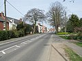
 Welcome to Theddingworth - geograph.org.uk - 547359.jpg 640 × 450; 96 KB
-
 White Lion in North Kilworth - geograph.org.uk - 597588.jpg 640 × 503; 82 KB
-
 Approaching Lubenham - geograph.org.uk - 580252.jpg 640 × 358; 91 KB
-
 Bosworth Road near Theddingworth - geograph.org.uk - 547345.jpg 640 × 474; 111 KB
-
 Bosworth Road, Theddingworth - geograph.org.uk - 547325.jpg 640 × 403; 102 KB
-
 Bridge 45, Station Road - geograph.org.uk - 597605.jpg 640 × 480; 67 KB
-
 Harborough Road towards Lubenham - geograph.org.uk - 580208.jpg 640 × 433; 121 KB
-
 Harborough Road towards Lubenham - geograph.org.uk - 580234.jpg 640 × 448; 118 KB
-
 Harborough Road towards Market Harborough - geograph.org.uk - 547370.jpg 640 × 495; 124 KB
-

-
 North Kilworth - geograph.org.uk - 167627.jpg 640 × 480; 173 KB
-
 North Kilworth - geograph.org.uk - 597580.jpg 640 × 599; 92 KB
-
 Scoborough Cottage - geograph.org.uk - 547374.jpg 640 × 488; 110 KB
-
 Signpost for Marston Trussell - geograph.org.uk - 580446.jpg 556 × 640; 103 KB
-
 Station Road, North Kilworth - geograph.org.uk - 597591.jpg 640 × 413; 59 KB
-
 The road to Lubenham. - geograph.org.uk - 322064.jpg 640 × 480; 96 KB
-
 The Tavern Inn Walcote - geograph.org.uk - 598961.jpg 640 × 480; 82 KB
-
 Theddingworth Road, Leicestershire - geograph.org.uk - 547349.jpg 640 × 494; 115 KB


.jpg)


.jpg)


