Category:A427 road (England)
Jump to navigation
Jump to search
road in England | |||||
| Upload media | |||||
| Instance of | |||||
|---|---|---|---|---|---|
| Location |
| ||||
| Transport network |
| ||||
| Length |
| ||||
 | |||||
Media in category "A427 road (England)"
The following 11 files are in this category, out of 11 total.
-
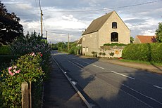
A427 Harborough Road - geograph.org.uk - 230251.jpg 640 × 480; 67 KB
-
A427 towards Weldon - geograph.org.uk - 375731.jpg 640 × 480; 62 KB
-
Bus Garage and Texaco Petrol Station - geograph.org.uk - 834247.jpg 640 × 480; 73 KB
-
Culvert below the A427 - geograph.org.uk - 307278.jpg 640 × 480; 147 KB
-
Four For Sale - geograph.org.uk - 187411.jpg 640 × 480; 85 KB
-
Junction of Hermitage Road with A427 - geograph.org.uk - 307236.jpg 640 × 480; 80 KB
-
Lower Benefield - geograph.org.uk - 187407.jpg 640 × 480; 89 KB
-
UK road A427.PNG 568 × 184; 6 KB
-
Underpass under the A427. - geograph.org.uk - 429556.jpg 640 × 480; 132 KB
-
Upper Benefield - geograph.org.uk - 484575.jpg 640 × 428; 95 KB
-
Zebra Crossing - geograph.org.uk - 1451766.jpg 480 × 640; 94 KB


