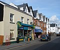
Category:A375 road (England)
Jump to navigation
Jump to search
road in England | |||||
| Upload media | |||||
| Instance of | |||||
|---|---|---|---|---|---|
| Location |
| ||||
| Transport network |
| ||||
| |||||
Media in category "A375 road (England)"
The following 11 files are in this category, out of 11 total.
-
A375, near Putts Corner, Sidbury - geograph.org.uk - 205007.jpg 640 × 427; 275 KB
-
Battishorne Farm, Honiton - geograph.org.uk - 201154.jpg 640 × 480; 80 KB
-
Bridge over the Wool Brook - geograph.org.uk - 1512920.jpg 640 × 480; 113 KB
-
Drews Stores - geograph.org.uk - 1700006.jpg 2,560 × 1,920; 1.07 MB
-
Masts at Putts Corner - geograph.org.uk - 1706154.jpg 2,560 × 1,920; 1.07 MB
-
Post Office and Post box. - geograph.org.uk - 1482362.jpg 640 × 480; 78 KB
-
The High Street, Honiton - geograph.org.uk - 1140217.jpg 640 × 480; 51 KB
-
The Wool Brook goes under Sidford Road - geograph.org.uk - 1511554.jpg 640 × 480; 140 KB
-
UK road A375.PNG 597 × 184; 9 KB


