Category:A35 road (England)
Jump to navigation
Jump to search
Main Wikipedia article: A35 road.


road in England   | |||||
| Upload media | |||||
| Instance of | |||||
|---|---|---|---|---|---|
| Location |
| ||||
| Transport network |
| ||||
| Length |
| ||||
 | |||||
Subcategories
This category has the following 6 subcategories, out of 6 total.
B
- Burgess Road, Southampton (10 F)
C
- The Cat and Fiddle, Hinton (4 F)
H
M
- Milestone at Askerswell Down (3 F)
W
Media in category "A35 road (England)"
The following 200 files are in this category, out of 217 total.
(previous page) (next page)-
 A35 - geograph.org.uk - 159844.jpg 640 × 480; 47 KB
-
 A35 - geograph.org.uk - 59235.jpg 640 × 481; 151 KB
-

-
 A35 Bridge - geograph.org.uk - 1070033.jpg 640 × 480; 70 KB
-
 A35 bridge over the river Avon - geograph.org.uk - 784062.jpg 640 × 358; 55 KB
-
 A35 crossing River Yarty - geograph.org.uk - 1055793.jpg 640 × 480; 74 KB
-
 A35 Dorchester Bypass - geograph.org.uk - 963614.jpg 640 × 480; 69 KB
-

-

-
 A35 in the New Forest.jpg 640 × 480; 168 KB
-
 A35 minor road junction - geograph.org.uk - 171621.jpg 640 × 481; 94 KB
-
 A35 near Morcombelake - geograph.org.uk - 390237.jpg 640 × 480; 94 KB
-
 A35 near Morcombelake looking east - geograph.org.uk - 390257.jpg 640 × 480; 71 KB
-
 A35 near Upton - geograph.org.uk - 1233711.jpg 640 × 480; 62 KB
-
 A35 towards Dorchester - geograph.org.uk - 1176376.jpg 640 × 480; 129 KB
-
 A35 towards Poole - geograph.org.uk - 1176385.jpg 640 × 480; 120 KB
-
 A35 Winterbourne Abbas - geograph.org.uk - 1555639.jpg 640 × 480; 66 KB
-
 A35, Bere Regis - geograph.org.uk - 1370516.jpg 640 × 455; 104 KB
-
 A35, Roman road and parish boundary - geograph.org.uk - 550524.jpg 640 × 480; 105 KB
-
 Artwave West, Morcombelake - geograph.org.uk - 1586945.jpg 640 × 480; 67 KB
-
 Bend on the A35 west of Kilmington - geograph.org.uk - 1716867.jpg 480 × 640; 77 KB
-
 Bere Regis , A35 Roundabout - geograph.org.uk - 1263507.jpg 640 × 480; 56 KB
-
 Bere Regis - geograph.org.uk - 1595364.jpg 640 × 480; 64 KB
-
 Bere Regis - Woodbury Hill - geograph.org.uk - 1595396.jpg 640 × 480; 58 KB
-

-
 Bob Perry Marine, near Axminster - geograph.org.uk - 1586882.jpg 640 × 404; 56 KB
-
 Bournemouth , Christchurch Road A35 - geograph.org.uk - 1289086.jpg 640 × 449; 75 KB
-
 Bournemouth , St Paul's Road A35 - geograph.org.uk - 1289065.jpg 640 × 480; 78 KB
-

-

-
 Bournemouth , Wessex Way - geograph.org.uk - 1152198.jpg 640 × 256; 50 KB
-
 Bournemouth , Wessex Way and ASDA - geograph.org.uk - 1119519.jpg 640 × 480; 37 KB
-
-
 Bournemouth Road in east Parkstone - geograph.org.uk - 383971.jpg 640 × 443; 73 KB
-
 Bournemouth Road Veterinary Centre - geograph.org.uk - 1341612.jpg 640 × 480; 88 KB
-

-
-
 Bournemouth, air show advertisement - geograph.org.uk - 932946.jpg 640 × 480; 77 KB
-
 Bournemouth, Berkeley Mansions - geograph.org.uk - 729368.jpg 640 × 480; 101 KB
-
 Bournemouth, bollards in snow - geograph.org.uk - 1150566.jpg 480 × 640; 75 KB
-
-

-

-
 Rosebery Park Baptist Church.jpg 2,592 × 1,944; 2.31 MB
-
 Bournemouth, skating directions - geograph.org.uk - 1150549.jpg 480 × 640; 70 KB
-
 Bournemouth, snow-spattered postbox - geograph.org.uk - 1150558.jpg 480 × 640; 87 KB
-
 Bournemouth, St. Paul's Roundabout - geograph.org.uk - 617855.jpg 640 × 480; 64 KB
-
 Bournemouth, St. Swithun's Road South - geograph.org.uk - 615847.jpg 640 × 480; 68 KB
-
 Bournemouth, St. Swithun's Roundabout - geograph.org.uk - 729361.jpg 640 × 480; 59 KB
-

-

-
 Bournemouth, town centre by-pass - geograph.org.uk - 495938.jpg 640 × 480; 54 KB
-
-

-

-

-

-

-
 Bridge over A35 near Puddletown - geograph.org.uk - 1721927.jpg 640 × 480; 77 KB
-
 Bridle Way underpass on A35 - geograph.org.uk - 484318.jpg 640 × 480; 89 KB
-
 Bridport , South Sea Road - geograph.org.uk - 1517831.jpg 640 × 460; 70 KB
-
-

-
 Disused A35 Tunnel - geograph.org.uk - 413761.jpg 640 × 431; 187 KB
-

-
 Dorchester , The A35 and Bridge - geograph.org.uk - 1517828.jpg 640 × 461; 92 KB
-
 Dorchester , The A35 Trunk Road - geograph.org.uk - 1517829.jpg 640 × 480; 102 KB
-
 Dorchester , Weymouth Road - geograph.org.uk - 1263501.jpg 640 × 466; 81 KB
-
 Dorchester bypass - geograph.org.uk - 435875.jpg 640 × 480; 90 KB
-
 Dorchester Bypass looking North West - geograph.org.uk - 803798.jpg 426 × 640; 76 KB
-
 Dorchester Bypass looking South East - geograph.org.uk - 803796.jpg 426 × 640; 75 KB
-
 Dorchester bypass, Dorchester, Dorset - geograph.org.uk - 336944.jpg 640 × 480; 105 KB
-
 Dual carriageway (A35) road junction - geograph.org.uk - 529365.jpg 623 × 493; 74 KB
-
 Dunces Arch, New Forest - geograph.org.uk - 164782.jpg 480 × 640; 181 KB
-
 East Devon , The A35 - geograph.org.uk - 1538044.jpg 640 × 480; 81 KB
-
 East Devon , The A35 - geograph.org.uk - 1538047.jpg 640 × 432; 85 KB
-
 East Devon , The A35 - geograph.org.uk - 1538050.jpg 640 × 434; 113 KB
-
 East Road, Bridport - geograph.org.uk - 1587797.jpg 640 × 480; 84 KB
-
 Feline humour - geograph.org.uk - 485102.jpg 640 × 383; 85 KB
-
 Frosty layby on the A35 - geograph.org.uk - 1072448.jpg 640 × 480; 55 KB
-
 Hardown Hill, view east - geograph.org.uk - 519414.jpg 640 × 429; 102 KB
-
 High Street, Honiton - geograph.org.uk - 903723.jpg 640 × 395; 64 KB
-
 Honiton High Street - geograph.org.uk - 1062294.jpg 640 × 480; 68 KB
-
 Honiton High Street - geograph.org.uk - 46341.jpg 640 × 480; 82 KB
-
 Honiton post office and High Street - geograph.org.uk - 1062287.jpg 640 × 480; 78 KB
-

-
 Honiton, High Street and New Street - geograph.org.uk - 1244191.jpg 640 × 427; 380 KB
-
 Honiton, W H Smith - geograph.org.uk - 1244170.jpg 427 × 640; 362 KB
-
 Honiton, Wing Hong Chinese Takeaway - geograph.org.uk - 1244167.jpg 640 × 427; 358 KB
-
 Iford Bridge Tavern - geograph.org.uk - 1077670.jpg 640 × 514; 53 KB
-
 Iford roundabout - geograph.org.uk - 1450106.jpg 640 × 424; 69 KB
-

-
 Kilmington Cafe - geograph.org.uk - 1586807.jpg 640 × 459; 65 KB
-
 Lambert's Hill - geograph.org.uk - 1006458.jpg 640 × 426; 77 KB
-
 Lay-by on the A35 - geograph.org.uk - 379192.jpg 640 × 427; 88 KB
-
 Lay-by on the A35 - geograph.org.uk - 379201.jpg 640 × 427; 85 KB
-

-
 Lay-by on the A35 west of Kilmington - geograph.org.uk - 1716857.jpg 640 × 480; 101 KB
-
 Lay-by, on the A35, near Kilmington - geograph.org.uk - 1586761.jpg 640 × 480; 134 KB
-
 Layby and A35 - geograph.org.uk - 1518578.jpg 480 × 640; 178 KB
-
 Layby on the A35, Shitterton - geograph.org.uk - 5451819.jpg 2,048 × 1,536; 1.49 MB
-
 Layby, A35 - geograph.org.uk - 1721923.jpg 640 × 385; 44 KB
-
 Looking NE on the A35 near Kilmington - geograph.org.uk - 427751.jpg 640 × 480; 37 KB
-
 Looking SW on the A35 near Kilmington - geograph.org.uk - 427752.jpg 640 × 480; 33 KB
-
 Lyndhurst Swan Green geograph-4113725-by-Ben-Brooksbank.jpg 2,363 × 1,425; 4.9 MB
-
-
 Lytchett Minster, the A35 in sleet - geograph.org.uk - 1719197.jpg 480 × 640; 50 KB
-
 Max Gate roundabout - geograph.org.uk - 435880.jpg 640 × 409; 72 KB
-
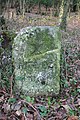
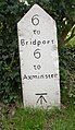
 Milestone at Miles Cross on the A35 - geograph.org.uk - 365124.jpg 640 × 575; 148 KB
-

-
 Milestone on south side of A35 - geograph.org.uk - 3185557.jpg 683 × 1,024; 236 KB
-
 Milestone, A35, Morcombelake (geograph 6666221).jpg 498 × 733; 328 KB
-
 Moores Dorset Biscuits - geograph.org.uk - 1397308.jpg 640 × 480; 89 KB
-

-
 Morcombelake, postbox No. DT6 54 - geograph.org.uk - 1353550.jpg 480 × 640; 86 KB
-
 Morcombelake, the post office - geograph.org.uk - 1353546.jpg 640 × 480; 62 KB
-
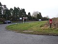
 Morden Park Corner, Sherford - geograph.org.uk - 713455.jpg 640 × 480; 72 KB
-
 Morden Park Corner, Sherford - geograph.org.uk - 713462.jpg 640 × 480; 94 KB
-
 Morden, Park Corner - geograph.org.uk - 1752524.jpg 480 × 640; 59 KB
-
 New flats, Winchester Road - geograph.org.uk - 991596.jpg 640 × 480; 99 KB
-
 North side of High Street, Honiton - geograph.org.uk - 1140180.jpg 640 × 480; 64 KB
-
 Offwell, Windmill Garage - geograph.org.uk - 193078.jpg 640 × 427; 144 KB
-
 Old Boundary Marker by the A35, Burgess Road (geograph 6094367).jpg 555 × 800; 181 KB
-

-
 Old Milepost by the A35, Bransgore parish (geograph 6072463).jpg 1,246 × 1,704; 466 KB
-
 Old Milepost by the A35, Christchurch Road, Pokesdown (geograph 5302907).jpg 768 × 1,024; 225 KB
-
 Old Milepost by the A35, Hinton (geograph 5325347).jpg 480 × 640; 146 KB
-
 Old Milepost by the A35, Holmsley (geograph 5349140).jpg 480 × 640; 137 KB
-
 Old Milepost by the A35, Somerford (geograph 5325454).jpg 480 × 640; 87 KB
-
 Old Milestone by the A35, Askerswell (geograph 5327128).jpg 480 × 640; 80 KB
-
 Old Milestone by the A35, Askerswell (geograph 5516234).jpg 768 × 1,024; 303 KB
-
 Old Milestone by the A35, below Lyme Hill (geograph 5623887).jpg 1,126 × 1,704; 394 KB
-
 Old Milestone by the A35, Burley Old Enclosure, Burley parish (geograph 6049864).jpg 1,406 × 1,704; 481 KB
-
 Old Milestone by the A35, east of Bere Regis (geograph 5623941).jpg 1,001 × 1,704; 382 KB
-
 Old Milestone by the A35, east of Chideock (geograph 5623891).jpg 1,152 × 1,636; 364 KB
-
 Old Milestone by the A35, east of Tolpuddle (geograph 5623938).jpg 1,115 × 1,604; 412 KB
-
 Old Milestone by the A35, East Road, Bridport (geograph 5623915).jpg 1,195 × 1,704; 396 KB
-
 Old Milestone by the A35, Loders (geograph 5327110).jpg 480 × 640; 122 KB
-
-
 Old Milestone by the A35, Long Bredy, west of Dorchester (geograph 5516257).jpg 805 × 1,024; 361 KB
-
 Old Milestone by the A35, Lyndhurst Road, Ashurst (geograph 6102093).jpg 400 × 539; 133 KB
-
 Old Milestone by the A35, Miles Cross (geograph 5623893).jpg 1,035 × 1,704; 365 KB
-
 Old Milestone by the A35, Morecombelake (geograph 5623890).jpg 907 × 1,533; 318 KB
-
 Old Milestone by the A35, Mount Pleasant (geograph 5624129).jpg 579 × 800; 283 KB
-
 Old Milestone by the A35, near Hunter's Inn Hill (geograph 6035804).jpg 1,989 × 1,566; 613 KB
-

-
 Old Milestone by the A35, north of Shute (geograph 5624127).jpg 549 × 640; 430 KB
-
 Old Milestone by the A35, north of Stinsford (geograph 5623931).jpg 768 × 1,014; 387 KB
-
 Old Milestone by the A35, north of Wilverley Cottage (geograph 6035309).jpg 1,360 × 1,704; 478 KB
-
 Old Milestone by the A35, north west of Shute (geograph 5624128).jpg 440 × 640; 228 KB
-
 Old Milestone by the A35, south east of Bere Regis (geograph 5623940).jpg 1,158 × 1,704; 428 KB
-

-

-
 Old Milestone by the A35, Spicers Hill, Rushington (geograph 6037467).jpg 1,173 × 1,704; 415 KB
-
 Old Milestone by the A35, west of Morecombelake (geograph 5623889).jpg 1,015 × 1,704; 364 KB
-
 Old Milestone by the A35, west of Vinney Cross (geograph 5623916).jpg 400 × 767; 135 KB
-
 Old Milestone by the A35, west of Winterbourne Abbas (geograph 5516319).jpg 768 × 1,024; 255 KB
-

-
 Old Milestone by the former A35, east of Charmouth (geograph 5623888).jpg 984 × 1,704; 309 KB
-
 Old Milestone by the slip road to the A35 at Shitterton (geograph 5623939).jpg 1,144 × 1,533; 360 KB
-
 Old stone milepost on the A35 - geograph.org.uk - 427757.jpg 640 × 522; 87 KB
-
 Poole , Fleetsbridge Intersection and Roundabout - geograph.org.uk - 1767966.jpg 3,264 × 2,448; 2.95 MB
-
 Poole , Sandbanks Road - geograph.org.uk - 1778983.jpg 3,130 × 2,260; 1.04 MB
-
 Post Box House, Symondsbury - geograph.org.uk - 1587794.jpg 640 × 480; 81 KB
-

-
 Shute, Taunton Cross - geograph.org.uk - 294300.jpg 640 × 427; 134 KB
-

-
 Slepe, postbox No. BH16 85 - geograph.org.uk - 1122783.jpg 640 × 480; 69 KB
-
 Somerford Roundabout bridges.JPG 3,712 × 2,088; 3.04 MB
-
 St Swithun's Road South, Bournemouth - geograph.org.uk - 1078972.jpg 640 × 480; 56 KB
-

-
 Symondsbury, former London Inn - geograph.org.uk - 983821.jpg 640 × 480; 41 KB
-

-
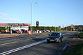
 Texaco Service Station, on the A35 - geograph.org.uk - 1586341.jpg 640 × 397; 74 KB
-
 Thatched cottages, Chideock - geograph.org.uk - 1587581.jpg 640 × 480; 69 KB
-
 The A35 - geograph.org.uk - 388192.jpg 640 × 480; 21 KB
-
 The A35 at Kingston Russell - geograph.org.uk - 967361.jpg 640 × 480; 79 KB
-
 The A35 at Kingston Russell - geograph.org.uk - 967362.jpg 640 × 480; 70 KB
-
 The A35 at Winterbourne Abbas - geograph.org.uk - 1235956.jpg 640 × 480; 97 KB
-
 The A35 behind Stonebarrow Hill - geograph.org.uk - 1086470.jpg 640 × 480; 63 KB
-
 The A35 crosses Askerswell Down - geograph.org.uk - 1087489.jpg 640 × 480; 48 KB
-

-
 The A35 near Kingston Russell - geograph.org.uk - 1075568.jpg 640 × 455; 81 KB
-
 The A35 sweeps down the hill - geograph.org.uk - 1072457.jpg 640 × 443; 49 KB
-
 The A35 through Wilmington looking east - geograph.org.uk - 2908941.jpg 1,024 × 733; 161 KB
-
 The Church of St Giles - Chideock - geograph.org.uk - 1227103.jpg 640 × 483; 77 KB
-

-
 The main street, Chideock - geograph.org.uk - 1587609.jpg 640 × 480; 64 KB
-
 The Old Inn, Kilmington - geograph.org.uk - 19943.jpg 636 × 315; 85 KB
-
 The Old Inn, Kilmington 2009 - geograph.org.uk - 1482565.jpg 500 × 358; 106 KB
-
 The Old Toll Gates on Axminster Road - geograph.org.uk - 974613.jpg 640 × 399; 50 KB
-
 The Orange, Winterbourne Abbas - geograph.org.uk - 1587855.jpg 640 × 480; 65 KB
-
 The South Winterbourne - geograph.org.uk - 1235534.jpg 640 × 480; 114 KB
-

-
 The White Hart, Wilmington - geograph.org.uk - 1447565.jpg 640 × 480; 106 KB
-
 The White Hart, Wilmington - geograph.org.uk - 1586357.jpg 640 × 480; 78 KB
-
 This is called a plough - geograph.org.uk - 1518581.jpg 640 × 480; 160 KB
-
 Troy Town Junction. - geograph.org.uk - 881291.jpg 640 × 426; 62 KB
-
 UK road A35.svg 387 × 191; 3 KB
-
 Underpass at A35 - geograph.org.uk - 423926.jpg 640 × 480; 113 KB


_-_geograph.org.uk_-_1407347.jpg)
_-_geograph.org.uk_-_1407349.jpg)


_road_junction_-_geograph.org.uk_-_529365.jpg)


.jpg)


.jpg)
.jpg)
.jpg)
.jpg)
.jpg)
.jpg)
.jpg)
.jpg)
.jpg)
.jpg)
.jpg)
.jpg)
.jpg)
.jpg)
.jpg)
.jpg)
.jpg)
.jpg)
.jpg)
.jpg)
.jpg)
.jpg)
.jpg)
.jpg)
.jpg)
.jpg)
.jpg)
.jpg)
.jpg)
.jpg)
.jpg)
.jpg)
.jpg)
.jpg)
.jpg)
.jpg)
.jpg)
.jpg)


&filefrom=Upton%2C+A35+-+geograph.org.uk+-+1516078.jpg#mw-category-media)