Category:A33 Relief Road
Jump to navigation
Jump to search
English: Images relating to the A33 Relief Road, a road constructed in the 1990s between Reading town centre and the M4 motorway junction, in order to relieve the then A33 route along Reading's Basingstoke Road. The A33 Relief Road now forms the northern section of the A33.
Media in category "A33 Relief Road"
The following 16 files are in this category, out of 16 total.
-
 A33 - exiting Reading - geograph.org.uk - 3628744.jpg 640 × 428; 72 KB
-
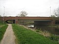 A33 - River Kennet - geograph.org.uk - 2875005.jpg 640 × 480; 52 KB
-
 A33 approaches junction with Island Road - geograph.org.uk - 3368227.jpg 3,648 × 2,736; 1.2 MB
-
 A33 beside Reading Sewage Treatment Works - geograph.org.uk - 3368217.jpg 3,527 × 2,675; 1.21 MB
-
 A33 leaving Reading - geograph.org.uk - 4703070.jpg 800 × 428; 94 KB
-
 A33 leaving Reading - geograph.org.uk - 4703088.jpg 584 × 310; 150 KB
-
 A33 towards Reading - geograph.org.uk - 848857.jpg 427 × 640; 95 KB
-
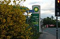
 How many lights at red^ - geograph.org.uk - 848846.jpg 640 × 427; 50 KB
-
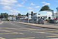
 Stop, sale now on - geograph.org.uk - 848881.jpg 640 × 423; 78 KB
-
 Temple Place - geograph.org.uk - 1329216.jpg 640 × 426; 201 KB
-
 The A33, Reading - geograph.org.uk - 604114.jpg 640 × 480; 137 KB
-
 The A33, Reading - geograph.org.uk - 626449.jpg 640 × 480; 98 KB
-
 The A33, Reading - geograph.org.uk - 633587.jpg 640 × 480; 132 KB
-
 The A33, Reading - geograph.org.uk - 633745.jpg 640 × 480; 119 KB
-
 The A33, Reading - geograph.org.uk - 633805.jpg 640 × 480; 156 KB
-
 The A33, Reading - geograph.org.uk - 665159.jpg 640 × 480; 128 KB


