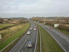
Category:A338 road (England)
Jump to navigation
Jump to search
road in England | |||||
| Upload media | |||||
| Instance of | |||||
|---|---|---|---|---|---|
| Location |
| ||||
| Transport network |
| ||||
| Connects with | |||||
| Length |
| ||||
 | |||||
Subcategories
This category has the following 8 subcategories, out of 8 total.
A
- A338 road in Wiltshire (18 F)
E
G
- Tulwick milestone, Grove (4 F)
I
- St Martin's Church, Ibsley (35 F)
V
- Venn Mill (24 F)
W
Media in category "A338 road (England)"
The following 63 files are in this category, out of 63 total.
-
'W W' is for Wessex Way - geograph.org.uk - 617853.jpg 640 × 480; 89 KB
-
A338 at Holdenhurst - geograph.org.uk - 1546856.jpg 640 × 400; 63 KB
-
A338 at the Cooper Dean roundabout - geograph.org.uk - 1326495.jpg 640 × 480; 64 KB
-
A338 Bournemouth Spur Road - geograph.org.uk - 468289.jpg 640 × 478; 81 KB
-
A338 view Northeastward to Blackwater bridge.jpg 480 × 309; 22 KB
-
A338, looking north - geograph.org.uk - 1736051.jpg 640 × 480; 214 KB
-
Ashley Heath Junction - geograph.org.uk - 99052.jpg 640 × 480; 73 KB
-
Aughton, A338 - geograph.org.uk - 1405210.jpg 640 × 480; 98 KB
-
Bournemouth , Wessex Way A35 - geograph.org.uk - 1289061.jpg 640 × 480; 53 KB
-
Bournemouth , Wessex Way and ASDA - geograph.org.uk - 1119519.jpg 640 × 480; 37 KB
-
Bournemouth, air show advertisement - geograph.org.uk - 932946.jpg 640 × 480; 77 KB
-
Bournemouth, Braidley Road bridge 2 - geograph.org.uk - 1174821.jpg 640 × 480; 94 KB
-
Bournemouth, by-pass over the Gardens - geograph.org.uk - 637215.jpg 640 × 480; 61 KB
-
Bournemouth, by-pass subway detail - geograph.org.uk - 757682.jpg 480 × 640; 65 KB
-
Bournemouth, path from Central Drive - geograph.org.uk - 1728888.jpg 640 × 480; 92 KB
-
Bournemouth, St. Paul's Roundabout - geograph.org.uk - 617855.jpg 640 × 480; 64 KB
-
Bournemouth, the snow comes again^ - geograph.org.uk - 1150555.jpg 640 × 480; 75 KB
-
Bournemouth, Wessex Way - geograph.org.uk - 878809.jpg 640 × 480; 74 KB
-
Junction on A338 at Breamore - geograph.org.uk - 291586.jpg 640 × 480; 108 KB
-
Canal workers' cottages at Grove in Oxfordshire.jpg 640 × 426; 75 KB
-
Collingbourne Kingston - geograph.org.uk - 274258.jpg 640 × 480; 107 KB
-
Old Milestone by the A338, north of Frilford (geograph 5622401).jpg 640 × 960; 207 KB
-
A338 past the canal - geograph.org.uk - 1206507.jpg 640 × 426; 61 KB
-
Highway2.JPG 1,632 × 1,224; 348 KB
-
Holland Inn, Hatt, Saltash - geograph.org.uk - 178779.jpg 640 × 427; 228 KB
-
Old Milestone by the A338, south of Frilford (geograph 5622400).jpg 436 × 640; 147 KB
-
Milepost on A338 - geograph.org.uk - 267412.jpg 480 × 640; 94 KB
-
Old Milepost by the A338, Salisbury Road, Ringwood parish (geograph 6072282).jpg 1,190 × 1,787; 398 KB
-
Park House Motel and the A338 - geograph.org.uk - 478890.jpg 640 × 480; 124 KB
-
Salisbury this way - geograph.org.uk - 772923.jpg 640 × 427; 75 KB
-
The A338 - geograph.org.uk - 1583411.jpg 640 × 428; 56 KB
-
The A338 - geograph.org.uk - 274260.jpg 640 × 480; 165 KB
-
The A338 in East Hanney - geograph.org.uk - 1472235.jpg 640 × 410; 67 KB
-
The A338 near Burbage - geograph.org.uk - 395552.jpg 640 × 480; 120 KB
-
The A338 near Burbage - geograph.org.uk - 395555.jpg 640 × 480; 117 KB
-
The A338 to East Hanney - geograph.org.uk - 1472286.jpg 640 × 427; 78 KB
-
The B3078 and the A338 By-Pass - geograph.org.uk - 776084.jpg 640 × 480; 88 KB
-
UK road A338.PNG 568 × 184; 8 KB
-
BlackBushes ManorRd milestone.jpg 731 × 1,024; 463 KB
-
Old Milestone by the A338, near Manor Road Farm (geograph 5622291).jpg 533 × 800; 154 KB


