Category:A3060 road (England)
Jump to navigation
Jump to search

road in England | |||||
| Upload media | |||||
| Instance of | |||||
|---|---|---|---|---|---|
| Location |
| ||||
| Transport network |
| ||||
| |||||
Subcategories
This category has only the following subcategory.
Media in category "A3060 road (England)"
The following 31 files are in this category, out of 31 total.
-
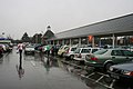 A wet Tesco car park - geograph.org.uk - 1767664.jpg 1,024 × 683; 171 KB
-
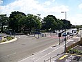 A3060 at Castlepoint - geograph.org.uk - 504168.jpg 640 × 480; 100 KB
-
-
 Bournemouth , Castle Lane - geograph.org.uk - 1119561.jpg 480 × 640; 56 KB
-
 Bournemouth , Castle Lane - geograph.org.uk - 1120165.jpg 640 × 480; 76 KB
-
 Bournemouth , Castle Lane East - geograph.org.uk - 1289937.jpg 640 × 480; 75 KB
-
 Bournemouth , Castle Lane East - geograph.org.uk - 1290013.jpg 640 × 480; 59 KB
-

-
 Bournemouth , Castle Lane West - geograph.org.uk - 1289131.jpg 640 × 469; 52 KB
-
 Bournemouth , Castle Lane West - geograph.org.uk - 1289807.jpg 640 × 480; 67 KB
-
-
 Bournemouth , Muscliff - Castle Lane West - geograph.org.uk - 1704405.jpg 3,264 × 2,448; 3.06 MB
-

-
 Bournemouth , Muscliff - Muscliff Lane - geograph.org.uk - 1704404.jpg 3,264 × 2,448; 2.63 MB
-

-
 Bournemouth , Muscliff - Wimborne Road Junction - geograph.org.uk - 1704407.jpg 3,264 × 2,448; 2.97 MB
-
 Bournemouth , Riverside Avenue - geograph.org.uk - 1120175.jpg 640 × 480; 67 KB
-

-

-
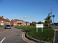
 Iford roundabout - geograph.org.uk - 1450106.jpg 640 × 424; 69 KB
-
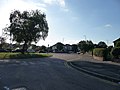
 Muscliff, bungalows in Castle Lane - geograph.org.uk - 854290.jpg 640 × 480; 77 KB
-
-
 Red Hill, Westover Retail Park - geograph.org.uk - 1184434.jpg 640 × 480; 53 KB
-
 Strouden, Bradpole Road Post Office - geograph.org.uk - 676523.jpg 640 × 480; 67 KB
-
 Strouden, Point 500 - geograph.org.uk - 855014.jpg 640 × 480; 65 KB
-

-
-

-
 Strouden, the forgotten house - geograph.org.uk - 855007.jpg 640 × 480; 62 KB
-
 The A3060 near Throop, Bournemouth - geograph.org.uk - 961367.jpg 640 × 480; 66 KB
-
 UK road A3060.PNG 597 × 184; 10 KB


