Category:A272 road (England)
Jump to navigation
Jump to search

road in England  | |||||
| Upload media | |||||
| Instance of | |||||
|---|---|---|---|---|---|
| Location | West Sussex, South East England, England | ||||
| Transport network |
| ||||
| Length |
| ||||
 | |||||
Subcategories
This category has the following 8 subcategories, out of 8 total.
F
- Fox Inn, Bramdean (9 F)
L
N
R
S
- Shakespeare Roundabout (3 F)
T
- Trotton Bridge (5 F)
W
- West Meon Hut pub (6 F)
Media in category "A272 road (England)"
The following 54 files are in this category, out of 54 total.
-
 91-92-93-PeterfieldtoMidhurstTimetableatChithurstCoveredwithMoss.jpg 4,160 × 3,120; 1.62 MB
-
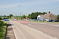
 A22-A272 (West) Roundabout - geograph.org.uk - 318269.jpg 640 × 429; 74 KB
-
 A272 at Cheesefoot Head - geograph.org.uk - 209846.jpg 640 × 480; 109 KB
-
 A272 enters Midhurst - geograph.org.uk - 4013808.jpg 3,648 × 2,736; 1.9 MB
-

-
 A272 in centre of Rogate - geograph.org.uk - 786534.jpg 640 × 480; 73 KB
-
 A272 looking south-east - geograph.org.uk - 63172.jpg 640 × 480; 163 KB
-
 A272 near Chilcomb - geograph.org.uk - 705481.jpg 640 × 480; 76 KB
-
 A272 near Chilcomb - geograph.org.uk - 706045.jpg 640 × 480; 86 KB
-
 A272 near Hill Farm - geograph.org.uk - 96866.jpg 640 × 480; 84 KB
-
 A272 passes The Fox Inn - geograph.org.uk - 4068481.jpg 3,648 × 2,736; 1.74 MB
-
 A272 road near the nursery - geograph.org.uk - 33045.jpg 640 × 480; 140 KB
-
 A272 SE towards Coolham - geograph.org.uk - 1691759.jpg 1,600 × 1,200; 397 KB
-
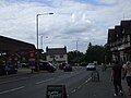
 A272, Petersfield Road - geograph.org.uk - 188977.jpg 640 × 480; 240 KB
-
 A272midhurstdirection.jpg 4,160 × 3,120; 3.02 MB
-
 A272petersfielddirection.jpg 4,160 × 3,120; 3.5 MB
-
 Ansty Cross mini roundabout - geograph.org.uk - 23234.jpg 640 × 480; 96 KB
-
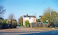
 Gatehouse lodge at Petworth Park - geograph.org.uk - 92663.jpg 640 × 426; 266 KB
-
 Hadlow Down Church - geograph.org.uk - 393921.jpg 640 × 428; 164 KB
-
 Hill Farm Garage - geograph.org.uk - 61250.jpg 640 × 480; 101 KB
-
 Hill Farm Garage - geograph.org.uk - 822996.jpg 640 × 427; 97 KB
-
 Junction of A272 and A31 - geograph.org.uk - 760820.jpg 640 × 427; 136 KB
-
 Junction of A272 and B2070 - geograph.org.uk - 349.jpg 640 × 480; 73 KB
-

-
 Junction of A272, A30 and B3420 - geograph.org.uk - 822997.jpg 640 × 427; 102 KB
-

-

-
 Newick Green - geograph.org.uk - 21009.jpg 640 × 248; 47 KB
-
-
 Old Milestone (geograph 6099237).jpg 442 × 640; 301 KB
-
 Paint spattered road sign at Ramshill - geograph.org.uk - 1346949.jpg 480 × 640; 104 KB
-
 Roundabout at Ramshill - geograph.org.uk - 1346964.jpg 640 × 480; 68 KB
-

-
 The A23 flyover - geograph.org.uk - 84696.jpg 600 × 447; 54 KB
-
 The A272 eastbound to Petworth - geograph.org.uk - 1637854.jpg 640 × 480; 67 KB
-
 The A272 heading in to New Cheriton - geograph.org.uk - 1437569.jpg 640 × 480; 85 KB
-
 The A272 west to Coolham - geograph.org.uk - 1578855.jpg 640 × 480; 93 KB
-
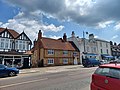 The Harrow, Midhurst.jpg 4,000 × 3,000; 3.02 MB
-
 The Post Office at Scaynes Hill - geograph.org.uk - 33021.jpg 640 × 480; 82 KB
-
 The Three Crowns - geograph.org.uk - 1330538.jpg 640 × 480; 60 KB
-

-
 UK road A272.PNG 568 × 184; 6 KB
-

-
 West Grinstead station remains geograph-4063990-by-Ben-Brooksbank.jpg 2,335 × 1,398; 2.97 MB
-
 West Meon - geograph.org.uk - 1573.jpg 640 × 428; 35 KB
-
 Westward View towards Drayton along The Hyde, East Meon (July 2019) (1).JPG 3,000 × 1,600; 1.46 MB
-
 Westward View towards Drayton along The Hyde, East Meon (July 2019) (2).JPG 2,600 × 1,600; 1.05 MB
-
 Westward View towards Park Lodge along The Hyde, East Meon (July 2019) (1).JPG 3,000 × 2,000; 1.63 MB
-
 Westward View towards Park Lodge along The Hyde, East Meon (July 2019) (2).JPG 3,000 × 2,000; 1.58 MB
-
 A267-A272 junction - geograph.org.uk - 333070.jpg 640 × 480; 93 KB
-
 A272 east of Buxted - geograph.org.uk - 332943.jpg 640 × 480; 138 KB
-
 A272 near Piltdown - geograph.org.uk - 318276.jpg 640 × 428; 112 KB
-
 Disused shop on A272 - geograph.org.uk - 332940.jpg 640 × 480; 70 KB
-
 The A272 looking down Scaynes Hill - geograph.org.uk - 33060.jpg 640 × 480; 111 KB

_Roundabout_-_geograph.org.uk_-_318269.jpg)


.jpg)


_(1).JPG)
_(2).JPG)
_(1).JPG)
_(2).JPG)


