Category:A249 road (England)
Jump to navigation
Jump to search

A road in Kent, England, UK  | |||||
| Upload media | |||||
| Instance of | |||||
|---|---|---|---|---|---|
| Location | Kent, South East England, England | ||||
| Transport network |
| ||||
| Length |
| ||||
 | |||||
Subcategories
This category has the following 2 subcategories, out of 2 total.
K
- Kingsferry Bridge (33 F)
S
- Sheppey Crossing (18 F)
Media in category "A249 road (England)"
The following 19 files are in this category, out of 19 total.
-

-
 A249 road Kent, England 004167.jpg 640 × 357; 34 KB
-
 A249 Sittingbourne Road, Maidstone - geograph.org.uk - 3571478.jpg 3,488 × 2,616; 2.91 MB
-
 A249detlinghill-Richard-Dorrell.jpg 640 × 480; 86 KB
-
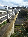 Bridge over A249 - geograph.org.uk - 1065758.jpg 481 × 640; 93 KB
-
 Bridleway bridge over A249 - geograph.org.uk - 639388.jpg 640 × 480; 146 KB
-
-

-
 Jade's Crossing, Detling, Kent - geograph.org.uk - 41949.jpg 640 × 427; 70 KB
-
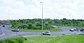 Key Street Roundabout - geograph.org.uk - 11850.jpg 639 × 325; 52 KB
-
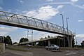
 M2viaduct-by-Richard-Dorrell.jpg 640 × 480; 99 KB
-
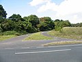
 New Roundabout on A249 - geograph.org.uk - 1278901.jpg 640 × 480; 58 KB
-
 The A249 in Stockbury Valley - geograph.org.uk - 733398.jpg 640 × 480; 78 KB
-
 The Hop Farm - geograph.org.uk - 3721204.jpg 640 × 480; 285 KB
-

-
 UK road A249.PNG 568 × 184; 8 KB
-
 Wormdale Hill Road over A249 - geograph.org.uk - 1065676.jpg 481 × 640; 78 KB
-
 New road to Queenborough - geograph.org.uk - 109983.jpg 640 × 480; 93 KB
-
 New roundabout on Sheppey - geograph.org.uk - 109956.jpg 640 × 480; 85 KB


