Category:A22 (Portugal)
Jump to navigation
Jump to search
road in Portugal | |||||
| Upload media | |||||
| Instance of | |||||
|---|---|---|---|---|---|
| Part of | |||||
| Location |
| ||||
| Connects with | |||||
| Length |
| ||||
| |||||
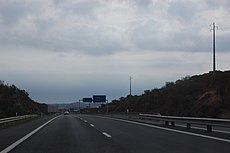
English: The A22 autoestradade de Portugal is also known as Via do Infante D. Henrique and the Via Longitudinal do Algarve or sometimes the Via do Infante de Sagres (Prince Henry the Navigator). This motorway run longitudinally through the Algarve region from Bensafrim, near Lagos in the west to and Vila Real de Santo António to the east, finishing next to the Guadiana International Bridge, which borders Spain. The middle section of the motorway gives access to the A2 motorway to Lisbon at a junction close to the village of Ferreiras. Starting from the east, along the motorway, there are several junctions giving easy access to Portimão, Lagoa, Silves Albufeira, Loulé, Faro, Olhão, Tavira, Castro Marim and Vila Real de Santo António.
Português: Também conhecida por Via do Infante (Infante Dom Henrique, o Navegador).
Subcategories
This category has only the following subcategory.
B
Media in category "A22 (Portugal)"
The following 53 files are in this category, out of 53 total.
-
12-06-2017 A22 motorway, Cerro do Ouro, Albufeira (1).JPG 4,608 × 3,456; 3.92 MB
-
12-06-2017 A22 motorway, Cerro do Ouro, Albufeira (2).JPG 4,608 × 3,456; 3.9 MB
-
12-06-2017 Bridge over the A22 motorway, Cerro do Ouro, Albufeira (1).JPG 4,608 × 3,456; 5.75 MB
-
12-06-2017 Bridge over the A22 motorway, Cerro do Ouro, Albufeira (2).JPG 4,608 × 3,456; 5.27 MB
-
12-06-2017 Bridge over the A22 motorway, Cerro do Ouro, Albufeira (3).JPG 4,608 × 3,456; 5.71 MB
-
12-06-2017 Bridge over the A22 motorway, Cerro do Ouro, Albufeira (4).JPG 4,608 × 3,456; 4.01 MB
-
13-06-2017 Bridge under A22 motorway, Texugueiras, Albufeira.JPG 4,608 × 3,456; 4.04 MB
-
14-06-2017 A22 motorway, Paderne, Albufeira (1).JPG 4,608 × 3,456; 4.09 MB
-
14-06-2017 A22 motorway, Paderne, Albufeira (2).JPG 4,608 × 3,456; 4.25 MB
-
14-06-2017 A22 motorway, Paderne, Albufeira (3).JPG 4,608 × 3,456; 4.3 MB
-
14-06-2017 A22 motorway, Paderne, Albufeira (4).JPG 4,608 × 3,456; 4.37 MB
-
14-06-2017 Designation sign, A22 motorway, Paderne, Albufeira (1).JPG 4,608 × 3,456; 5.26 MB
-
14-06-2017 Designation sign, A22 motorway, Paderne, Albufeira (2).JPG 3,456 × 4,608; 4.98 MB
-
14-06-2017 Way-marker, Via Algarviana long distance hiking trail, Cerro do Ouro (8).JPG 4,608 × 3,456; 5.32 MB
-
17 November 2016, Motorway bridge over Linha do Algarve, Alfarrobeiras, Albufeira (2).JPG 4,608 × 3,456; 5.97 MB
-
19-09-2017 A22 motorway, Ferreiras (1).JPG 4,608 × 3,456; 4.13 MB
-
19-09-2017 A22 motorway, Ferreiras (2).JPG 4,608 × 3,456; 3.51 MB
-
19-09-2017 IC1 road junction with A22 motorway, Malhada Velha, Ferreiras (1).JPG 4,608 × 3,456; 4.48 MB
-
19-09-2017 IC1 road junction with A22 motorway, Malhada Velha, Ferreiras (2).JPG 4,608 × 3,456; 4.59 MB
-
2017-08-24 A22-IP1 motorway bridge, Paderne Castle.JPG 4,608 × 3,456; 6.13 MB
-
2018-01-10 Lidl advertisment, A22 motorway, Paderne, Albufeira.JPG 4,608 × 3,456; 3.95 MB
-
2018-02-25 Motorway A22 near Paderne Castle.JPG 5,152 × 3,864; 4.55 MB
-
2018-03-16 A22 motorway, Vale Verde, Albufeira.JPG 5,152 × 3,864; 4.63 MB
-
A View of River Quarteira near Paderne castle 13 April 2016 (2).JPG 4,608 × 3,456; 6.88 MB
-
A22 Km. 0 Placa de confirmação.JPG 5,184 × 3,456; 6.07 MB
-
A22 motorway Juct 10, 20 September 2015 (1).JPG 5,152 × 3,864; 8.53 MB
-
A22 motorway Juct 10, 20 September 2015 (2).JPG 5,152 × 3,864; 8.45 MB
-
A22 motorway Paderne 18 December 2015 (2).JPG 5,152 × 3,864; 8.41 MB
-
A22 motorway Paderne 18 December 2015 (3).JPG 5,152 × 3,864; 8.16 MB
-
A22 Motorway Toll road near Paderne 16 September 2015 (1).JPG 5,152 × 3,864; 7.68 MB
-
A22 Motorway Toll road near Paderne 16 September 2015 (2).JPG 5,152 × 3,864; 7.72 MB
-
A22 Motorway, Paderne, 13 October 2015 (1).JPG 5,152 × 3,864; 4.23 MB
-
Algarve from the air (36193605674).jpg 5,184 × 3,456; 12.32 MB
-
Casal. Faro (Portugal) (34302694531).jpg 2,040 × 1,145; 525 KB
-
Congestion caused by a road accident, Algarve, Portugal.jpg 525 × 394; 53 KB
-
Herdade de Morgado de Arge - Portimão - 14.12.2019.jpg 6,000 × 4,000; 7.83 MB
-
IP1-A22.jpg 3,008 × 2,000; 1.5 MB
-
Junction 10 on A22 Motorway Toll road near Paderne 16 September 2015 (1).JPG 5,152 × 3,864; 11.73 MB
-
Karte A22 PT.svg 800 × 1,000; 142 KB
-
Mapa do povoado islamico de Barradas.jpg 1,050 × 1,163; 133 KB
-
On the Highway A22 leading through the Algarve (36487828024).jpg 5,184 × 3,456; 8.12 MB
-
Pontes da Ladeira do Vau - Portimão - 14.12.2019.jpg 6,000 × 4,000; 7.74 MB
-
Pontes da Ladeira do Vau 2 - Portimão - 14.12.2019.jpg 6,000 × 4,000; 6.98 MB
-
Puente Internacional 395.jpg 2,560 × 721; 301 KB
-
Puente Internacional 397.jpg 2,048 × 1,536; 700 KB
-
Ribeira da Quarteira - Portugal (5559049202).jpg 2,048 × 1,365; 841 KB
-
River Quarteira Paderna 17 September 2008.JPG 2,560 × 1,920; 1.23 MB
-
Viaduto da Via do Infante perto de Portimão - 14.12.2019.jpg 6,000 × 4,000; 6.93 MB
-
Welcome to Algarve (Portugal) (49141785428).jpg 3,617 × 2,156; 1.07 MB
-
Zona das Eiras Velhas em Lagos - 16.01.2023.jpg 4,080 × 3,060; 5.42 MB


