Category:A166 road from Stamford Bridge to Fridaythorpe
Jump to navigation
Jump to search
Media in category "A166 road from Stamford Bridge to Fridaythorpe"
The following 13 files are in this category, out of 13 total.
-
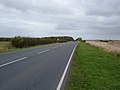 A166 towards Fridaythorpe - geograph.org.uk - 1541378.jpg 640 × 480; 48 KB
-
 A166 towards York (Man Street) - geograph.org.uk - 1374855.jpg 640 × 480; 79 KB
-
 A166 towards York - geograph.org.uk - 1838218.jpg 640 × 480; 47 KB
-
 A166, Garrowby Hill with emergency run off lane.jpg 640 × 480; 62 KB
-
 Crossroads on the A166 - geograph.org.uk - 285345.jpg 640 × 480; 86 KB
-
 Entering Fridaythorpe (geograph 3110637).jpg 640 × 437; 96 KB
-
 Fridaythorpe village (geograph 5984605).jpg 1,024 × 768; 185 KB
-
 Garrowby Lodge - geograph.org.uk - 125982.jpg 640 × 480; 138 KB
-
 Garrowby Lodge.jpg 640 × 468; 80 KB
-
 Road junction near Garrowby Wold - geograph.org.uk - 1437802.jpg 640 × 449; 40 KB
-
 Site of the former Hare & Hounds public house (geograph 6574170).jpg 1,600 × 1,065; 639 KB
-
 South of Fridaythorpe - geograph.org.uk - 125356.jpg 640 × 480; 185 KB
-
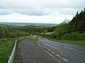
 The road to Stamford Bridge - geograph.org.uk - 411472.jpg 640 × 480; 86 KB

_-_geograph.org.uk_-_1374855.jpg)


.jpg)
.jpg)


.jpg)

