Category:A1033 road (England)
Jump to navigation
Jump to search
a road in the East Riding of Yorkshire, England | |||||
| Upload media | |||||
| Instance of | |||||
|---|---|---|---|---|---|
| Location |
| ||||
| Transport network |
| ||||
 | |||||
Subcategories
This category has the following 8 subcategories, out of 8 total.
Media in category "A1033 road (England)"
The following 86 files are in this category, out of 86 total.
-
 A walk along the River Hull No3 (geograph 1998020).jpg 800 × 600; 229 KB
-
 A1033 Burstwick Drain Flyover Bridge - geograph.org.uk - 479923.jpg 640 × 480; 139 KB
-
 A1033 main road in Camerton.jpg 546 × 640; 118 KB
-
 A1033 road at Hollym.jpg 640 × 480; 58 KB
-
 A1033 Ryehill - geograph.org.uk - 1472632.jpg 640 × 480; 36 KB
-
 A1033 to Hollym (geograph 6909437).jpg 1,024 × 683; 511 KB
-
 A1033 towards Patrington (geograph 6373448).jpg 800 × 600; 128 KB
-
 A1033 west of Winestead - geograph.org.uk - 296879.jpg 640 × 479; 108 KB
-
 A1033, Camerton - geograph.org.uk - 1107053.jpg 640 × 426; 190 KB
-

-
 Baulk Cottage, near Winestead - geograph.org.uk - 1739355.jpg 640 × 592; 181 KB
-
 Burstwick Drain - geograph.org.uk - 561498.jpg 640 × 480; 92 KB
-
 Chapel and Institute, Thorngumbald - geograph.org.uk - 1087335.jpg 640 × 441; 185 KB
-
 Cycle path beside Raich Carter Way (A1033) (geograph 4349871).jpg 640 × 386; 51 KB
-
 Cycle Track - geograph.org.uk - 283652.jpg 640 × 616; 105 KB
-
 Cycle track beside Raich Carter Way (A1033) (geograph 4349862).jpg 640 × 480; 62 KB
-
 Cycle track beside Raich Carter Way (geograph 4353906).jpg 640 × 480; 55 KB
-
 Dunswell roundabout - geograph.org.uk - 603072.jpg 640 × 402; 148 KB
-

-
 Entering the East Riding of Yorkshire (geograph 3238229).jpg 800 × 600; 119 KB
-
 Entering Winestead - geograph.org.uk - 1472738.jpg 640 × 480; 70 KB
-
 Farm road - geograph.org.uk - 14925.jpg 640 × 480; 95 KB
-
 Glencoe Villas, Preston - geograph.org.uk - 316965.jpg 640 × 461; 83 KB
-

-
 High Bridge, Keyingham - geograph.org.uk - 887519.jpg 640 × 474; 256 KB
-
 Hollym Road (geograph 6909436).jpg 1,024 × 683; 433 KB
-
 Keyingham Road towards Ottringham - geograph.org.uk - 1472731.jpg 640 × 480; 43 KB
-
 Keyingham Road, Ottringham - geograph.org.uk - 718870.jpg 640 × 461; 88 KB
-
 Main Road Camerton.jpg 640 × 428; 72 KB
-
 Main Street, Keyingham - geograph.org.uk - 1472724.jpg 640 × 480; 53 KB
-
 Manor House - geograph.org.uk - 595037.jpg 640 × 427; 85 KB
-
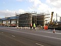
 Marfleet Roundabout under Construction - geograph.org.uk - 279074.jpg 640 × 480; 115 KB
-
 Marsh lane, Camerton - geograph.org.uk - 1472628.jpg 640 × 480; 59 KB
-
 Myton Bridge A1033 Approach, Kingston upon Hull Jan24.jpg 4,176 × 2,784; 3.49 MB
-
 Northgate - geograph.org.uk - 595057.jpg 640 × 427; 58 KB
-
 Northside - geograph.org.uk - 540158.jpg 640 × 427; 47 KB
-
 Old Milepost by the A1033 at Salt End (geograph 6102314).jpg 479 × 640; 283 KB
-
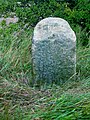
 Old Milestone beside the A1033 near Ottringham (geograph 6373447).jpg 800 × 528; 223 KB
-
-
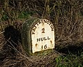
 Old Milestone by the A1033, Keyingham Road (geograph 6035829).jpg 479 × 640; 312 KB
-
 Old Milestone by the A1033, Main Road, Camerton (geograph 6048037).jpg 450 × 600; 134 KB
-
-

-

-
 Old milestone on the A1033 near Winestead (geograph 6373652).jpg 800 × 647; 230 KB
-
 Old railway crossing - geograph.org.uk - 28777.jpg 640 × 480; 103 KB
-
 Ottringham Road, Keyingham - geograph.org.uk - 1472726.jpg 640 × 480; 48 KB
-
 Park your concrete wheels here - geograph.org.uk - 803809.jpg 640 × 360; 130 KB
-
 Patrington - geograph.org.uk - 1261002.jpg 640 × 428; 90 KB
-
 Patrington Road near Baulk Cottage - geograph.org.uk - 1472735.jpg 640 × 480; 43 KB
-

-
 Raich Carter Way (geograph 3072446).jpg 1,024 × 753; 144 KB
-
 Raich Carter Way towards Beverley Road (geograph 3675822).jpg 800 × 600; 161 KB
-
 Raich Carter Way, Kingswood (geograph 3238117).jpg 800 × 600; 112 KB
-
 Raich Carter Way, Kingswood (geograph 3238123).jpg 800 × 600; 91 KB
-
 Raich Carter Way, Kingswood (geograph 3238156).jpg 800 × 600; 75 KB
-
 Raich Carter Way, Kingswood (geograph 3675789).jpg 800 × 600; 146 KB
-
 River Hull and traffic on the A1033 (geograph 2985592).jpg 3,264 × 2,448; 1.65 MB
-
-
 Saltend Flyover during its construction - geograph.org.uk - 275148.jpg 640 × 480; 101 KB
-
 St Mary's C. of E, Thorngumbald - geograph.org.uk - 885913.jpg 640 × 436; 170 KB
-
 Stobart truck on the A1033, Kingston Upon Hull, 6 November 2013.jpg 1,024 × 681; 347 KB
-
 The A1033 - geograph.org.uk - 28800.jpg 640 × 480; 90 KB
-
 The A1033 and High Bridge, Keyingham - geograph.org.uk - 887508.jpg 640 × 408; 142 KB
-
 The A1033 at Winestead - geograph.org.uk - 1739194.jpg 640 × 469; 187 KB
-
 The A1033 at Winestead Bridge - geograph.org.uk - 28807.jpg 640 × 480; 117 KB
-
 The A1033 road into Hollym.jpg 640 × 480; 82 KB
-
 The A1033 to Withernsea - geograph.org.uk - 57382.jpg 640 × 480; 97 KB
-

-
 The Barn Farm Thorngumbald.jpg 640 × 403; 200 KB
-
 The Ottringham to Patrington road - geograph.org.uk - 28771.jpg 640 × 480; 92 KB
-
 The road at Bridge Bungalows - geograph.org.uk - 14908.jpg 640 × 480; 85 KB
-
 The Road into Keyingham - geograph.org.uk - 417741.jpg 640 × 480; 92 KB
-
 The Royal Mail, pub sign - geograph.org.uk - 887532.jpg 480 × 640; 211 KB
-
 The view looking towards Winestead Corner - geograph.org.uk - 28803.jpg 640 × 480; 101 KB
-
 Thorngumbald Village Hall - geograph.org.uk - 11927.jpg 640 × 480; 103 KB
-
 Thorngumbald Village Hall.jpg 640 × 471; 115 KB
-
 Towards Kingswood - geograph.org.uk - 778353.jpg 640 × 350; 128 KB
-
 UK road A1033.PNG 568 × 184; 8 KB
-
 Villa Lane, Thorngumbald - geograph.org.uk - 1087360.jpg 640 × 426; 204 KB
-
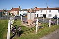 War Memorial Patrington.jpg 640 × 427; 80 KB
-
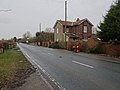
 Westgate Farmhouse - geograph.org.uk - 540156.jpg 640 × 427; 66 KB
-
 Winestead Corner - geograph.org.uk - 302027.jpg 640 × 473; 86 KB
-
 Winestead railway station (site), Yorkshire (geograph 5657857).jpg 1,600 × 1,200; 407 KB
-
 Holwell Road underpass - geograph.org.uk - 415789.jpg 640 × 480; 278 KB
-
 Sutton Road roundabout - geograph.org.uk - 39283.jpg 640 × 480; 83 KB
.jpg)


.jpg)
.jpg)


_(geograph_4349869).jpg)


_(geograph_4349871).jpg)

_(geograph_4349862).jpg)
.jpg)

,_Hollym_-_geograph.org.uk_-_6374800.jpg)
.jpg)


.jpg)


.jpg)
.jpg)
.jpg)
.jpg)
.jpg)
.jpg)
.jpg)
.jpg)
.jpg)


_approaching_Kingswood_Roundabout_(geograph_6091770).jpg)
.jpg)
.jpg)
.jpg)
.jpg)
.jpg)
.jpg)
.jpg)


,_Yorkshire_(geograph_5657857).jpg)

