Category:59 Rodney Street, Liverpool
Jump to navigation
Jump to search
| Object location | | View all coordinates using: OpenStreetMap |
|---|
historic house museum in Liverpool  | |||||
| Upload media | |||||
| Instance of |
| ||||
|---|---|---|---|---|---|
| Part of | |||||
| Location | Liverpool, Merseyside, North West England, England | ||||
| Located on street | |||||
| Occupant |
| ||||
| Operator | |||||
| Maintained by |
| ||||
| Heritage designation |
| ||||
| official website | |||||
 | |||||
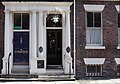
English: The Hardmans' House is a Grade II listed building at number 59 Rodney Street, in Liverpool, Merseyside, England.
Media in category "59 Rodney Street, Liverpool"
The following 5 files are in this category, out of 5 total.
-
 59 Rodney Street, Liverpool 2020.jpg 2,644 × 4,457; 12.31 MB
-
 59 Rodney Street, Liverpool.jpg 1,182 × 1,498; 1.16 MB
-
 Door of 59 Rodney Street, Liverpool 0298.jpg 2,289 × 3,234; 4.05 MB
-
 Door of 59 Rodney Street, Liverpool.jpg 3,066 × 4,680; 15.31 MB
-
 HardmanRodneyStreetOM.jpg 4,595 × 3,204; 3.58 MB


