Category:50 Leszczyńskiego Street in Lublin
Jump to navigation
Jump to search
| Object location | | View all coordinates using: OpenStreetMap |
|---|
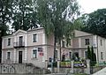
Polski: Lublin, ul. Leszczyńskiego 50 - budynek samorządu gminy dawnego miasteczka Wieniawa, 1 poł. XIX
building in Lublin, Polish–Lithuanian Commonwealth, Poland  | |||||
| Upload media | |||||
| Instance of | |||||
|---|---|---|---|---|---|
| Location | Lublin, Lublin Voivodeship, Poland | ||||
| Street address |
| ||||
| Heritage designation |
| ||||
| Inception |
| ||||
 | |||||
Media in category "50 Leszczyńskiego Street in Lublin"
The following 9 files are in this category, out of 9 total.
-
 Lublin leszczyńskiego street PZG-back.jpg 640 × 480; 101 KB
-
 Lublin, ul. Leszczyńskiego 50 foto1.jpg 3,670 × 2,116; 5.55 MB
-
 Lublin, ul. Leszczyńskiego 50 foto2.jpg 3,500 × 2,085; 5.28 MB
-
 Lublin, ul. Leszczyńskiego 50 foto3.jpg 3,400 × 1,912; 5.24 MB
-
 Lublin, ul. Leszczyńskiego 50 foto4.jpg 3,600 × 2,292; 6.3 MB
-
 Lublin2-1.jpg 9,000 × 6,008; 27.71 MB
-
 PL Lublin Leszczynskiego50 cały.jpg 2,510 × 1,783; 2.92 MB
-
 PL Lublin Leszczynskiego50 front.jpg 2,560 × 1,920; 2.33 MB
-
 PL Lublin Leszczynskiego50 z boku.jpg 2,057 × 1,920; 2.88 MB


