Category:47th Avenue (Sacramento RT)
Jump to navigation
Jump to search
| Object location | | View all coordinates using: OpenStreetMap |
|---|
 | |||||
| Upload media | |||||
| Instance of |
| ||||
|---|---|---|---|---|---|
| Location | Sacramento, Sacramento County, California, Pacific States Region | ||||
| Transport network | |||||
| Inception |
| ||||
| Connecting line | |||||
| Adjacent station | |||||
 | |||||
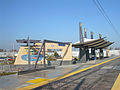
English: Media pertaining to the 47th Avenue (Sacramento RT) light rail stop in Sacramento, California, USA.
Media in category "47th Avenue (Sacramento RT)"
The following 2 files are in this category, out of 2 total.
-
 47th Avenue 3927.JPG 2,048 × 1,536; 624 KB
-
 47th Avenue Station.jpg 2,272 × 1,704; 976 KB
