Category:46 Old Town Market Square in Kraków
Jump to navigation
Jump to search
| Object location | | View all coordinates using: OpenStreetMap |
|---|
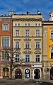
house in Kraków, Poland  | |||||
| Upload media | |||||
| Instance of | |||||
|---|---|---|---|---|---|
| Location | Kraków, Lesser Poland Voivodeship, Poland | ||||
| Heritage designation |
| ||||
 | |||||
| Address |
|
Media in category "46 Old Town Market Square in Kraków"
The following 9 files are in this category, out of 9 total.
-
 008Cracow.JPG 1,360 × 2,048; 746 KB
-
 A-174 Kamienica Czerwona Kraków, Rynek Główny 46 MM.jpg 1,944 × 2,896; 2.45 MB
-
 Czerwona tenement house, 46 Main Market square, Old Town, Kraków, Poland.jpg 3,157 × 5,062; 16.64 MB
-
 Kamienica Czerwona.JPG 1,452 × 2,809; 3.03 MB
-
 Krakow OldMarketSquare43-46 6592.JPG 3,888 × 2,592; 7.3 MB
-
 Krakow OldMarketSquare46-47 6590.JPG 3,264 × 2,486; 5.86 MB
-
 Kraków - Rynek Główny 46 Kamienica Brendlarowska AL01.JPG 1,485 × 2,298; 877 KB
-
 Kraków - Rynek Główny 46 Kamienica Brendlarowska AL02.JPG 1,728 × 2,304; 651 KB
-
 Kraków - Rynek Główny 46 Kamienica Brendlarowska detal AL01.JPG 1,728 × 2,304; 785 KB


