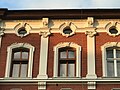
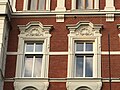
Category:2 Wojska Polskiego Street in Racibórz
Jump to navigation
Jump to search
| Object location | | View all coordinates using: OpenStreetMap |
|---|
historic building in Racibórz, Silesian Voivodeship, Poland .jpg) | |||||
| Upload media | |||||
| Instance of | |||||
|---|---|---|---|---|---|
| Location | Racibórz, Racibórz County, Silesian Voivodeship, Poland | ||||
| Street address |
| ||||
| Architectural style | |||||
| Heritage designation |
| ||||
| Inception |
| ||||
 | |||||
Media in category "2 Wojska Polskiego Street in Racibórz"
The following 6 files are in this category, out of 6 total.
-
 POL Racibórz Kamienica przy ul Wojska Polskiego 2 (1).jpg 1,024 × 768; 345 KB
-
 POL Racibórz Kamienica przy ul Wojska Polskiego 2 (2).jpg 315 × 615; 96 KB
-
 POL Racibórz Kamienica przy ul Wojska Polskiego 2 (3).jpg 1,024 × 768; 281 KB
-
 POL Racibórz Kamienica przy ul Wojska Polskiego 2 (4).jpg 1,024 × 768; 275 KB
-
 POL Racibórz Kamienica przy ul Wojska Polskiego 2 (5).jpg 1,024 × 768; 277 KB
-
 POL Racibórz Kamienica przy ul Wojska Polskiego 2 (6).jpg 1,024 × 768; 290 KB
.jpg)
.jpg)
.jpg)
.jpg)
.jpg)