
Category:21st-century maps of Pittsburgh
Subcategories
This category has the following 2 subcategories, out of 2 total.
- 2000s maps of Pittsburgh (31 F)
- 2010s maps of Pittsburgh (31 F)
Media in category "21st-century maps of Pittsburgh"
The following 11 files are in this category, out of 11 total.
-
 2021 Pittsburgh Mayoral Democratic Primary Results By Ward.svg 660 × 531; 29 KB
-
 Flag map of Pittsburgh.svg 800 × 643; 87 KB
-
 Motorcade Path-01.jpg 5,333 × 4,421; 12.39 MB
-
 Pittsburgh Mayor 2021.svg 879 × 709; 436 KB
-
 Pittsburgh Mayoral Election Results by Ward, 2021 fixed.svg 660 × 531; 29 KB
-
 Pittsburgh Mayoral Election Results by Ward, 2021.svg 660 × 531; 28 KB
-
 Pittsburgh Pennsylvania US street map.svg 8,588 × 8,324; 61.24 MB
-
 Pittsburgh T System map.png 1,597 × 2,762; 438 KB
-
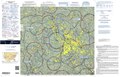 Pittsburgh TAC.tif 9,554 × 6,136; 17.66 MB
-
 Pittsburghmetroresults.svg 850 × 482; 91 KB
-
 The 2020 United States Presidential Election in Pittsburgh.svg 1,804 × 1,381; 189 KB


