Category:21st-century maps of Antarctica
Jump to navigation
Jump to search
Temperate regions: North America · South America · Africa · Europe · Asia · Oceania – Polar regions: Antarctica · Arctic – Other regions:
Media in category "21st-century maps of Antarctica"
The following 34 files are in this category, out of 34 total.
-
2018 AWS Sites ALL 03 29 2018.jpg 3,300 × 2,550; 1.66 MB
-
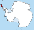
American Cordillera in Antarctica.png 1,726 × 1,522; 60 KB
-
Antarctic region. LOC 2005626386.jpg 2,490 × 3,247; 792 KB
-
Antarctic region. LOC 2005626386.tif 2,490 × 3,247; 23.13 MB
-
Antarctic region. LOC 2005626493.jpg 2,483 × 3,211; 840 KB
-
Antarctic region. LOC 2005626493.tif 2,483 × 3,211; 22.81 MB
-
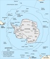
Antarctic-Convergence-Map.TIF 2,373 × 2,768; 898 KB
-
Antarctic-Overview-Map-EN.tif 2,373 × 2,768; 910 KB
-
Antarctic-Overview-Map.tif 2,373 × 2,768; 923 KB
-
Antarctic1.jpg 761 × 964; 195 KB
-
Antartic - Topografia - Localizacion de l'Illa Alexandre.png 1,468 × 1,458; 813 KB
-
Antartica.jpg 1,293 × 1,080; 924 KB
-
Antpen-en.jpg 1,030 × 1,588; 588 KB
-
Antpen-en.png 1,025 × 1,584; 1,021 KB
-
Antpen-es.png 1,025 × 1,581; 1.03 MB
-
Australasian Antarctic Expedition English.png 1,806 × 2,126; 1.41 MB
-
Australasian Antarctic Expedition no lang.png 1,806 × 2,126; 1.25 MB
-
Bahari zinazopakana na Antaktiki.png 1,118 × 882; 514 KB
-
Base Antartica Ecuatoriana y Chilena.jpg 764 × 473; 146 KB
-
COMNAP Bransfield Strait map.png 1,630 × 1,229; 552 KB
-
COMNAP Larsemann Hills map 2012.png 1,912 × 1,569; 91 KB
-
Comnap map edition5 a0 2009-07-24.png 1,927 × 1,583; 139 KB
-
Drake-Passage-Area-Map.tif 1,906 × 2,420; 565 KB
-
Enderby Land, East Antarctica.jpg 1,800 × 753; 273 KB
-
Estrecho de Gerlache.png 800 × 627; 1.93 MB
-
Gerlache Strait.png 800 × 627; 588 KB
-
Größenvergleich Antarktis und Europa.png 699 × 553; 261 KB
-
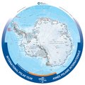
IPY Antarctica 2012 150.pdf 4,987 × 4,987; 2.8 MB
-
Karte antarktis2 exp.png 1,300 × 996; 299 KB
-
Karte antarktis2.png 1,300 × 996; 259 KB
-
Map of Antarctica without Ice.png 1,200 × 1,200; 267 KB
-
PAT - Antarctica.gif 975 × 860; 90 KB
-
Sustained greening of the Antarctic Peninsula observed from satellites fig 3.webp 1,773 × 1,038; 257 KB
-
Transantarctic mountains highlighted.jpg 6,963 × 5,809; 1.04 MB


