Category:20th-century maps of the Western Mediterranean
Jump to navigation
Jump to search
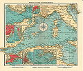
English: This category collects 20th-century maps that show only the Western part of the Mediterranean Sea (between Italy and Spain). This includes (from west to east) the Alboran Sea, the Balearic Sea, the Gulf of Lion, the Ligurian Sea, the Tyrrhenian Sea and the Strait of Sicily
Incomplete maps (like cut-off double pages) should be categorized according to the full content of the original map, unless it is a deliberate crop.
Incomplete maps (like cut-off double pages) should be categorized according to the full content of the original map, unless it is a deliberate crop.
Subcategories
This category has the following 3 subcategories, out of 3 total.
Media in category "20th-century maps of the Western Mediterranean"
The following 6 files are in this category, out of 6 total.
-
 Mittelmeer west.jpg 4,570 × 3,940; 6.29 MB
-

-

-
 Cables sous-marins France, Algérie, Tunisie - btv1b531583161 (12 of 12).jpg 9,052 × 6,516; 7.58 MB
-
 Admiralty Chart Catalogue 1967 Page 032 Index E.jpg 8,568 × 6,820; 9.91 MB
-
 Admiralty Chart No 160 Algiers to Genoa, Published 1928.jpg 11,098 × 16,300; 18.36 MB

._LOC_2014589397.jpg)
.jpg)

