Category:20th-century maps of the Nile Delta
Jump to navigation
Jump to search
Media in category "20th-century maps of the Nile Delta"
The following 12 files are in this category, out of 12 total.
-
 Heinrich Kiepert. Asia citerior.Aegyptus.Mare.Aegyptium.Libya.jpg 2,585 × 755; 302 KB
-
 D068- N° 436. Egypte et Syrie de Bonaparte. - Liv3-Ch16.png 1,444 × 1,798; 336 KB
-
 D161-Delta du Nil.-L2-Ch6.png 1,518 × 1,352; 284 KB
-
 Egyptian campaign, 1882. Map no. 1, Sketch map of Lower Egypt.png 7,700 × 6,407; 40.5 MB
-
 W. & A.K. Johnston. Asia Minor. 1911 F.jpg 879 × 483; 74 KB
-
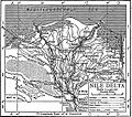 EB1911 Egypt - Nile delta.jpg 1,121 × 989; 641 KB
-

-
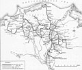 Egyptian Delta Railways - Map of the tracks in the 1920s.jpg 800 × 677; 110 KB
-
 1916 map of Sinai Peninsula, Egypt, the Gulf of Suez and the Gulf of Akaba by the British War Office.jpg 15,719 × 15,179; 34.02 MB
-
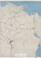
 Map of Lower Egypt - NARA - 131043700.jpg 19,744 × 17,228; 26.25 MB
-
 (Cairo region, north to Damietta, east to Suez. LOC 77693714.jpg 11,244 × 15,631; 32.74 MB
-
 (Cairo region, north to Damietta, east to Suez. LOC 77693714.tif 11,244 × 15,631; 502.84 MB


_(14762414554).jpg)


