Category:20th-century maps of the Bosphorus
Jump to navigation
Jump to search
Subcategories
This category has only the following subcategory.
2
Media in category "20th-century maps of the Bosphorus"
The following 20 files are in this category, out of 20 total.
-
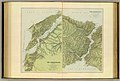
 1901 map of The Bosphorus and Constantinople (cropped).jpg 4,265 × 6,691; 6.88 MB
-
 1901 maps of The Dardanelles and the Troad and The Bosphorus and Constantinople.jpg 8,657 × 6,820; 11.09 MB
-
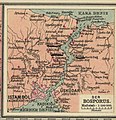
 Turkishstraits.jpg 6,237 × 4,188; 4.22 MB
-
 Konstantinopel - K. u. k. Militärgeographisches Institut - btv1b101041283.jpg 7,101 × 9,024; 17.76 MB
-
 Map of Constantinople from Turkey 1 to 250,000.jpg 9,032 × 6,640; 8.76 MB
-

-
 Istanbul ve Boğazı ve civarı haritası.jpg 8,500 × 7,844; 14.83 MB
-
-
 1915 Australian map of the Sea of Marmara (cropped).jpg 4,826 × 3,580; 10.73 MB
-
-
 1915 map - Bosphore (cropped).jpg 1,330 × 2,090; 595 KB
-
 1915 map - Flemmings Kriegskarte - Dardanellen, Bosporus und die Europäische Türkei.tif 10,149 × 8,312; 36.65 MB
-
 1915 map - Mapa Półwyspu Bałkańskiego.jpg 13,057 × 17,176; 52 MB
-
 1915 War map of the Dardanelles and Bosporus.tif 7,936 × 6,336; 143.93 MB
-
 20-Dardanellen, Bosporus und die europäische Türkei (1915).png 12,082 × 9,917; 150.19 MB
-

-
 1920 Map of Dardanelles, Sea of Marmara, Bosporus.tif 6,390 × 8,463; 155 MB
-
 Asian places in Brockhaus 1937.jpg 1,600 × 2,601; 2.4 MB
-
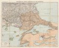
 Karte des Bosporus und der Bithynischen Halbinsel... - von Dr. Rudolf Fitzner - btv1b53060497f.jpg 11,265 × 6,642; 11.43 MB
-

.jpg)


_(cropped).jpg)

.jpg)
.jpg)
.jpg)

.png)
_(cropped).jpg)


.jpg)