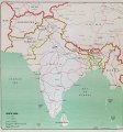
Category:20th-century maps of South Asia
Appearance
Subcategories
This category has the following 4 subcategories, out of 4 total.
Media in category "20th-century maps of South Asia"
The following 34 files are in this category, out of 34 total.
-
Inde.jpg 1,024 × 1,251; 2.65 MB
-
D287- N° 366. Théâtre des Conquêtes portugaises. - liv3-ch10.png 1,432 × 1,374; 168 KB
-
079 ostindien (1905).png 1,730 × 2,172; 2.28 MB
-
Political Divisions of the Indian Empire, 1909.jpg 734 × 599; 165 KB
-
13-Karte von Britisch-Indien (1914).png 12,082 × 9,917; 180.56 MB
-
1922 Map of India by Bartholomew in Imperial Gazetteer of India.jpg 3,729 × 3,449; 4.79 MB
-
1942 Japanese pictorial map of the Middle East and South Asia during World War II.tif 8,752 × 6,343; 158.85 MB
-
1963 South Asia (30249403993).jpg 4,500 × 4,811; 12.22 MB
-
South Asia. 10-63. LOC 75695120.jpg 11,624 × 12,427; 8.52 MB
-
South Asia. 10-63. LOC 75695120.tif 11,624 × 12,427; 413.28 MB
-
India and Indochina, 1967.jpg 4,036 × 2,900; 2.55 MB
-
South Asia, oil and gas prospects. LOC 78695633.jpg 3,182 × 4,182; 1.68 MB
-
South Asia, oil and gas prospects. LOC 78695633.tif 3,182 × 4,182; 38.07 MB
-
Southern Asia - DPLA - 2ba3fe504a11bdcd868d376f878b7c81.jpg 3,276 × 2,558; 1.65 MB
-
Southern Asia - DPLA - 91f0af900ad0a584eafa3f679e5eb29a.jpg 3,276 × 2,554; 1.27 MB
-
South Asia. LOC 2003625194.jpg 2,092 × 2,944; 1.17 MB
-
South Asia. LOC 2003625194.tif 2,092 × 2,944; 17.62 MB
-
South Asia. LOC 94680640.jpg 9,454 × 9,919; 12.16 MB
-
South Asia. LOC 94680640.tif 9,454 × 9,919; 268.29 MB
-
South Asia. LOC 94680784.jpg 9,452 × 9,928; 13.78 MB
-
South Asia. LOC 94680784.tif 9,452 × 9,928; 268.48 MB
-
South Asia. LOC 2001622357.jpg 8,419 × 10,609; 7.8 MB
-
South Asia. LOC 2001622357.tif 8,419 × 10,609; 255.54 MB
-
Golden langur highres habitat1909.jpg 1,188 × 718; 325 KB
-
Hindu percent 1909.jpg 2,358 × 1,969; 2.32 MB
-
India 1920.jpg 2,000 × 1,499; 3.25 MB
-
Muslim percent 1909.jpg 2,358 × 1,970; 2.29 MB
-
Near East & India 1930, svatlas.jpg 2,289 × 1,700; 1.93 MB
-
Near East 1930 (cropped).jpeg 619 × 514; 207 KB
-
Population density impgazind1909.jpg 1,462 × 1,205; 491 KB
-
Prevailing languages impgazind1909.jpg 1,455 × 1,202; 1.98 MB
-
Sikhs buddhists jains percent1909.jpg 2,358 × 1,969; 1.51 MB


