Category:20th-century maps of Mongolia
Jump to navigation
Jump to search
Subcategories
This category has the following 7 subcategories, out of 7 total.
1
- Complete Atlas of China (1917) (49 F)
- 1920s maps of Mongolia (3 F)
- 1950s maps of Mongolia (2 F)
Media in category "20th-century maps of Mongolia"
The following 4 files are in this category, out of 4 total.
-
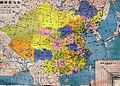
 China old map.jpg 1,868 × 1,380; 567 KB
-
 China old map 1936.jpg 1,067 × 761; 417 KB
-
 Union of Socialist Republics - DPLA - d04955c04489c018d432fb388e9545a1 (page 1).jpg 15,216 × 11,155; 21.19 MB
-
 Union of Socialist Republics - DPLA - d04955c04489c018d432fb388e9545a1 (page 2).jpg 14,979 × 11,159; 21.47 MB


.jpg)
.jpg)