Category:20th-century maps of Manchuria
Jump to navigation
Jump to search
Media in category "20th-century maps of Manchuria"
The following 13 files are in this category, out of 13 total.
-
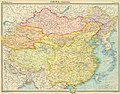 China - political (1922).jpg 9,344 × 7,284; 16.04 MB
-
 Asia 1932.jpg 8,315 × 9,984; 12.4 MB
-
 Manchuria - DPLA - 7ac20a4ccbdcc2ab877df6616cc72575.jpg 12,006 × 8,804; 9.48 MB
-
 Manchuria - DPLA - bd891d8889df9a3a63547178e3067c1c.jpg 12,021 × 8,808; 11.26 MB
-
 Manchuria and Jehol Administration Divisions - DPLA - 42ae8666e4e58af1f0e25120eecd7355.jpg 5,112 × 6,612; 3.44 MB
-
 Manchuria Coal, Petroleum, Electric Power - DPLA - 489304a2659f858ef0cf715db9d255c8.jpg 4,432 × 4,157; 2.06 MB
-
 Manchuria Construction Materials - DPLA - 9e8fa46d546b5761c45ebe61ddb2e23d.jpg 3,808 × 3,988; 2.1 MB
-
 Manchuria Density of Population - DPLA - 04f3f27e7530ddb9de58da1c033a8a91.jpg 5,366 × 6,012; 4.58 MB
-

-
 Manchuria Roads - DPLA - 6e0ff9d51679b840fa4897f168f2cb7f.jpg 5,400 × 6,033; 3.83 MB
-

-

-

.jpg)


_-_DPLA_-_5ae72f7a1f69955fce1b7fda54cc31ae.jpg)


.jpg)
.jpg)