Category:20th-century maps of Luxembourg
Jump to navigation
Jump to search
Subcategories
This category has the following 4 subcategories, out of 4 total.
- 1920s maps of Luxembourg (4 F)
Media in category "20th-century maps of Luxembourg"
The following 6 files are in this category, out of 6 total.
-
 Netherlands Belgium 1900.jpg 1,276 × 1,749; 395 KB
-
 Brockhaus and Efron Encyclopedic Dictionary b5 392-0.jpg 2,552 × 3,498; 4.32 MB
-
 NIEdot400D01.jpg 1,275 × 1,640; 466 KB
-
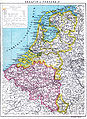
 Belgien Niederlande 1905.png 1,394 × 2,000; 1.7 MB
-
 The Harmsworth atlas and Gazetter 1908 (135848908).jpg 12,533 × 9,575; 124.41 MB
-


.jpg)
