Category:20th-century maps of Liberia
Jump to navigation
Jump to search
Countries of Africa: Algeria · Angola · Benin · Botswana · Burkina Faso · Burundi · Cameroon · Cape Verde · Central African Republic · Chad · Comoros · Democratic Republic of the Congo · Republic of the Congo · Djibouti · Egypt‡ · Equatorial Guinea · Eritrea · Eswatini · Ethiopia · Gabon · The Gambia · Ghana · Guinea · Guinea-Bissau · Ivory Coast · Kenya · Lesotho · Liberia · Libya · Madagascar · Malawi · Mali · Mauritania · Morocco · Mozambique · Namibia · Niger · Nigeria · Rwanda · São Tomé and Príncipe · Senegal · Sierra Leone · Somalia · South Africa · South Sudan · Sudan · Tanzania · Togo · Tunisia · Uganda · Zambia · Zimbabwe
Limited recognition: Somaliland – Other areas: Canary Islands · Madeira · Western Sahara
‡: partly located in Africa
Limited recognition: Somaliland – Other areas: Canary Islands · Madeira · Western Sahara
‡: partly located in Africa
Subcategories
This category has the following 4 subcategories, out of 4 total.
1
Media in category "20th-century maps of Liberia"
The following 27 files are in this category, out of 27 total.
-
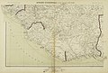
 (1901) Map of Liberia.jpg 1,873 × 1,172; 785 KB
-
-

-
 JOHNSTON(1907) Sketch Map of the Republik of Liberia.jpg 600 × 687; 337 KB
-
 FORBES(1910) 11 Map of Liberia.jpg 715 × 877; 489 KB
-

-

-

-
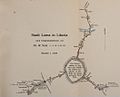 VOLZ(1911) Karte zur Stadt Loma.jpg 1,051 × 851; 379 KB
-
 (1913) Map of Liberia.jpg 1,531 × 1,384; 616 KB
-
 FYFE(1920) Map.jpg 1,536 × 1,719; 2.42 MB
-

-
 JONES(1922) Map of Liberia.jpg 719 × 910; 389 KB
-
 SCHWAB(1947) Fig. 001 Map.jpg 648 × 745; 288 KB
-
 SCHWAB(1947) Fig. 006 Map.jpg 604 × 677; 286 KB
-
 U.S.DOC(1965) Liberia. Map.jpg 812 × 825; 333 KB
-
 U.S.DOC(1965) Liberia. Political map.jpg 781 × 634; 220 KB
-
 U.S.DOC(1965) Liberia. Map Highway system.jpg 875 × 771; 302 KB
-
 (1968) Map of Liberia.jpg 801 × 810; 448 KB
-
 (1987) Iron ore. Location map, West Africa deposits.jpg 1,131 × 1,445; 656 KB
-
 Admiralty Chart No 1173 Grand Butu Point to Great Nifu, Published 1913.jpg 16,586 × 11,277; 22.66 MB
-
 Admiralty Chart No 1980 Garraway to Tafu Point, Published 1914.jpg 16,491 × 11,226; 23.42 MB
-
 Annual report - New York Zoological Society (1912) (17808783314).jpg 3,150 × 2,700; 1.53 MB
-
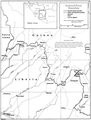 Guinea-Liberia border map.png 870 × 1,145; 305 KB
-
 Ivory Coast-Liberia border.png 944 × 1,324; 146 KB
-
 Liberia Ivory Coast border.png 799 × 1,094; 250 KB
-
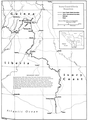
 Liberia Sierra Leone border.png 848 × 1,166; 261 KB
_Map_of_Liberia.jpg)
.jpg)
.jpg)
_Sketch_Map_of_the_Republik_of_Liberia.jpg)
_11_Map_of_Liberia.jpg)
_Karte2_Grenzgebiet_Liberias_%C3%B6stlich_des_St.Paul_River.jpg)
_Karte_zur_Reise_durch_das_Hinterland_von_Liberia_im_Winter_1906-1907.jpg)
_Karte_zum_Reiseweg_durch_das_Hinterland_von_Liberia_im_Winter_1906-1907.jpg)
_Karte_zur_Stadt_Loma.jpg)
_Map_of_Liberia.jpg)
_Map.jpg)
_(20324942999).jpg)
_Map_of_Liberia.jpg)
_Fig._001_Map.jpg)
_Fig._006_Map.jpg)
_Liberia._Map.jpg)
_Liberia._Political_map.jpg)
_Liberia._Map_Highway_system.jpg)
_Map_of_Liberia.jpg)
_Iron_ore._Location_map,_West_Africa_deposits.jpg)


_(17808783314).jpg)


