Category:20th-century maps of Guyana
Jump to navigation
Jump to search
Subcategories
This category has the following 3 subcategories, out of 3 total.
1
Media in category "20th-century maps of Guyana"
The following 12 files are in this category, out of 12 total.
-
 N548 w1150 (50567274637).jpg 1,344 × 961; 414 KB
-
 The birds of British Guiana (7794726562).jpg 1,280 × 1,900; 519 KB
-
 West India Islands and the Approaches to the Panama Canal.png 1,454 × 1,024; 2.41 MB
-
 Map Brasil, Bolivia and Guyana 1930 - Touring Club Italiano CART-TRC-17.jpg 7,105 × 8,922; 8.87 MB
-
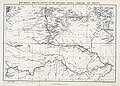
 1967 data of Northern South America.jpg 1,991 × 2,879; 1.75 MB
-
 Admiralty Chart No 2784 Berbice River, Published 1954.jpg 8,245 × 11,229; 13.26 MB
-
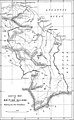
 Brazil 1900.jpg 1,276 × 1,699; 364 KB
-
 Ecuador, Colombia, Venezuela and Guiana, 1967.jpg 5,918 × 2,880; 3.61 MB
-
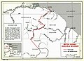 Guyana-Venezuela border.jpg 988 × 713; 159 KB
-

-

-
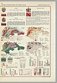
 Third Salisbury administration, 1895-1900 (1900) (14756910076).jpg 3,356 × 5,432; 3.38 MB
.jpg)
.jpg)


_(14729509556).jpg)
_(14750107314).jpg)
_(14756910076).jpg)