Category:20th-century maps of Carmarthenshire
Jump to navigation
Jump to search

Media in category "20th-century maps of Carmarthenshire"
The following 6 files are in this category, out of 6 total.
-
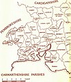
Carmarthenshire parishes.jpg 1,260 × 1,448; 559 KB
-
Carmarthenshiremap1946.jpg 6,992 × 5,072; 5.23 MB
-
Ordnance Survey One-Inch Sheet 139 Cardigan, Published 1947.jpg 10,928 × 12,772; 16.12 MB
-
Carmarthenmap 1952.jpg 2,880 × 1,520; 626 KB
-
Whitlandrailway lines map1952.jpg 2,912 × 1,648; 587 KB
-
Ordnance Survey One-Inch Sheet 152 Carmarthen & Tenby, Published 1966.jpg 8,293 × 9,906; 8.54 MB


